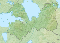
Pike - a river in Russia, flows in the Slantsevsky district of the Leningrad region . It originates from the lake in the swamp Duboyemsky Moss. On the banks of the river is the village of Chernivske . It flows into the Narva reservoir . The river is 17 km long. In the upper and lower reaches, the riverbed is straightened by drainage channels.
Before the creation of the Narva Reservoir, it flowed into the Pyat River (a former tributary of Plyussa ) [2] . Moreover, the mouth of the river was in 1920-1940 on the state border between Estonia and the USSR.
| Pike | |
|---|---|
| Characteristic | |
| Length | 17 km |
| Watercourse | |
| Source | Pike |
| • Height | 48.9 m |
| • Coordinates | |
| Mouth | Narva reservoir |
| • Height | 24.9 m |
| • Coordinates | |
| Location | |
| Water system | Narva reservoir → Narva → Baltic Sea |
| A country |
|
| Region | Leningrad region |
| HWR code | |

Water registry data
According to the state water register of Russia, it belongs to the Baltic Basin District , the water management section of the river is Narva, and the river sub-basin is not sub-basin. It belongs to the river basin of the Narva River (the Russian part of the basin) [3] .
According to the geographic information system of water management zoning of the territory of the Russian Federation, prepared by the Federal Agency for Water Resources [3] :
- The code of the water body in the state water registry is 01030000412102000026697
- The code for hydrological knowledge (GI) - 102002669
- Pool Code - 01.03.00.004
- GI Volume Number - 2
- GI Issue - 0
Notes
- ↑ Surface Water Resources of the USSR: Hydrological Understanding. T. 2. Karelia and the North-West / ed. E.N. Tarakanova. - L .: Gidrometeoizdat, 1965 .-- 700 p.
- ↑ Map O-35-033 of 1939.
- ↑ 1 2 State Water Register . Pike . textual.ru . Ministry of Natural Resources of Russia (March 29, 2009). Date of treatment December 20, 2018. Archived March 29, 2009.
Links
- Map sheet O-35-33 Slates . Scale: 1: 100,000. Status of the area for 1970. 1972 edition