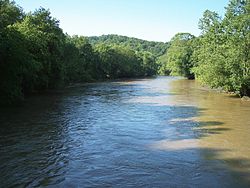
Mohican ( English Mohican River ) - a river in the United States , in the east of the central part of Ohio . It is one of the two components of the Walhonding River, which, in turn, is one of the two components of the Maskingum River. The length is 64 km [2] ; The basin area is 2587 km² [3] .
| Mohican | |
|---|---|
| English Mohican river | |
 | |
| Characteristic | |
| Length | 64 km |
| Pool | 2587 km² |
| Watercourse | |
| Source | |
| • Coordinates | |
| Mouth | Walhonding |
| • Height [?] | 249 [1] m |
| • Coordinates | |
| Location | |
| A country |
|
| Region | Ohio |

It originates in Echland County, about 3 km south-west of the village of Ludonville as a confluence of the Black Fork and Clear Fork rivers. It flows mainly in the southern and southeastern directions, flowing through Holmes, Knox and Coshocton counties. In Coshocton County, it merges with the Cocosing River , forming the River Ualkhonding.
Notes
- ↑ US Geological Survey Geographic Names Information System: Walhonding River
- ↑ Columbia Gazetteer of North America entry
- ↑ Ohio Department of Natural Resources. A Guide to Ohio Streams. Chapter 10: Major Ohio Watersheds (pdf)