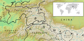
Pamir ( Chinese р 帕米尔 , pinyin : Pàmǐ'ěr , Pers. پامیر , Taj. Pomir ) is a mountain system in the south of Central Asia and in the north of the Himalayan mountain range, mainly in Tajikistan ( Gorno-Badakhshan Autonomous Region ) [ to. 1] [1] , of China , Afghanistan and Pakistan . The Pamir is located at the junction of the spurs of other powerful mountain systems of Central Asia - the Hindu Kush , Karakorum , Kunlun and Tien Shan [k. 2] .
| Pamir | |
|---|---|
 | |
| Specifications | |
| Square | |
| Length | |
| Width | |
| Highest point | |
| Highest peak | Kongur peak |
| Highest point | 7719 m |
| Location | |
| Country |
|


In the XVIII-XX centuries, the Pamir and its surrounding areas became the arena of geopolitical rivalry between the British and Russian empires, which received the name " Great Game " in the history of British geopolitics [c. 3] .
Currently, the Pamir is a knot of unresolved contradictions between a number of states, which leads to geopolitical tension in the region [2] .
Name Origin
In 140-135 years. BC e. Chinese Zhang Qian traveled in the Pamirs, who first called the Pamir “onion mountains” (tsun-lin, Chinese trade. 蔥嶺 , exercise р ) - because of the abundance of historically wild mountain bows (anzur) growing here [to. 4] , while the Pamir, he took for the continuation of the Tien Shan [3] .
In the literature, the word "Pamir" was mentioned for the first time in the 7th century in notes by a Chinese traveler and translator from the Tang Xuanzang dynasty , who at that time visited countries at the source of the Amu Darya river (length 1,415 km (2,620 km from the source of the Panj River with the Wahandarya River) ) According to local residents, Xuanzang noted: “Po-mi-lo” country stretches between two snow ridges, according to other data “Pa-mi-yi” [3] , in which cold and winds reign, snow falls in winter and summer, soil impregnated with salt and covered with stones. " He wrote down the name “Po-mi-lo”, according to other sources, “Pa-mi-yi” [3] , in Chinese - breaking it into syllables, which undoubtedly corresponds to the Pamirs, since the letter “r” is not spelled in Chinese [ 4] [3] .
The name Pamir was written differently; in the works of the 9th – 10th centuries the name is found as “Famir” or “Bamir”. It is believed that the Arabs borrowed this name from the Indians [3] , in Indian mythology there is Mount Meru , which is supposedly located in the center of the world. In Buddhist geography, the Himalayas and Southern Tibet were considered the center of the world. Hence the assumption that “Upa-Meru”, that is, “the country lying under Meru ”, is “(y) pamer (y)” or “Pamir” (“Famir”, “Bamir” in Arabic works) [ 4] .
Marco Polo is an Italian merchant and traveler who presented the story of his trip to Asia , in particular the Pamirs, in the famous “ Book on the Diversity of the World ” in the 13th century, as the name Pamer or Pamier writes. Many geographical names in the upper Indus and Amu Darya rivers are similar: Pamir, Kashmir , Tirichmir , Aimir and so on. It is believed that the Sanskrit word “peace”, meaning “lake” [3] , is the basis of these names; there are really many lakes in the Pamirs. It turned out to be impossible to prove just such an origin of the word “Pamir”, the first syllable remained unexplained [4] [3] .
In the Persian composition of the 16th century Mirza-Gaidar the name “Pamir” or “Bamir” is mentioned; linguists - Iranists suggested that the "Pamir" is the Persian word "Bam-iar", which means "the roof of the earth." This is probably where the famous definition “roof of the world” came from, its translation from Tajik is “Bomi Dunye”, which means “roof of the world”. There were other interpretations from the Persian, for example, “Po-i-mor”, that is, “the foot of death”, or “Po-i-murg” - “the foot of a bird”. All these names, however, are devoid of geographical meaning [4] [3] .
At the end of the 50s, first by the Uzbek geographer X. K. Khasanov, then by professor N. G. Malitsky it was suggested that in Afghanistan they still do not write the Pamir, but Pa-i-mir. "Mihr" or " Miter " [4] is the sun god of the ancient Iranians, and the word "Pai-mihr" should mean "the foot of the sun or the sun god", that is, a mountainous country in the east, due to which the sun rises. In relation to the lands inhabited by ancient Iranian peoples [3] , the Pamir really occupies such a position, and the given name reflects this well. It is possible that the word "Pamir" came from him [4] .
Orography
Pamir mountain ranges
- Ridge of the Academy of Sciences
- Vanch Range
- Wahan Range
- Vakhsh ridge
- Darvaz Range
- Zaalai Range
- Zulumart
- Ishkashim Range
- Kalat (mountain)
- Karategin ridge
- Muzkol
- The ridge of Peter I
- Pshart Range
- Rushansky ridge
- Sarykol ridge
- North Tanymas
- North Alichur Range
- Hazratishoh
- Shahdara Range
- Shugnan Range
- South Alichur Range
- Yazgulemsky ridge
Mountain peaks of the Pamirs - seven thousandths
- Kongur Peak (height 7649 m) - the highest point of the Pamirs, located in China .
- The peak of Ismoil Somoni (the former peak of Communism) (height 7495 m) is the highest point of the former USSR , discovered in the 1880s by Russian researchers of the Pamirs [5] . It was mistakenly identified with the peak of Garmo ; later the bug was fixed. In 1932 it was named the peak of Stalin ; in 1962 it was renamed the peak of Communism; in 1998 it was renamed Ismoil Somoni peak.
- Lenin peak (Abu Ali ibn Sina peak) - height 7134 m, opened in 1871, was called Kaufman peak; in 1928 it was renamed the peak of Lenin ; in 2006 it was renamed the peak of Abu Ali ibn Sina (in honor of Avicenna ) [6] , it is also the peak of Ibn Sina.
- Korzhenevskaya peak - height 7105 m, discovered in 1910 by the Russian geographer N. L. Korzhenevsky , named after his wife Evgenia Korzhenevskaya .
Other Pamir Peaks
- Garmo Peak
- Karl Marx Peak
- Mayakovsky Peak
- Muztagata
- Independence Peak
- Peak Frunze
- Euler Peak
- Engels Peak
Climate
The Pamir is characterized by long and harsh winters and short summers. The peaks remain covered in snow all year round.
The climate of the Pamirs is mountainous, severe, sharply continental. High mountain regions above 2500 m include the Central and Eastern Pamirs [k. 5] , the climate of these areas is continental. Temperature fluctuations from winter to summer and from day to night are quite significant and increase towards the east. Often in the winter morning, a temperature of about −20 ° C is observed, and in the afternoon it rises several degrees above zero. The Pamir is located in the subtropical zone, in winter air masses of temperate latitudes prevail here, in summer - tropical. The average January temperature at altitudes of about 3600 m −17.8 ° C. Winter lasts from October to April inclusive. The absolute minimum temperatures reach −50 ° C. Summer is short and cold. Summer temperatures do not rise above 20 ° C. The average July temperature (for the same altitudes as in January) is 13.9 ° C. Especially unfavorable climatic conditions are different in the Eastern Pamirs. Winter is long and harsh. Negative monthly temperatures are observed from October to April. The average monthly temperature in January drops to −14 ° C −26 ° C. The absolute minimum is extremely low: −63 ° C (according to Bulunkul hydrometeorological station). Summer is short and cool. The average July air temperature does not exceed 15 ° C (HMS Irkht - located on the shore of Lake Sarez ). The absolute maximum ranges from 20 ° C ( HMS named after academician N. P. Gorbunov [ building 6] , Fedchenko glacier [ building 7] ) to 34 ° C (HMS Irkht) [ building . 8] .
The longest frost-free period is 111 days (HMS Irkht), and in a number of the coldest regions ( Shaimak , Karakul , Bulunkul ) there is no frost-free period at all. Mountain areas are very diverse in terms of the onset and end of periods with different temperatures, and in terms of the duration of these periods. So, in the highlands, a period with a temperature above 5 ° C is 90–160 days, with a temperature of 10 ° C - 26–44 days, there is no period with a temperature above 0 ° C in Karakul and on the Fedchenko glacier [7] .
In the valleys of Murghaba, Oksu, in closed hollows ( Lake Karakul , etc.), perennial frozen rocks are widespread. The cyclonic processes during the southwest mass transfer have a predominant effect on the annual precipitation. The complexity of the terrain and the diversity of heights cause significant non-uniformity of precipitation in certain areas. In mountainous areas exposed to humid western air masses, most of the precipitation falls. The eastern regions, fenced off from these air masses by high mountains, receive little moisture [7] .
Quite high temperatures are distinguished in the Western Pamir. So, the average monthly temperature in January in MS Darvaz is positive and is 0.2 ° C. The absolute minimum of air temperature reaches −34 ° C (MS of Tavildara ) [7] .
In the valleys of the Western Pamirs, the amount of annual precipitation is 92-260 mm, in the Eastern Pamirs - 60-119 mm. In the highlands and on the mountain slopes, the amount of precipitation increases (on the Fedchenko Glacier - 1100 mm). The maximum rainfall in the Western Pamirs is in March-April, the minimum - in the summer; in the East - in May-June and in August. In the summer in the Eastern Pamirs, the influence of moist tropical air masses participating in the monsoon circulation of India is possible.
Some climatic data on the regional centers of the Pamirs:
- The average annual temperature in Kalai Khumb is 12.3 ° C. The average annual rainfall is 507 mm. The driest month is August, with 1 mm of rainfall. Most precipitation falls in March, with an average of 101 mm. The warmest month of the year is July, with an average temperature of 25.1 ° C. The average temperature in January is −1.8 ° C. This is the lowest average temperature throughout the year. The difference between the rainfall and the wettest month is 100 mm. The average temperatures vary during the year by 26.9 ° C.
- The average annual temperature in Vancha is 9.9 ° C. About 341 mm of precipitation falls annually. The driest month is August, with 1 mm of rainfall. Most precipitation falls in March, with an average of 64 mm. The warmest month of the year is July, with an average temperature of 23.0 ° C. The average temperature in January is −4.9 ° C. This is the lowest average temperature throughout the year. The difference between the rainfall and the wettest month is 63 mm. The average temperatures vary during the year by 27.9 ° C.
- The average annual temperature in Rushan is 9.2 ° C. The average annual rainfall is 292 mm. The driest month is August, with precipitation 0 mm. Most precipitation falls in March, with an average of 54 mm. The warmest month of the year is July, with an average temperature of 22.4 ° C. The average temperature in January is −6.1 ° C. This is the lowest average temperature throughout the year. The difference between the rainfall and the wettest month is 54 mm. The average temperatures vary during the year by 28.5 ° C.
- The average annual temperature in Khorog is 9.3 ° C. The average annual rainfall is 276 mm. The driest month is August, with precipitation 0 mm. Most precipitation falls in March, with an average of 52 mm. The warmest month of the year is August, with an average temperature of 22.6 ° C. The average temperature in January is −6.2 ° C. This is the lowest average temperature throughout the year. The difference between the rainfall and the wettest month is 52 mm. The average temperatures vary during the year by 28.8 ° C.
- The average annual temperature in Ishkashim is 7.5 ° C. The average annual rainfall is 416 mm. The driest month is August, with precipitation 4 mm. Most precipitation falls in April, with an average of 82 mm. The warmest month of the year is July, with an average temperature of 19.5 ° C. The average temperature in January is −6.0 ° C. This is the lowest average temperature throughout the year. The difference between the rainfall and the wettest month is 78 mm. The average temperatures vary during the year by 25.5 ° C.
- The average annual temperature in Murghab is 0.3 ° C. About 72 mm of precipitation falls annually. The driest month is November, with 1 mm of rainfall. Most precipitation falls in May, with an average of 11 mm. The warmest month of the year is July, with an average temperature of 13.8 ° C. The average temperature in January is −15.5 ° C. This is the lowest average temperature throughout the year. The difference between the rainfall and the wettest month is 10 mm. The average temperatures vary during the year by 29.3 ° C [8] .
Glaciology
- Fedchenko Glacier is the largest glacier in the Pamirs. Located in central Tajikistan ( Gorno-Badakhshan Autonomous Region ). Belongs to the mountain-valley type of glaciers. It is the longest glacier in the world outside the polar regions. The area of the glacier is about 700 km². Among Eurasia’s glaciers, the Fedchenko Glacier is second only to the Karakoram Glaciers Siachen (76 km long, 750 km²) and Baltoro (62 km long, 750 km²).Fedchenko Glacier, Landsat 7 image
- The Bear Glacier is located in Gorno-Badakhshan , on the western slope of the ridge of the Academy of Sciences , which stretches across the strike of the main sub-latitudinal geological structures of the Pamirs. The modern Bear Valley consists of two sharply distinct parts: the valley itself and the firn area of the glacier. Bear Valley ( Hirsdara River Valley, Abdukagor River Basin, left source of the Vanch River) is a deep- cut gorge that inherits a tectonic fault . The strike of the gorge coincides with the general strike of the geological structures , the depth of the gorge reaches 2 km with an average steepness of the sides of up to 40 °. The slopes of the gorge are complicated by erosion furrows, along which avalanches , mudflows and rockfalls descend. On the left side of the main valley from the food area of the vast circus, the Bear Bears takes its only tributary . At the foot of the slopes, an avalanche-talus plume of merged drift cones stretches to an almost continuous ribbon, to which narrow, peaked ridges of lateral moraines are leaned (or buried). The languages of the Bearish have been almost completely “embedded” in this system of proluvially - colluvially moraine arcs [10] .The upper reaches of the Vanch River, the estuaries of the valleys of Abdukagor, Hirsdara, Dustiroz and the Bear Glacier are visible [9]
Bear's firn area consists of three branches that merge in the vast flat-bottomed lowering of the firn trough above the edge of the icefall . The main one is the southern branch, the length of which reached 5 km, an area of about 12.5 km²; the length of the eastern branch was 4.6 km with an area of about 4.7 km²; the northern branch is over 2 km long and its area is about 4.4 km². Thus, the total area of the firn mold, together with the part of the icefall lying above the firn line , was about 22.2 km².
Bear’s Serge happened many times: shortly before 1916, in 1937 and in 1951. However, this glacier attracted the attention of specialists only in 1963, when Medvezhy moved almost 1.75 km down its valley (the Hirsdara River) and reached the headwaters of Vancha, blocking the Abdukagor valley. The glacier's advancement speed in the spring of 1963 was up to 100 m / day, and at the beginning of July this year, Serge stopped. Abdukagorsky glacier-dammed lake formed above the end of the glacier. The extended end of the glacier quickly lost touch with the main language and turned into a huge array of frozen dead ice stretched along the stretch of the Vancha Valley.
Another bearish movement occurred 10 years later and lasted until August 1973. The glacier this time advanced further. Subsequently, the Bear’s earrings were regularly repeated, and already in the new millennium systematic earrings of various sizes were noted.
As a result of measurements carried out in March - July 1989 by employees of the Tajik Hydrometeorological Service, a continuous record of changes in the speed of movement of the glacier tongue was obtained, and their maximums were established (more than 50 m / day from June 13 to 17). Using the airport-parallax method, it was possible to establish that at the same time, at a speed of about 2 km above the glacial front, the ice speed was 70 m / day.
Observation of the Medvezhye glacier and some other Pamir glaciers since the late 1990s. was conducted from space by the crews of the Mir orbital station, and at present, the ISS [11] .
Lakes
Hydrography
Hydrography: February 5, 18 ( according to the Gregorian calendar ), an earthquake of magnitude 9 occurred on the Richter Scale . A giant landslide descended from the side of the mountain into the channel of the Murgab river, under which the village of Usoy was buried. Murgab stopped its flow, and in its channel formed a natural dam 567 m high, called the Usoi Dam .
The waters of the Murgab river began to fill the hollow before the blockage and by the end of 1911 flooded the village of Sarez, which gave the name to the resulting lake. In 1914, the first springs appeared in the Usoi block below Lake Sarez . Part of the collapsed rocks then blocked the small river Shadau-Darya that flowed into Murghab, which led to the formation of another, smaller Lake Shadau. The hydrological regime of lakes has stabilized over a period of more than 100 years. Today the length of Lake Sarez is about 55.8 km, the depth is more than 500 m, the water edge is about 3263 m above sea level, the volume of water is more than 16 km³. The surrounding mountains rise above the lake by about 2.5 km. Below the Usoi Dam, 57 springs form the Murghab River again. In 1967, an unstable section of a steep slope with a volume of loose deposits of 1.25 km³ was discovered on the right bank of the lake. There is a risk of landslide falling into the bowl of the lake. Presumably, the excess of lake water in the form of a giant wave will overlap through the blockage and collapse downstream of the Murghab. A catastrophic flood and the formation of a powerful mudflow below the dam of Lake Sarez can be expected. About 6 million people live in the potentially dangerous zone, and there are residential and industrial buildings .
In 2000, Kazakhstan , Kyrgyzstan , Tajikistan and Uzbekistan appealed to the world community to provide support in solving the problem of Lake Sarez. Under the direction of the World Bank, the International Program, called “Sarez Lake: A Risk Reduction Project ,” is being implemented.
- [12]
Rivers
- Balyandkiik
- Bartang
- Beleuli
- Vanc
- Gunt
- Kaindy (river)
- Marcansu
- Obihingou
- Pamir (river)
- Panj
- Sauksoy
- Seldara
- Shahdara
- Yazgulem
Geological structure
The Pamir mountains are distinguished by the complexity and heterogeneity of their geological structure. They include sedimentary rocks - limestones , sandstones - and crystalline, in particular granites . They contain inclusions of rock crystal , gems [13] .
Physical-geographical zoning of the Pamirs
There are several schemes of zoning of the Pamirs with the allocation of separate areas that have individual characteristics and appearance. Zoning is carried out on the basis of orography, geology, geomorphology, hydrology, glaciology, climatic differences, geobotany information and a number of other natural features.
In the second half of the 20th century, the explorer of the Pamir, geographer and geobotanist Okmir Agahanyants, based on extensive field research and scientific analysis, proposed his own scheme for dividing the Pamir into physical and geographical areas, called the “Zoning scheme for the Pamir Agahanyants” [14] .
Peoples of the Pamir
- The areas of settlement of the Pamiri — the western, southern, and eastern Pamirs, adjoining the Hindu Kush in the south — are high mountain narrow valleys with a rather harsh climate, almost never dropping below 2000 m above sea level and surrounded by steep slopes covered with eternal snow, the heights of which in places approaching 7000 m. To the north of the Hindu Kush watershed, the valleys belong to the Upper Amu Darya basin (Verkhnyaya Kokcha, Pyanj, Pamir, Vakhandarya). The eastern slopes of the Pamirs belong to the river basin. Yarkend, south of the Hindu Kush, the Indus basin begins, represented by the Kunar (Chitral) and Gilgit rivers. Administratively, this entire territory, which has long been an eclectic, but single area, was divided between Tajikistan, Afghanistan, Pakistan and China as a result of expansion in the 19th century. Russian, British and Chinese empires and their satellites (Bukhara and Afghan emirates). As a result, the ranges of many Pamir peoples were artificially divided. The historical regions, such as Shugnan, Rushan, Ishkashim, Vakhan, Munjan, Sarykol, as a whole, initially coincided with the ethnic groups formed in them, serve as ethno-geographical units in the Pamirs. If, in terms of material and spiritual culture, the Pamirians, due to millennia-old mutual contacts, have significantly become closer to each other, the study of their languages shows that different Pamir peoples emerged from at least four ancient East Iranian communities, only remotely related to each other and listed in the Pamirs independently.
- For a comparison of the dynamics of the size and national composition of the population of GBAO according to the All-Union censuses of 1939-1989 and the 2010 census of Tajikistan, see the article Population of the Gorno-Badakhshan Autonomous Region .
- Most of the Afghan population of Badakhshan is represented by indigenous Pamir peoples and Farsivans who speak the Dari language. In addition, there live peoples speaking purely Pamirian languages: Rushan, Shugnan, Mundzhan, Ishkashim, Vakhan. There are small groups of Uzbeks , Kyrgyz, and Pashtuns . Most of the population - Sunni Muslims - 94%, although part of the Pamir peoples professes Ismailism.
- Pamir Kirghiz - ethnic Kyrgyz began to populate the high-mountain Pamir in several stages since 1575. The second wave of Kyrgyz moved to the Pamir Highlands in the 1920s - 1930s in order to avoid the expropriation of livestock after the establishment of Soviet power in Kyrgyzstan.
Languages of the peoples of the Pamirs
Pamiri languages - areal group of languages included in the East Iranian group of Iranian languages spoken by the Pamiri . Distributed in the Western Pamirs ( Mountain Badakhshan ), divided between Tajikistan , Pakistan , China (south-west of the Xinjiang Uyghur Autonomous Region ), Afghanistan .
Message Ways
Roads, trails and gullies
Most of the Pamir settlements are connected by mountain trails and ravines . Due to the fact that the Pamir is a young mountainous country with a difficult-to-cross relief, the construction of roads here is an extremely difficult engineering task and requires significant funding. The construction of communication lines is also complicated by the high seismicity of the region, the risk of landslides , landslides, rockfalls, avalanches and drifts, ice landslides, floods and mudflows . Therefore, in the Pamirs, the number of well-equipped roads is small. The construction of new roads is carried out on a limited scale [15] .
Several millennia ago, in the Pamirs, there were already ways of communication, both internal and transit - crossing this mountainous region and connecting countries and regions lying to the north and south of the Pamirs. There were few such roads. Movement on roads was carried out on foot, riding on donkeys, horses, camels , sometimes - on arb. Hardy and unpretentious donkey - and currently the most common animal, which is used both for horseback riding and for transportation of goods. For the camels, the Pamir is too cold a country, and for horses there is not enough food.
On sections of steep-walled canyons or bombs — steep cliffs falling into the waters of a lake or mountain river — usually the whole population, under the guidance of a master usto, built ravines — overhanging “balconies” of logs, twigs, woven from branches of shrubs that were often covered with turf or flat slates of mountain slate. Roads, trails and ravines are constantly maintained in working condition. Passes were sought out and built through the mountains, through abysses and rivers, where it was possible - bridges and crossings of various designs were arranged. In shallow waters, fords marked along the shores existed. If necessary, across rivers in certain convenient places with gently sloping banks and a non-turbulent course, they swam in wineskins made of goatskin and inflated with air. In some areas constructions were made like rafts - a wooden frame made of juniper with rows of wineskins tied to it.
A barely noticeable mountain trail, pass, turn, branch, ford place and other important places on the lines of communication were marked by pyramids made of hand-made stones. Both were also the place of halt, the performance of the sacrifice to the gods and spirits, and the place of prayer. According to custom, everyone who walked along a road or trail had to remove accidentally dropped stones from the path and put some of them in both. Some of the Pamirs are up to several millennia old; these are very large structures made up of tens of thousands of stones.
With the onset of winter and snowfall, very often all communication between settlements ceased for a long time, until the next summer.
The means of communication served not only the everyday purposes of communication, internal and foreign trade, but also the administrative goals of management, tax collection, the formation of recruits in the army, and the search for young women to replenish harems.
Ancient mines, mines and mine workings, where minerals were mined, also contributed to the creation of a network of trails, ravines and roads in the Pamirs, through which lapis lazuli , sapphires , rubies , mono-and polymetallic ores , raw materials for construction purposes, were exported outside the mountainous country. A special article of export was mummy , medicinal and medicinal herbs, agricultural products: raisins , raisins , dried apricots and more. The mountains also supplied livestock products to the lowland areas: goat meat, mutton, dairy by-products and more. Archa was especially popular, which had various uses outside the mountainous region in the steppe, semi-desert and desert areas, where there was an acute shortage of wood.
The so-called Badakhshan lapis lazuli brought special fame to the Pamirs, one of the best in the world in quality.
For a long time, a branch of the Great Silk Road passed through the Pamir.
The caravans, ambassadorial missions, military detachments, reconnaissance parties, religious missionaries and preachers, dervises and wandering monks used the Pamir roads, trails, and ovrings.
The measure of the path on the Pamir trails, gullies and roads was the chakra - usually the distance that the traveler covered from halt to halt.
Pamiri developed their own original technique for the construction of roads, trails, ravines and bridges, which absorbed the experience of millennia. Some roads, trails and gullies had their own names.
With the colonial seizure and development of the Pamir mountain country, the arrangement of roads here was undertaken by professional engineers and builders of the British, Russian and Chinese empires, each in their own controlled territory.
Currently, the construction of roads, bridges, tunnels and other track structures in the Pamirs is carried out either by national road services or foreign capital [12] [15] .
Old Pamir Highway
Having conquered new colonies in Central Asia, the Russian authorities began to create a network of strategic roads along which Russian troops could be quickly transferred and equipped. It was decided to connect the Fergana and Alai valleys with a mountain wheel road [16] .
In 1894, Russian engineer units, led by the head of the Osh district, Lt. Col. Bronislaw Grombchevsky, built the first wheeled road from the Ferghana Valley to the Alai Valley through the Taldyk pass 3615 meters high. Later, the road was called the "Old Pamir Highway . " The photographic description of the Pamir tract was first carried out in 1901 by the adjutant of the commander of the troops of the Turkestan military district, Lieutenant P. P. Rodstvennoy [17] .
The design and construction of the military strategic road was kept secret, for a long time nothing was known about its creators. According to the diary of researcher Pamir Nikolai Leopoldovich Korzhenevsky , transcribed in 1977, in the summer of 1903 on the Taldyk pass he found a memorial pillar with the names of people who took part in the design and construction of the road. These were lieutenant colonel Bronislav Grombchevsky , railway engineers Mitskevich, Burakovsky, Zarakovsky and lieutenant Irmut [16] . Prior to this, it was believed that the Austrians captured in the First World War built the first track through the pass in 1916.
Fauna
The Pamir, despite the harsh living conditions, is quite rich and peculiar. Here you can find the Tien Shan brown bear , foxes and wolves, including the red wolf , hare, many marmots ( Arctomys caudatus ), leopards , numerous herds of mountain sheep ( argali ), a characteristic animal (up to 11 pounds of weight) for the Pamirs, mountain goats , etc. Of the pets, the yak (in Kyrgyz kutas) is especially remarkable, which gives dairy products and serves to carry heavy loads at these enormous heights. Of the many birds, we mention eagles, geese, ducks, loons, Ulars ( Megalepedrix tibetana ), etc. There are apparently no reptiles in the Pamirs; from amphibians, a grass frog and an Iranian toad ( Bufo variabilis ) were found. Rivers and lakes abound in fish, in places even bears feed on it, catching paws [18] .
Pamir Biological Station Chechekty
The permanent Pamir biological station in Chechekty ( altitude 3860 m), 25 km from the district center Murghab , 395 km from the city of Osh, the Kyrgyz SSR , was preceded by the first biological station created in 1934 in the tract Dzhaushangoz (altitude 3600 m), which existed 3 years, which was then transferred in the autumn of 1936 to the tract Chechekty of the river valley. Murghab with strong points with a height of 2860–4750 m above sea level. m
The Pamir Biological Station was created on the basis of the SAGU Pamir expedition led by P. A. Baranov (director in 1937-1940)and I. A. Raikova (director in 1940-1942) , they created the first hospitals: experimental fields in Jamantal on r. Karasu and in the tract Madyan (altitude 3640 and 3660 m, respectively), where some varieties of cereals, legumes and vegetables were sown; in the valley of the river. Alichur, in the Bashgumbez tract, they chose a place for a meadow and livestock hospital; on the shore of Lake Bulunkul - a place for sowing. Here, we studied the possibilities of adaptation of plants to extremely adverse conditions of the cold high mountain desert for sharp temperature fluctuations, summer frosts reaching -15 ° C, pronounced dryness of the soil and air, constant and strong winds, lack of carbon dioxide in the atmosphere, and increased solar radiation and other environmental factors. Agrobiological methods were developed to increase the productivity of pastures and their reclamation, and about a thousand samples of seeds of cereals, fodder, legumes and vegetables were tested [19] [20] [21] .
Since 1939, O. V. Zalensky became an employee, after the director of the Pamir Biological Station, Tajik branch of the USSR Academy of Sciences (1942-1951) [22] [23] .
In 1938, the Pamir Biological Station became part of the Tajik branch of the Academy of Sciences of the USSR , and in 1951 it became part of the Academy of Sciences of the Tajik SSR .
Since 1939, the Pamir Biological Station was included in the number of participants in the All-Union Agricultural Exhibition (later renamed VDNH ) [20] .
In 1946, K. V. Stanyukovich began work as a senior researcher at the Pamir Biological Station, Tajik Branch of the Academy of Sciences of the USSR (1946-1951), then Director of the Pamir Biological Station, Academy of Sciences of the Tajik SSR (1951-1959) [24] .
In 1959-1962, the director of the Pamir Biological Station was Evgenia Kirillova (1911-1993), a plant grower, candidate of biological sciences, who proved the possibility of growing perennial onions, turnips, turnips and Dungan radishes in the Pamirs; the organizer of the introduction of these crops in the sowing practice of collective farms [20] [25] [23] .
In 1962, X. Yu. Yusufbekov became the director of the Pamir Biological Station and launched a large experimental work to improve pastures and hayfields in all areas of the Gorno-Badakhshan Autonomous Region, as well as the Alai Valley of the Kyrgyz SSR . Under his leadership, three laboratories were created at the Pamir Biological Station in 1964: plant physiology and biochemistry, plant introductions , and experimental geobotany . Here, along with the problems of ecological physiology and biochemistry of plants initiated by Professor O.V. Zalensky, research on experimental geobotany, phytomelioration, soil , microorganism , climatology , and also the issues of plant cultivation in the Eastern Pamirs got further development. For all the years of his leadership, the number of employees and the volume of research work increased significantly, which had a positive impact on the activities of the biological station [K. 9] . At the same time since 1965 he was elected chairman of the bureau of the Pamir base of the Academy of Sciences of the Tajik SSR in combination. In 1969, X. Yu. Yusufbekov all biological scientific institutions of the Pamirs (East Pamir Biological Station in Chechekty (altitude 3860 m), Khorog - Pamir Botanical Garden named after A.V. Gursky ( altitude 2180-3600 m) and Ishkashim strong point (altitude 2600 m)) were merged into the Pamir Biological Institute, now the institute bears the name of its founder and practically creator, academician X. Yu. Yusufbekov [19] [20] [21] [22] [23] .
Prominent Pamir researchers
XIX century
- Nikolai Severtsov (1827–1885), a Russian zoologist and traveler, was appointed a member of the Committee for the Ural Cossack Army in 1860, accompanied General Chernyaev for research in the Zachuisk Territory in 1864, and Seversov made excursions between by the Chu and Syr Darya rivers, then, in 1865-1867, he explored the Tien Shan and the environs of Lake Issyk-Kul, in 1868 additional excursions were made in Khojent district. In 1877-1878 as the head of the Fergana-Pamir scientific expedition, he explored uncharted areas of the Pamirs, he published an article on Pamir animals and a large article on ancient travels to the Pamirs. In 1878, he received the F. P. Litke Medal for researching the Tien Shan, and in 1883, the Konstantinov Medal of the Russian Geographical Society, for research in Central Asia, became a member of the Moscow Society of Nature Researchers. The actual material obtained by N. A. Severtsov is great: one collection of birds of 12,000 copies, he found out the orographic nature of the countries he studied, connected it with their zoological nature; established the dependence of the distribution of animals of Central Asia on the height of their place of residence; he pointed out the differences between the fauna of the European Alps and the Tien Shan and the reasons for these differences; he established the zoological regions of the vast section of Central Asia, from Altai to the Pamirs inclusive; compiled lists of birds by region and a provisional map of the Pamir-Tien Shan system in various geological eras. N.A. Severtsov made a revolution in geographical representations of the Pamirs, proving for the first time that this is an independent mountain system. He was named after Severtsov peak in the Pamir-Alai, in the ridge of Peter I and the glacier [26] [27] .
- Alexei Fedchenko (1844–1873) is a Russian scientist, biologist, geographer and traveler, researcher of Central Asia (1868–1871), first of all completely unknown in the scientific plan, mysterious and mysterious for the Europeans of the Pamirs. During his Turkestan expeditions in 1871 along the Kokand khanate, he went down to the Alai valley, discovered and described the Zaalai ridge and the highest peak of this ridge - Kaufman Peak, but circumstances did not allow him to continue further research of the Pamir, here is what he wrote about these circumstances:
“How could we go for a few days to the wilderness, without supplies of either fodder or provisions! What was with us was not enough for the return trip from Alai: we were starving for two days . "
- A. P. Fedchenko [28]
[26] [28] .
- Arnold Regel (1856-1917) - Russian gardener and dendrologist, in 1876-1884. He made several trips to Central Asia, in particular to the Pamirs and became the first European to visit Lake Shiva (1882), was well received by the ruler of Shugnan, Yusuf Ali Khan, and enjoyed his hospitality. When the Afghan emir Abdur-Rahman, having learned about the traveler’s stay in Bar Panj (at that time the center of all Shugnan, located on the left bank of the Pyanj river, the Afghan side), he suspected that the ruler of Shugnan was negotiating with the Russians about Shugnan joining the protectorate of Russia, and subsequently the ruler of Shugnan, Yusuf Ali-khan, was executed by Abdur-Rahman for the hospitality provided by A. E. Regel. During his travels A.E. Regel collected many insects, plants, stuffed birds and animals [26] [29] .
- Arminius Wamberi , aka German Bamberger (1832-1913) - Hungarian orientalist, traveler, polyglot; Corresponding Member of the Hungarian Academy of Sciences. He came from a poor Jewish family. In 1861, taking the fictitious name Reshid Effendi, under the guise of a dervish - a beggarly preacher - he made a research trip to Central Asia. In 1864 he returned to Hungary, published a book about his journey. The journey of Arminius Vambury was one of the first European penetrations into the unexplored areas of the Pamirs [30] .
- Mikhail Ionov (1846-1919) - Russian major general, participant in the Turkestan campaigns, ataman of the Semirechensk Cossack Army. In 1891–1892 seconded with hunting teams (volunteers) of Turkestan battalions and Cossacks to Alai and Pamir. In the campaign, geographical descriptions and mapping of the mountainous country of the Pamir were carried out, since 1893 he was the head of the Alai reserve and troops located “beyond Alai and the Pamirs” [31] .
- Dmitry Ivanov (1846-1924) - a Russian scientist, geographer, researcher of Kazakhstan, mining engineer, artist, in 1883 he visited the expedition of Captain D. M. Putyaty in the Pamirs, for the research carried out as part of this expedition, was awarded the Russian Gold Medal Geographical Society [26] [32] /
- Ivan Mushketov (1850-1902) - Russian traveler and scientist, geologist and geographer, professor of St. Petersburg Technical University, member of the Imperial Russian Geographical Society. Researcher of the Urals, the Caucasus, Central Asia, the Circum-Baikal Railway on the shores of Lake Baikal in Eastern Siberia. From the Don Cossacks. In 1867 he graduated from the Novocherkassk gymnasium, then as a fellow of the Donskoy Troops graduated in 1873 from the Mining Institute in St. Petersburg. As a student, he took up scientific research in the field of geology and geography. From 1874 to 1877 he made several trips to Central Asia, explored the Tien Shan and the Pamir-Alai. He discovered several large mineral deposits: coal, manganese, silver, copper-lead ores. In 1880, the highest award of the Russian Geographical Society was awarded - the Konstantinov Gold Medal for researching the upland part of the Turkestan Territory, the northern border of Afghanistan, the sands of Kara-Kuma and Kyzyl-Kuma. He compiled the first geological map of the Turkestan Territory. Twice awarded the Makariyev Prize for his work “Geological Description of Turkestan” and “Physical Geology” - a basic academic textbook for universities [26] [33] .
- Sergei Korzhinsky (1861-1900) - Russian botanist and geneticist-evolutionist, one of the founders of phytocenology, full member of the St. Petersburg Academy of Sciences (1896), full state adviser (1898), introduced the concept of "race" as the main taxonomic category of plants, regardless of X De Vries and A. Kölliker substantiated the mutation theory (“theory of heterogenesis”), contrasting it with Darwinism. A professor at the Department of Botany of Tomsk University, one of the founders of the Siberian Botanical School, gave students the first lecture in the history of Tomsk University “What is life?”, Traveled to Central Asia, traveled to central and southern Bukhara, Darvaz, and was one of the first Russian botanists to visit Rushan and Shugnan in the Pamirs and gave the first description of the vegetation of Central Asia (1897) [26] [34]
- Fedor Alekseenko (1882-1904) - Russian systematic florist and traveler. In 1901, he traveled to Central Asia, exploring the Pamir, the Vakhan Range, the Shugnan and Darvaz in the botanical respect, and brought 4,000 herbarium specimens from this expedition [35] .
- Konstantin von Kaufman (1818-1874) - Russian military leader, engineer-general, adjutant general; led the conquest and colonization of Central Asia. Since 1867 - Governor-General of Turkestan, commander of the troops of the Turkestan Military District. A talented colonial administrator and organizer of the systematic study of the Pamirs, both for military strategic and general scientific purposes. One of the founders of the Public Library in Tashkent in 1870 , where military-geographical and general scientific information about the Pamirs and surrounding areas was accumulated [36] .
XX century
- Grigory Shpilko (1872-1936) - Russian, Soviet military and statesman, graduate of the St. Petersburg Infantry Junker School, Cartographic courses at the Military Topographic School and the Nikolaev Academy of the General Staff. Since 1909 he served in the Turkestan military district, was sent to the Pamir to examine the border areas and demarcate the border with China (since March 1911, a member of the Russian Geographical Society). From 1912 to 1914 The head of the Pamir detachment, during this period of service, becomes a famous explorer of the Pamir, Lake Sarez. His studies, the results of which were published in the Izvestia of the Russian Geographical Society, were the first and so detailed that they are still used. He was fluent in German, French and Persian (Farsi), with the help of officers he provided subscription assistance (collected 2,276 rubles 83 kopecks) to the resettled residents of the village of Sarez for the purchase of seeds and food [37] .
- Nikolai Korzhenevsky (1879-1958) - a native of Belarus, an outstanding traveler, geographer and glaciologist, doctor of geographical sciences, corresponding member of the Academy of Sciences of the Uzbek SSR, professor of SAGU in Tashkent. After graduating from the Kiev Military School in 1901, he elected Osh in Turkestan as a place of service, in 1903 he was sent to the Pamirs, where in 1928 he made 11 expeditions to the Pamirs. In the ridge of Peter the Great discovered the glacier them. I. Mushketova, in 1905, for the first time in the world, made a sketch, photographs of the peak, called Kaufman peak (now - Abu Ali Ibn Sina peak, 7134 m). In 1905 he married the daughter of Colonel Sergei Topornin - Eugenia, who helped her husband in research, her father provided material assistance to the expeditions of the spouses in the Pamirs. Korzhenevsky in 1910 named by the name of his wife - " Korzhenevskaya Peak ", since 1928 in the military pedagogical work on training personnel of the Red Army, is one of the founders of SAGU. In 1928, he compiled a unique map of the Pamirs, where he first designated the open "Ridge of the Academy of Sciences", described the "eternal" layers of ice on the banks of Lake Kara-Kul and in the Muzlkol river valley, compiled a catalog of Central Asian glaciers (1930), discovered and studied more than 70 glaciers in Central Asia and mountain peaks in the Pamirs and Tien Shan. The mountain peak in the Zaalaysky ridge and three glaciers in the Zaalaysky, Kokshaltau and Zailiysky ranges are named in his honor. For works in geography and pedagogy he was awarded the Order of the Red Banner of Labor [38] [39] .
- Nikolai Vavilov (1887-1943) - Russian, Soviet geneticist, botanist, breeder, chemist, geographer, public and statesman, academician of the USSR Academy of Sciences, USSR Academy of Sciences and the All-Union Agricultural Academy, president of the All-Union Agricultural Academy, president of the Higher Military School (1931-1940), founder and Director of VIR (1930-1940), Director of the Institute of Genetics of the Academy of Sciences of the USSR (1930-1940), member of the Expeditionary Commission of the USSR Academy of Sciences, member of the board of the People's Commissariat of the USSR, member of the Presidium of the All- Union Central Aviation Administration , member of the Central Executive Committee of the USSR (1926-1935), member of the All-Russian Central Executive Committee, member of IOPS (1927 -1929). The organizer and participant of botanical and agronomic expeditions of most continents (except Australia and Antarctica), during which he revealed the ancient centers of the morphogenesis of cultivated plants, created the doctrine of the world centers of origin of cultivated plants. He substantiated the doctrine of plant immunity, discovered the law of homologous series in the hereditary variability of organisms. He made a significant contribution to the development of the doctrine of the biological species. Under the leadership of Vavilov, the world's largest collection of seeds of cultivated plants was created, laid the foundations of the state system. testing field crop varieties. In 1916 he was involved as a consultant on the mass disease of soldiers of the Russian army in Persia, found out the cause of the disease, indicating that particles of seeds of the intoxicating chaff (Lolium temulentum), and with it the fungus Stromatinia temulenta, which produces alkaloid topiculin. The solution to the problem was the delivery of provisions from Russia. N. I. Vavilov, having received permission from the leadership to conduct an expedition, went deep into Iran, where he was engaged in the study and collection of cereal samples. During the expedition, he took samples of Persian wheat, sowing it later in England, tried to infect it with powdery mildew in various ways (up to the use of nitrogen fertilizer, which contributes to the development of the disease), but all attempts were unsuccessful, and he came to the conclusion that plant immunity depends on conditions environment where this species was originally formed. During the Iranian expedition, N. I. Vavilov had ideas about the pattern of hereditary variability, he traced the changes in rye and wheat species from Iran to the Pamir, noticed characteristic similar changes in the species of both genera, which led him to the idea that there was a pattern in the variability of related species . While in the Pamirs, I concluded that mountain “insulators” like the Pamirs serve as centers of origin of cultivated plants [26] [40] .
- Pavel Baranov (1892-1962) - Soviet, Russian botanist, in the field of morphology (embryology), anatomy and plant biology, researcher of wild-growing and cultivated vegetation, historian of botany, corresponding member of the USSR Academy of Sciences, Honored Scientist of the Uzbek SSR, worked at SAGU ( 1920-1944), headed the laboratory of the All-Union Scientific Research Institute of Cotton Production (1930-1938), led many botanical expeditions to Central Asia, the first of which was the expedition to Talas Alatau in 1921; Western Tien Shan (1923-1927); Darvaz (1927); Kopetdag (1928-1929); led the Pamir expedition (1933-1943) - is one of the organizers of the Pamir Biological Station and the Pamir Botanical Garden in Khorog, chairman of the Moldavian Branch of the Academy of Sciences (1949), delegate of the VII International Botanical Congress in Sweden (1950), delegate of the VIII Congress in France (1954 ), a member of the Presidium of the National Committee of Soviet Biologists (1958), took part in the creation of the fundamental monograph Flora of the USSR [26] [20] .
- Ilaria Raikova (1896-1981) - Russian, Soviet Uzbek scientist, biologist, geographer, traveler, one of the largest scientists in the field of botany, teacher, b. Professor of SAGU, Honored Scientist of the Uzbek SSR, Corresponding Member of the Academy of Sciences of the Uzbek SSR, Honorary Member of the RBO and the Russian Geographical Society, worked at the Botanical Museum of the Main Botanical Garden of the RSFSR (Researcher of the 1st category of the BIN RAS ) (1919-1920), in 1920 In Moscow, she was elected a teacher of botany and included in the organizational group of TurkSU in Tashkent - is one of the organizers of the university. For the first time I visited the Pamirs as part of the expedition of the Turkestan department of the Russian Geographical Society in 1923 - was awarded the silver medal of the state Russian Geographical Society, then I devoted my whole life to the botanical study and plant-growing development of the Pamir. Head Department of "Morphology and Systematics of Lower Plants" (1938-1943), head. Department of Darwinism, Genetics and Experimental Morphology, SAGU (1944). In 1927 she participated in two expeditions in the Eastern (Geological Committee) and Western Pamir - Darvaz expeditions of SAGU, as part of the VIR expedition to study cultivated grape varieties (1928-1929), in 1933 was deputy. Head of the Pamir Integrated Expedition of the SAGU for the agricultural development of the Pamirs, for 50 years she took part in expeditions to Central Asia, took part in the Mongolian pasture expedition (1950), organizer of the first agricultural exhibitions in GBAO (1933-1936), one of the organizers of the Pamir Biological Station (1936) was the deputy director (1937-1940), the director of the Pamir Biological Station of the Tajik branch of the USSR Academy of Sciences (1940-1942). The scientific activity of I.A. Raikova was mainly associated with the Pamirs, where she worked for 40 summer seasons. Her main scientific works are devoted to the study of the Pamir vegetation, she was awarded the Order of Lenin (1957, 1981), the Order of the October Revolution (1971), two orders of the Red Banner of Labor (1946, 1967), two orders of the “Badge of Honor” - awarded by the Government of the Tajik SSR (1944, 1957 ) [19] , the Order of Friendship of Peoples (1976), the medal "For Labor Valor" (1954), the medal "To commemorate the 100th anniversary of the birth of Vladimir Ilyich Lenin" (1970), the Silver Medal of the Russian Geographical Society) (1923), Bronze Medal of VDNH (1955), Honored Science Worker of the Uzbek SSR (1945), ten Honorary diplomas of the Presidium of the Supreme Council of the Tajik SSR, Honorary diploma of the Presidium of the Academy of Sciences of the Tajik SSR " [19] [20] [26] .
- Kirill Stanyukovich (1911-1986) - Soviet, Tajik scientist, botanist, geographer, geobotanist, participated in the battles of World War II on the Leningrad and 3rd Baltic Fronts (1941-1945), writer, traveler, Doctor of Biological Sciences, professor, Honored Professor scientist of the Tajik SSR, corresponding member of the Academy of Sciences of the Tajik SSR), director of the Pamir Biological Station of the Academy of Sciences of the Tajik SSR (1951-1959), head. sector "Atlas of the Tajik SSR" SOPS AN TajSSR (1965-1969), head. sector of experimental geobotany of the Pamir Biological Institute of the Academy of Sciences of the Tajik SSR (1969-1970), head. sector of the Council for the Study of Productive Forces (SOPS) Academy of Sciences of the Tajik SSR (1971-1975), head. the geography sector of the Department for the Protection and Rational Use of Natural Resources of the Academy of Sciences of the Tajik SSR (1975-1986). He participated in numerous expeditions to the Pamir, Tien Shan, mountainous Kazakhstan and Siberia. He established the laws of the belt distribution of vegetation in the mountains in height. He worked out the seasonal dynamics of phytocenoses. The head of the expedition of the Academy of Sciences of the USSR to search for the "Bigfoot" in the Pamirs, examined the unexplored high mountain regions of the Pamirs - Lake Sarez, Fedchenko Glacier and the surrounding area. KV Stanyukovich based on the materials of his expeditions wrote more than 150 scientific and popular science works and books. He was awarded the medal "For the Defense of Leningrad" (1943), the medal "For the Victory over Germany in the Great Patriotic War of 1941-1945" (1945), the Order of the Red Star (1945), the medal "For Labor Distinction" (1947), and the participant’s medal All-Union Agricultural Exhibition (1955), the medal "For Labor Valor" (1955), the Order of Friendship of Peoples (1981), the Russian Geographical Society - the gold medal named after Pyotr Petrovich Semenov-Tyan-Shansky (1976) [24] [41] [42] .
- Anatoly Gursky (1911-1986) - Soviet, Tajik botanist, introducer, naturalist, dendrologist. Doctor of Biological Sciences (1951), Professor (1951), Director of the Pamir Botanical Garden (1940-1965), First Chairman of the Pamir Base of the Academy of Sciences of the Tajik SSR (1960-1965), Head. Department of General Botany, Moscow Forestry Institute (1965-1967). In 1940, at the invitation of Professor P.A. Baranov, he arrived in the Pamir, headed all the work on organizing the highest mountain botanical garden in the USSR. In the spring of 1941, at his suggestion, the Khanev Canal was built using the folk construction method to develop the territory of the new botanical garden and increase its collection by providing plants with irrigation water. He made a significant contribution to the development of the sandy massifs of Vakhan, Ishkashim region (under difficult wind conditions, these sands, moving, occupied irrigated fields, roads), proposing to fix them by laying windbreaks. In the mid-1950s he visited Sarez Lake, during the expedition he collected a herbarium of unique plant species, leveled the Usoi Dam, described the scree vegetation along the shores of the Sarez Lake, and the results of this expedition were presented to him in the work “Overgrowing of the Usoi Dam and some other botanical problems of the Sarez lakes. " In 1958 he visited the PRC, got acquainted with the botanical gardens and reserves of this country, collected seeds, thanks to this expedition today the flora of Southeast Asia in the Pamir Botanical Garden is represented by hundreds of species. He developed a working scheme of rational distribution and zoning of crops for the western regions of GBAO, was awarded four Orders of the Badge of Honor, four Honorary Certificates of the Presidium of the Supreme Council of the Tajik SSR [43] [20] [25] .
- Nikolai Gvozdetsky (1913-1994) - Soviet Russian traveler, geographer and karstologist, cartographer, historian of geography, doctor of geographical sciences, professor of Moscow State University named after MV Lomonosov, awarded the Great Gold Medal of the Geographical Society of the USSR, Gold Medal named after N. M Przewalski, with gold medals of foreign universities and societies. Made a short trip to the Pamirs. Later he was engaged in the collection, systematization and generalization of geographical information about the mountainous country of the Pamirs, obtained by other scientists and travelers, the results of many years of work presented in his scientific works [44] .
- Oleg Zalensky (1915-1982) - Soviet, Tajik scientist, plant physiologist, Doctor of Biological Sciences, professor, director of the Pamir Biological Station of the Tajik Branch of the USSR Academy of Sciences (1942-1951), leading researcher at the Botanical Institute of the USSR Academy of Sciences, winner of the K. A prize Timiryazev (1988) [22] [23] .
- Okmir Agahanyants (1927-2002) - Soviet and Belarusian traveler, geobotanist, geographer, specialist in the field of regional geopolitics and strategic geography of the Caucasus and Central Asia, doctor of geographical sciences; Professor of Belarusian State University in Minsk. Several years traveled to the Pamirs for scientific purposes. One of the largest experts in the world in the study of the Pamir mountain country. Researcher of the Pamirian lake Sarez. He proposed his zoning scheme for the Pamir mountain system. He wrote a work on the history of the study of the nature of the Pamirs until 1960. He is the author of scientific works and popular books about the Pamirs. The name of Okmir Yegishevich Agahanyants is the mountain pass of Agakhanyants, the Southern Shugnan Range (height 5080 m) [45] [46] .
- Khudoyer Yusufbekov (1928-1990) - Soviet scientist, a native of the Pamirs, Dr. S.-kh. Sciences, Acad. Academy of Sciences of the Tajik SSR, professor, member of the Presidium of the Academy of Sciences of the Tajik SSR, full member of the Geographical Society of the USSR, chairman of the Council for the Coordination of Scientific Activities of the Department of Biological Sciences of the Academy of Sciences of the Tajik SSR, member of the Coordinating Council of the Department of General Biology of the Academy of Sciences of the USSR, member of the All-Union and Central Asian Councils of Botanical Gardens of the USSR (1972), member Council "Biological Foundations of the Development of Mountainous Territories of Central Asia", member of the Council on the problem of Biological Foundations of the Rational Use and Protection of the Flora of the USSR Academy of Sciences. The organizer of science in the Pamirs, a major scientist, whose name is associated with a new direction in crop production in the arid mountain and highland areas of the Pamir-Alai, a specialist in crop production, plant introduction and grazing, phytomelioration, and field research practitioner. He developed a system for improving the forage lands of the Pamir and Alai Valley (1968), differentiated by ecological and geographical areas and altitudinal zones, introduced a system of arid fodder production, proposed methods for cultivating useful plants in the conditions of the Pamir (1972), and developed a master plan for the reconstruction of the Pamir Botanical Garden (1970-1975 ) Since 1975, under his leadership, experiments were carried out on the introduction of citrus and other subtropical crops in Darvaz, and the prospects of developing citrus farming in the Kalaykhumb district of the GBAO were proved. Since 1962 - Director of the Pamir Biological Station of the Academy of Sciences of the Tajik SSR, simultaneously since 1965 - Chairman of the Bureau of the Pamir Base of the Academy of Sciences of the Tajik SSR, since 1969 - Director of the Pamir Biological Institute of the Academy of Sciences of the Tajik SSR (today the institute bears the name of its founder and practically the creator), rector of the TSHI of the USSR Ministry of Agriculture (1981) , Academician-Secretary of the Academy of Sciences of the Tajik Academy of Sciences (1986). He was awarded the Order of the Red Banner of Labor, Certificate of Honor of the Supreme Council of the Tajik SSR, and a medal to them. Academician S. I. Vavilov, with the bronze medal “Exhibitions of Achieving the National Economy of the USSR”, the medal “For Labor Valor” (1966), and the medal “For Valiant Labor. In commemoration of the centenary of the birth of V. I. Lenin ”, Honored Science Worker of the Tajik SSR, laureate of the State Prize named after Abuali ibn Sino (1989). “Khudoer Yusufbekov, a Pamiri, occupies a special place in the history of the study of the Pamirs ... Okmir Egishevich Agakhanyants Minsk, 09.26.1991” [47] [48] .
- Vladimir Kotlyakov (born 1931) - Russian traveler, glaciologist and geographer, academician of the Russian Academy of Sciences, doctor of geographical sciences, Honorary President of the Russian Geographical Society, Doctor Honoris Causa of Tbilisi State University, since 1968 the head. Glaciology Department of the Institute of Geography, since 1986 - Director of the Institute of Geography, participant and scientific adviser of expeditions and research on Novaya Zemlya Island, Antarctica, on Elbrus volcano, in Zailiysky Alatau. He conducted research on the Pamir glaciers in 1968-1974. For his work, the Russian Geographical Society awarded him the Gold Medal named after Fedor Litke and the Medal named after Nikolai Przhevalsky, Kotlyakov named glaciers in the Dzungarian and Zailiysky Alatau [49] .
21st Century
- Alexey Postnikov (born 1939) - Soviet and Russian scientist working in the field of the history of cartography and geographical research, doctor of technical sciences, professor, since 1980 at the Institute of the History of Natural Sciences and Technology of the Russian Academy of Sciences, director of the institute (2004-2009), chief research associate of the Institute in the Department of the History of Earth Sciences (since 2010), member of the Executive Committee (assessor) of the Department of the History of Science and Technology of the International Union of History and Philosophy of Science, ex-president of the International Center of the Roerichs. A number of his fundamental works are devoted to the history of geographical research, topographic, geodesic, and general cartographic works in Central Asia, the Pamirs and the Tien Shan. The book “Fighting on the Roof of the World” gives a detailed chronology, describes the causes and consequences of the geopolitical rivalry of the British and Russian empires in the region [50] .
Gallery
Notes
- Comments
- ↑ About 2/3 of the Pamir territory covers the Gorno-Badakhshan Autonomous Region of the Republic of Tajikistan. The issue of the natural boundaries of the Pamir is controversial, by the Pamir we mean the natural territory bounded in the north by the Alai Valley , in the east by the Sarykol Range , in the south by Lake Zorkul , the Pamir River Valley and the upper Pyanj River , in the west by the meridional segment of the Pyanj River Valley, to the north -western part of the Pamirs include the eastern parts of the ranges of Peter I and Darvaz . Some Soviet-Russian researchers ( K. V. Stanyukovich , E. M. Murzaev and others) refer to the Pamir only the eastern part of this territory. Others ( N. A. Gvozdetsky , R. D. Zabirov and others) include the Kashgar mountains adjacent to the east; O. E. Agakhanyants also considered the southern slope of the Hindu Kush and the eastern slope of the Lal ridge in the west.
- ↑ Pamir, Pamirs - the vast high plateau in Central Asia, located in the upper reaches of the Amu Darya and Tarim, between the Tien Shan in the North and the Hindu Kush in the South. Raised in its lowest parts to a height of 10½ — 14 thousand feet. (3048-4267 m) above sea level, the highlands generally represent a system of long, branched, more or less flat and wide river valleys and lake basins, separated by mountain, often snow, ridges and ridges, towering their rocky, often very gentle slopes only 3-8 thousand ft. (914-2438 m) above the bottom of neighboring valleys. <...> Located in the junction between the greatest mountain systems of the Asian continent (Tien Shan, Hindu Kush, Kuen-Lun, Himalayas, Kara-Korum), in the upper reaches of the most important Central Asian rivers, on the way between western and eastern Asia and India P. ESBE . Russia , St. Petersburg , 1890-1907
- ↑ The author of the term “Big Game” in the historical sense is Arthur Conolly ( English Arthur Conolly , 1807–1842) - a British intelligence officer , traveler, and writer.
- ↑ The name “tsun-lin” (“onion mountains”) is probably associated with an abundance of onions growing at the foot of the Alai and Zaalai ranges.
- ↑ In the east, the Sarykol Range, the Kashgar Mountains with the highest altitudes in the Pamirs belong to the Pamir (Kongur peak 7649 m above sea level and Muztagat 7546 m above sea level). The eastern region of the Pamirs is divided by the Kashgar mountains. It should be noted that the name “Eastern Pamir” in relation to the territory of the Republic of Tajikistan is used conditionally, and if we take the Pamir Highlands as a whole with the eastern part (with the Kashgar Mountains), then the Eastern Pamir will become Central (as K. K. Markov and O E. Agahanyants).
- ↑ Inaccessible hydrometeorological station named after Academician A.P. Gorbunov is located at an altitude of 4200 m , in harsh climatic conditions on the rocky ledges of the left side of the glacier named after Fedchenko.
- ↑ Fedchenko Glacier is one of the world's largest mountain-valley glaciers.
- ↑ In the USSR , in the Pamirs, in particular in GBAO , 16 hydrometeorological stations (GMS) were created - 1 meteorological station (MS); - 1 snow avalanche station (SLS); - 1 AMSG Khorog (civilian weather station) and 36 hydrological posts , where 372 people worked. From all specialized institutions, through radio stations, hydrometeorological information was transmitted to the Khorog Hydrometeorological Observatory (GMO Khorog), where simultaneously from the other end of the city information was received from the Aerological Station at the GMO Khorog (AS GMO Khorog) atmospheric sensing was carried out - measuring wind speed, temperature, pressure and humidity up to 50 km and more altitude in the atmosphere). With GMO Khorog, all information was transmitted by telegraph apparatus to Dushanbe , then to Tashkent , where all information was required to come from all of Central Asia , eventually to Moscow .
- ↑ The work of the Pamir Biological Station gained fame outside of Tajikistan. Unique observations and experiments were highly appreciated by scientists in Moscow , Leningrad , in the scientific community of the USA , Australia , Chile , Japan , where the development of highlands was on the agenda.
- Sources
- ↑ Petrushina M.N. PAMIR . Bigenc.ru/geography . Great Russian Encyclopedia. Date of treatment February 17, 2019.
- ↑ Pamir On the Physical Map of the Hemispheres (Inaccessible link) . Quotesfasr.weebly.com. Date of treatment February 3, 2019. Archived March 6, 2019. Alpine-Himalayan folded belt - Pyrenees, Alps, Carpathians, Caucasus, Pamir, Himalayas
- ↑ 1 2 3 4 5 6 7 8 9 Olga Fer “Legends of the Pamirs, Lapis Lazuli” . Prose.ru.
- ↑ 1 2 3 4 5 6 Agahanyants, 1962 , p. 3-6.
- ↑ Iordanishvili E.K. The last mystery of the Pamir mountains
- ↑ Decree of the Government of the Republic of Tajikistan No. 297 of July 4, 2006 (inaccessible link) . Archived March 12, 2007.
- ↑ 1 2 3 Tajikhydrometeorological center . Agency for Hydrometeorology of the Republic of Tajikistan.
- ↑ CLIMATE: PAMIR unopened (inaccessible link) . CLIMATE-DATA.ORG. Archived on August 9, 2016.
- ↑ L.V. Desinov . Bear Glacier is coming!
- ↑ Dolgushin L.D. Pulsating glaciers, 1982.- 192 p. / L. D. Dolgushin, G. B. Osipova; Ed. V.M. Kotlyakova. - L .: Gidrometeoizdat, 1982. - 192 p. USSR State Committee for Hydrometeorology and Environmental Control, Institute of Geography, USSR Academy of Sciences
- ↑ Desinov L.V., Kotlyakov V.M., Osipova G.B., Tsvetkov D.G. Again Bear Bear Glacier (Rus.) Made itself felt // Materials of glaciological studies. - MGI, 2001. - No. 91 . - S. 249-253 .
- ↑ 1 2 Pamir . Komanda-k.ru. Date of treatment February 23, 2019.
- ↑ Educational film “Pamir” from the series “Mountain systems”
- ↑ Pamir - information, photo, description . About-planet.ru. Date of treatment February 27, 2019.
- ↑ 1 2 Pamir . Psciences.net. Date of treatment February 26, 2019.
- ↑ 1 2 Paters P.F. Pamir Travels by Nikolai Korzhenevsky. Selected from an unpublished field diary . Questions of history, science and technology, 1998, No. 2. Date of treatment April 3, 2015.
- ↑ Baskhanov M.K., Shevelchinskaya S. L. "And the Himalayas was already visible from the Cossack picket": Pamir in the photo lens of Lieutenant Pavel Sibling. - SPb. : Nestor-Istoriya, 2019 .-- 440 p. - ISBN 978-5-4469-1585-9 .
- ↑ Massalsky, Vladislav Ivanovich . Pamir, Highlands // Brockhaus and Efron Encyclopedic Dictionary : in 86 volumes (82 volumes and 4 additional). - SPb. , 1890-1907.
- ↑ 1 2 3 4 Yusufbekov X. Yu. , Nigmatullin F. G. Outstanding Researcher of the Pamir - Ilaria Alekseevna Raikova: (on the occasion of the 80th birthday and the 60th anniversary of scientific and pedagogical activity) // Izv. AN Tajik SSR. Separation biol. sciences. - Dushanbe, 1977. - No. 2 (67) . - S. 87-89 .
- ↑ 1 2 3 4 5 6 7 Dontsova, Zoya Nikiforovna. Ilaria Alekseevna Raikova, 1896-1981 [Text : [nerd]] / [USSR Academy of Sciences]. - L .: Science. Leningrad Branch, 1988. - S. 27-28, 33, 73, 78, 82. - 134 p. - 3700 copies. - ISBN 5-02-026593-4 . RSL (Biographical Series)
- ↑ 1 2 Khudoyer Yusufbekovich Yusufbekov: [Scientist in the region. crop production ] / Academy of Sciences of the Tajik SSR, Center. scientific bk them. Indira Gandhi; Comp. M. D. Olimova, N. N. Shaposhnikova; Repl. ed. A.A. Konnov. -Shower. : Donish, 1989 .-- S. 10 .-- 52 p. Russian State Library.
- ↑ 1 2 3 Zoya Petrovna Tikhovskaya. Unknown pages of life . ResearchGate. Date of treatment January 4, 2019. Questions of modern algology. 2016. No. 1. (11). S. 1-17
- ↑ 1 2 3 4 Russian plant physiologists in the eastern Pamirs . Ras.ru/about/awards. Date of treatment January 2, 2019.
- ↑ 1 2 Kirill Vladimirovich Stanyukovich (1911-1986) / Comp. bibliogr. N. Bohan; Bibliogr. ed. D.S. Leivi. - Shower. : Donish, 1986.- 62 p.
- ↑ 1 2 Ikonnikov S. S. Contribution of Petersburg and Leningrad botanists and geographers to the study of the nature of the Pamirs . Scientific electronic library "CyberLeninka" journal Historical and biological research, field of science: Biology. Date of treatment January 16, 2019.
- ↑ 1 2 3 4 5 6 7 8 9 H. Yu. Yusufbekov. Pamir Biological Institute // Nature . - 1982. - No. 12 . - S. 48 .
- ↑ Facts from the biography of N. A. Severtsov . Istram.ucoz.ru. Date of treatment March 12, 2019.
- ↑ 1 2 Leonov N. For the first time in Alai. Travel A.P. Fedchenko in 1871 . Alai.bibrka-city.in.ua. Date of treatment March 12, 2019.
- ↑ Regel, Albert Eduardovich . Vostlit.info. Date of access March 12, 2019. Russian National Library
- ↑ Arminius Vambury . Central Asia (CA).
- ↑ Colonel Mikhail Ionov. 1846 -? . BORDER OF THE RUSSIAN FEDERATION.
- ↑ Ivanov, Dmitry Lvovich // Kazakhstan. National Encyclopedia . - Almaty: Kazakh encyclopedias , 2005. - T. II. - ISBN 9965-9746-3-2 .
- ↑ Mushketov Ivan Vasilievich . Electronic Encyclopedia TPU.
- ↑ KORZHINSKY Sergey Ivanovich . Wiki.tsu.ru. Date of treatment March 13, 2019.
- ↑ Alekseenko Fyodor Nikitich (c. 1880 - 1904), botanist, employee of the Botanical Museum of the Academy of Sciences . Biological sciences.
- ↑ Evgeny Aleksandrovich Glushchenko . Book: Russia in Central Asia. Conquest and transformation (Konstantin Petrovich von Kaufman).
- ↑ Agahanyants, 1989 .
- ↑ Korzhenevsky N.L. A trip to the Pamirs, Vakhan and Shugnan. - St. Petersburg, 1906 . Eastern literature . Date of treatment February 11, 2011. Archived March 1, 2012.
- ↑ Korzhenevsky N.L. Through the Pamir to the Hindu Kush (from Osh to the Pamir Post) // Historical Bulletin. - 1912. - No. 2. . Eastern literature . Date of treatment February 11, 2011. Archived March 1, 2012.
- ↑ Five Continents, 1987 , p. 35–39.
- ↑ List of awarded the insignia of the Russian Geographical Society (1845-2012)
- ↑ Kirill Stanyukovich . Fantlab.ru. Date of treatment January 5, 2019.
- ↑ Yusufbekov X. Yu. Anatoly Valeryanovich Gursky: (on the occasion of the 80th birthday) // Izv. AN Tajik SSR. Separation biol. sciences. - Dushanbe, 1987. - No. 1 (106) . - S. 94-96 .
- ↑ Gvozdetsky Nikolai Andreevich (Inaccessible link - history ) . Moscow State University M.V. Lomonosov Department of Geography DEPARTMENT OF PHYSICAL GEOGRAPHY AND LANDSCAPE STUDIES.
- ↑ O. E. Agahanyants. In the Pamirs. Notes geobotany . - M .: Thought , 1975 .-- 176 p.
- ↑ Agahanyants Okmir Egishevich . Encyclopedia of the Hayazg Foundation.
- ↑ Khudoyer Yusufbekovich Yusufbekov . Russian National Library, St. Petersburg.
- ↑ Mansurov X. Kh. , Maksumov A.N., Karimov Kh.Kh. , Kholdorov U. Kh., Aknazarov O. A. In memory of the scientist // Izv. Academy of Sciences of the Republic of Tajikistan. Separation biol. sciences. - Dushanbe, 1992. - No. 2 (126) . - S. 63-64 .
- ↑ Kotlyakov Vladimir Mikhailovich . Institute of Geography RAS.
- ↑ A.V. Postnikov. Total ed. and the preface by Academician V. S. Myasnikov: Fight on the “Roof of the World” . Politicians, scouts and geographers in the struggle for the Pamirs in the XIX century. (Monograph in documents) (PDF) P. 416 . M .: Monuments of historical thought (February 20, 2001) . Date of treatment July 29, 2016.
Literature
- Regel A... A trip to Karategin and Darvaz / [A. Regel, h. with. R. G. O. - [St. Petersburg]: type. V. Bezobrazova, [1882] - 5 c.
- Regel A.E. 1884. Journey to Shugnan // Izv. RGO. - T. 20. issue. 3. - c. 268-274.
- Vavilov N.I. Five Continents . - L .: Nauka, 1987 .-- 213 p.
- Agahanyants O. E. Between the Hindu Kush and the Tien Shan. The history of the study of the nature of the Pamirs . - Dushanbe: Tajik State Publishing House, 1962 .-- 128 p. - 3000 copies.
- Agahanyants O. E. Sarez: [Lake in the Pamirs ]. - L .: Gidrometeoizdat, 1989 .-- 110 p. - 40,000 copies.
- Description of Zhungaria and East Turkestan in the ancient and present state. Translated from Chinese by the monk Iakinf. Parts I and II. - St. Petersburg: 1829.
- Historical review of Oirats or Kalmyks from the 15th century to the present. Composed by the monk Iakinf. - St. Petersburg: 1834.
- 2nd ed. / Foreword V.P. Sanchirova. - Elista , 1991.
- China, its inhabitants, customs, customs, enlightenment. The work of the monk Iakinf . - St. Petersburg, 1840.
- Statistical description of the Chinese empire. The work of the monk Iakinf. Volume I and II. - St. Petersburg: 1842.
- 2nd ed. Under the scientific. ed. K.M. Tertitsky, A.N. Khokhlova . - M., 2002.
- China in civil and moral condition. The work of the monk Iakinf in four parts. St. Petersburg: 1848.
- 2nd ed. - Beijing, 1911-1912.
- 3rd ed. Under the scientific. ed. K.M. Tertitsky, A.N. Khokhlova . - M., 2002.
- 2nd ed. - Beijing, 1911-1912.
- Geographical index of places on the map to the history of the ancient Central Asian peoples. The work of the monk Iakinf. - St. Petersburg: 1851.
- A collection of information about the peoples who lived in Central Asia in ancient times. In three parts with a card on three large sheets. The work of the monk Iakinf, awarded the Imperial Academy of Sciences Demidov Prize. - St. Petersburg: 1851.
- 2nd ed. Under the scientific. ed. A.N. Bernshtam and N.V. Küner . - M., L., 1950-1953.
- Reprints in Kazakhstan ( Almaty ): 1992, 1998, 2000.
- 2nd ed. Under the scientific. ed. A.N. Bernshtam and N.V. Küner . - M., L., 1950-1953.
- Collection of information on the historical geography of East and Central Asia / Compiled by L. N. Gumilyov , M. F. Khvan . - Cheboksary: 1960.
- For the sake of eternal memory: Poetry, articles, essays, notes, letters [Iakinf Bichurin] / Compiled and written by the Preface V. G. Rodionov. - Cheboksary: 1991.
- Russian non-commissioned officer Efremov, now a college assessor, has traveled for nine years and traveled to Bukharia, Khiva, Persia, and India and returned from England to Russia. Written by himself // Travels in the East in the era of Catherine II. - Moscow, 1995.
- Krylenko N.V. , Scherbakov D.I., Markov K.K. Five years in the Pamirs: Results of the Pamir expeditions 1928, 1929, 1931, 1932, 1933. - Moscow-Leningrad: Publishing House of the Academy of Sciences of the USSR, 1935. - 326 p.
- Yusufbekov H. Yu. Improvement of pastures and hayfields of the Pamir and Alai Valley . - Dushanbe: Donish, 1968 .-- 320 p. - 1910 copies.
- Yusufbekov H. Yu. Methods of cultivation of useful plants in the Pamirs . - Dushanbe: Donish, 1972. - 159 p. - 1620 copies.
- Yusufbekov H.Y., Kasach. A.E. Teresken in the Pamirs . - Dushanbe: Donish, 1972. - 132 p. - 1395 copies.
- Yusufbekov H. Yu. Pamir . - Dushanbe: Donish, 1973. - 166 p. - 1200 copies.
- Yusufbekov H. Yu. Feed resources of Jaushangoz, their use and improvement . - Dushanbe: Donish, 1974.- 37 p. - 800 copies.
- Yusufbekov H. Yu., Agahanyants O. E. Vegetation of the Western Pamirs and the experience of its reconstruction . - Dushanbe: Donish, 1975 .-- 310 p. - 1200 copies. ( - Gorchakovsky P. L. p / p 199. [Review] // Ecology. —1976. - No. 3. - P. 108-109.)
- Yusufbekov H. Yu. Problems of biology and agriculture of the Pamirs . - Dushanbe: Donish, 1975 .-- 363 p. - 1200 copies.
- Stanyukovich K.V. Vegetative cover of the Eastern Pamirs . - M .: State Publishing House of Geographical Literature (Geografgiz), 1949. - 160 p. - 5,000 copies. since 1963, “Thought”. - (New Series / Notes of the All-Union Geographical Society; T. 10).
- Stanyukovich K.V. Vegetation of the Highlands of the USSR. Part 1 . - Stalinobad: Publishing House of the Academy of Sciences of the Tajik SSR, 1960. - 169 p. - 500 copies.
- Baskhanov M.K., Kolesnikov A.A., Matveeva M.F. Dervish Hindukush. Diaries of the Central Asian expeditions of General B. L. Grombchevsky. SPb., Nestor-Istoriya, 2015 .-- 376 p., Ill. - ISBN 978-5-4469-0557-7 .
- Baskhanov M.K., Kolesnikov A.A., Matveeva M.F., Glukhov A.I. Pamir, Khunza and Kashgar in expedition photographs of General B. L. Grombchevsky. M., PELICAN, 2017 .-- 188 p. - ISBN 978-5-9500502-0-6 .
- Baskhanov M. K. "At the gates of English power." A.E. Snesarev in Turkestan, 1899-1904. SPb., Nestor-Istoriya, 2015 .-- 328 p., Ill., Maps. - ISBN 978-5-4469-0728-1.
- A. Postnikov. Struggle on the “Roof of the World” (politicians, scouts and geographers in the struggle for the Pamirs in the 19th century): Monograph in documents / General. ed. and foreword by academician V. S. Myasnikov , Institute of History of Natural Science and Technology. S.I. Vavilova RAS. - M .: Monuments of historical thought, 2001. - 416 p. - 1200 copies. - ISBN 5-88451-100-0 . (per.)
- A. Postnikov. Struggle on the “Roof of the World”: Politicians, scouts, geographers in the struggle for the Pamirs in the 19th century / Society. ed. and foreword acad. V.S. Myasnikov . - Ed. 2nd. - M .: Ripol-classic , 2005 .-- 512 p. - 2000 copies. - ISBN 5-7905-3465-1 . (per.)
- A. Postnikov. The Formation of the Frontiers of Russia in Central and Central Asia (XVIII — XIX Centuries). - M .: Monuments of historical thought, 2007. - 464 p. - 800 copies. - ISBN 5-88451-216-0 . (per.)
- Dzhura Shovaliev : “Mountains are the priority of the future”, “Spark” magazine, article R.F. 2010 Moscow City - ISBN 7-231-21454-7
- Postnikov A.V. History of geographical study and mapping of Siberia and the Far East in the XVII - early XX centuries. in connection with the formation of the Russian-Chinese border. - M .: Lenand , 2013 .-- 364 p. - ISBN 978-5-9710-0699-2 .
- Countries, Capitals, Territories, Cities and Historic sites . - London: McFarland & Company, 1997 - ISBN 0-7864-0172-9
- Severtsov N.A. Orographic sketch of the Pamir mountain system. - SPb., 1886. - 384 p.
- The Great Soviet Encyclopedia / N. I. Bukharin , V. V. Kuybyshev , M. N. Pokrovsky , V. P. Zatonsky and others. Editor O. Yu. Schmidt . - M .: Joint Stock Company "Soviet Encyclopedia", 1930. - T. XVII. - 813 p.
- Space information in the geology of the Pamirs . Docplayer Date of treatment February 28, 2019.
Links
- The Pamir crisis - in 1890-1894 there was a rivalry between the Russian and British empires for control of the Pamirs. In 1891, during the Hunza-Nagar campaign, the British military invaded the vicinity of Gilgit and conquered the very north of modern Pakistan . After the oncoming expeditions of the Russian troops under the command of M.E. Ionov , a Russian-British agreement was concluded, according to which part of the Pamirs went to Afghanistan, part to Russia, and part to the Bukhara emirate , controlled by Russia.
- Pamir is the roof of the world. Collection of works and photos about the Pamirs
- Pamir "History, Culture, Religion, Morals and Customs" (Inaccessible link) . Archived on March 9, 2008.
- Nadezhda Emelyanova. Peoples of the Pamirs and Hindu Kush
- Pamir. From legends to knowledge. Some information from Pamir history
- Pamir passes
- Pulsating Glaciers - Bear Glacier, Research Results
- Pamir-Alai / in the book: N. A. Gvozdetsky, N. I. Mikhailov. Physical geography of the USSR. - M., 1978.
- Pamir Marathon 2009 (film about the trekking in the Pamirs with ascents to the peaks of the Revolution, Communism and Lenin)
- Central Asia. Documents