Shelby ( born Shelby County ) - one of the 67 counties of the state of Alabama , USA .
| district | |
| Shelby | |
|---|---|
| Shelby county | |
| A country | USA |
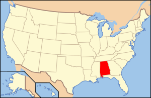
| Enters into | Alabama |
| Adm Centre | Columbiana |
| History and geography | |
| Date of education | 1818 |
| Square | 2097 km² (21st place ) |
| Timezone | UTC-6 |
| Largest cities | Alabaster Hoover (partially) |
| Population | |
| Population | 195,080 people ( 2010 ) ( 5th place ) |
| Density | 93 p / km² (5th place) |
| Nationalities | whites - 89.8% African Americans - 7.4% |
| Digital identifiers | |
| FIPS Index | 01117 |
| Automat code numbers | |
| Official site | |
 | |
 | |
Content
Description
Shelby is located in central Alabama, named like the other eight districts of the same name in other states, in honor of the politician Isaac Shelby . The capital is Columbiana ( Columbiana ), the largest city is Alabaster , an even larger city, but located in the district only partially - Hoover . Open water is 38 km², which is 1.8% of the total area of 2097 km².
The district is the geographical center of Alabama, this point is marked by a memorial sign near the University of Montevallo ( University of Montevallo ), although in fact it is located about 3.5 km east of Montevallo .
In the district, soybean and cotton are grown in large quantities.
The Alabama - Kusa ( Coosa River ) and the Kahab flow through the district.
Two secondary schools are open in the district, eight higher and one combined [2] [3] .
History
The district was formed on February 7, 1818 by separating the northern part of Montgomery County . The new district was one of the largest in the state, but was further crushed, forming several other districts [4] .
Transportation
The following major roads pass through the district:
- highway i-65
- US Route 31 federal highway
- US Route 231 federal highway
- US Route 280 federal highway
- Alabama State Route 25
- Alabama State Route 70 highway
- Alabama State Route 76 highway
- Alabama State Route 119
- Alabama State Route 145 highway
- Alabama State Route 155 highway
- Alabama State Route 261 highway
County Railways is served by CSX Transportation and the Norfolk Southern Railway .
There are two airports in the county: Shelby County Airport and Birmingham-Shuttlesworth International Airport .
Demographics
1820 year - 2416 inhabitants | 1890 - 20 886 (+ 21.2%) | 1960 - 32,132 (+ 5.8%) |
Racial composition:
- White - 89.8%
- African Americans - 7.4%
- Asians - 1.1%
- Native Americans - 0.3%
- Hawaiians or natives of Oceania - 0.0%
- Two or more races - 0.7%
- Others - 0.7%
- Latinos (of any race) - 2.0%
Attractions
- Railway Museum "Heart of Dixie" ( Heart of Dixie Railroad Museum )
- Oak Mountain State Park
- Cahaba River Wildlife Management Area
- Shopping center Colonial Promenade Alabaster
See also
- List of Alabama counties
- National Register of Historic Sites in Shelby County (Eng.)
- Register of Attractions and Cultural Heritage in Shelby County (eng.)
Notes
- La Alabama Automobile Tags Numerical by County - Alabama Department of Archives and History .
- ↑ For details, see Art. Shelby County Schools in Alabama (Eng.)
- ↑ Shelby County Schools in Alabama on shelbyed.k12.al.us
- ↑ District history on shelbycountytourism.org
- ↑ Shelby on quickfacts.census.gov
Links
- Official site
- Shelby County News on shelbycountyreporter.com
- Shelby on shelbycountytourism.org
- Shelby on zipmaps.net
- History of Shelby County + 64 historical photos on rootsweb.ancestry.com