Silovaya (in the upper reaches of Silov-Yakh , Silovaya ) is a river in the north of the European part of Russia . Located in the Republic of Komi and the Nenets Autonomous Okrug . The left tributary of the Kara .
| Force | |
|---|---|
| Characteristic | |
| Length | 192 km |
| Pool | 4390 km² |
| Watercourse | |
| Source | |
| • Coordinates | |
| Mouth | Kara |
| • Coordinates | |
| Location | |
| Water system | Kara → Kara Sea |
| A country |
|
| Regions | Komi Republic , Nenets Autonomous Okrug |
| HWR code | |
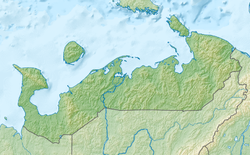
Length - 192 km, catchment area - 4390 km² [2] . The river originates in the north of the city of Vorkuta . It flows into Kara left 75 km from its mouth in the territory of the Yamalo-Nenets Autonomous Okrug. Most of the river flow is the border between the Komi Republic and the Nenets Autonomous Okrug.
The main tributaries of Madaga-Yakha , Darka-Ruz-Shor , Gurey-Ty-Vis , Silova-Musyur-Shor , Buredan-Yu , Sezym-Ty-Vis , Derentey-Ty-Vis , Yarey-Yu , Target-Shor , Halmer- Yu , Talma-Yu , Pesya-Vozh .
Water registry data
According to the state water register of Russia, it belongs to the Lower Ob basin district , the water sector of the river is the Kara Sea basin river from the western border of the Bol basin. Oyu to Cape Skuratova. The river basin is the Kara Sea basin between the Pechora and Ob rivers [2] .
The code of the object in the state water registry is 15010000112103000090776 [2] .
Notes
- ↑ Surface Water Resources of the USSR: Hydrological Understanding. T. 3. The Northern Territory / ed. N.M. - L .: Gidrometeoizdat, 1965 .-- 612 p.
- ↑ 1 2 3 State Water Register . Silova-Yah (Power) . textual.ru . Ministry of Natural Resources of Russia (March 29, 2009). Date of treatment December 20, 2018. Archived March 29, 2009.