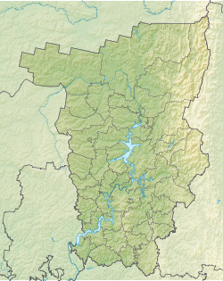
Kosa ( Komi-Perm. Kӧsva ) - a river in the Perm region of Russia , the right tributary of the Kama . Length - 267 km. The pool area is 10,300 km² . The mouth is located 1109 km on the right bank, near the village of Ust-Kosa [2] .
| Scythe | |
|---|---|
| Komi-Permyatsk. Kӧsva | |
 Kama Pool Kama Pool | |
| Characteristic | |
| Length | 267 km |
| Pool | 10 300 km² |
| Watercourse | |
| Source | |
| • Location | Verkhnekamsk Upland |
| • Height | 240.8 m |
| • Coordinates | |
| Mouth | Kama |
| • Location | 1109 km on the right bank |
| • Height | below 119 m |
| • Coordinates | |
| River slope | 0.2 m / km |
| Location | |
| Water system | Kama → Volga → Caspian Sea |
| A country |
|
| Region | Perm region |
| Areas | Yurlinsky district , Kochevsky district , Kosinsky district |
| HWR code | |
Content
Geography
The source of the river on the Verkhnekamsk Upland near the border with the Kirov region . The source is located on the watershed , near the river begins Black . Spit repeatedly changes the direction of the current, the general direction - northeast. The river flows through the territory of three districts - Yurlinsky , Kochevsky and Kosinsky . On Kos there are a number of villages and villages - the largest of them are: Komsomolsky (Yurlinsky district); Ust-Yancher, Krasnaya Kurya, Ust-Onolva, Byuvdy, Marat (Kochevsky district); Puxib, Gorki, Cordon, Solym (Kosinsky district).
It flows into Kama near the village of Ust-Kosa. Near the mouth is a pier on the Kama. The width of the river at the mouth is about 60 meters.
Hydrography
The riverbanks are mostly lowland, in some places the valley is very boggy. In spring and autumn floods, the river spills heavily. The average height of the catchment is 180 m . The average slope is 0.2 m / km. The flow rate of 0.7-1.5 km / h [3] . In the lower reaches, the Spit winds along a very swampy lowland with a lot of old women .
Tributaries (km from the mouth)
- 0.9 km: Sym river (lv)
- 23 km: Odan River (lv)
- 25 km: Bulach river (ave.)
- 28 km: Lel river (lv)
- 36 km: Lolog river (lv)
- 40 km: river Loch (pr)
- 66 km: river Vum (pr)
- 66 km: Sam River (lv)
- 86 km: Siya creek (pr)
- 89 km: Lolym river (ave.)
- 96 km: Kosya river (lv)
- 114 km: Lopan River (ave)
- 119 km: Onolva River (lv)
- 128 km: Olkhovka river (ave.)
- 143 km: Syrol river (ave.)
- 149 km: Sepol river (lv)
- 158 km: Lopva River (pr)
- 182 km: Alien River (pr)
- 190 km: Hume River (South Hume, pr)
- 193 km: Lemia river (Santomai, lv)
- 202 km: Yancher river (Nilinsky Yancher, lv)
- 218 km: Suchkovskaya river (lv)
- 220 km: Lipovskaya river (lv)
- 222 km: Polva river (pr)
- 231 km: Khobodskaya river (pr)
- 233 km: Kodz River (lv)
- 238 km: Usburka river (pr)
- 241 km: Kamenka river (lv)
The largest tributaries are Yancher , Hume , Lopva , Sepol , Syurol , Onolva , Lopan , Lolym , Lolog , Bulach , Sym .
On the territory of the river basin is the Ыdzidnur swamp [4] .
Water registry data
According to the state water register of Russia, it belongs to the Kama basin district , the Kama river water sector from the source to the water gauge near the village of Bondyug , the river sub-basin - the Kama tributary basins to the confluence of the White. The river basin of the river is Kama [5] .
According to the geographic information system of water management zoning of the territory of the Russian Federation, prepared by the Federal Agency for Water Resources [5] :
- The code of the water body in the state water registry is 10010100112111100002294
- The code for hydrological knowledge (GI) is 111100229
- Pool code - 10.01.01.001
- GI Volume Number - 11
- GI Issue - 1
Notes
- ↑ Surface Water Resources of the USSR: Hydrological Understanding. T. 11. The Middle Urals and the Urals. Vol. 1. Kama / ed. V.V. Nikolaenko. - L .: Gidrometeoizdat, 1966 .-- 324 p.
- ↑ Encyclopedia of the Perm Region - KOSA (Unavailable link) . Date of treatment January 12, 2007. Archived on September 28, 2007.
- ↑ Ryzhavsky G. Ya. “On Kama and its tributaries”. - M.: Physical Education and Sports, 1986. - 240 p., S.
- ↑ Encyclopedia of Perm Region - IJIDNYUR (Unavailable link) . Date of treatment January 15, 2007. Archived on September 28, 2007.
- ↑ 1 2 State Water Register of the Russian Federation: Spit . Archived July 19, 2012.
Literature
- Scythe - p. Perm lips. // Brockhaus and Efron Encyclopedic Dictionary : in 86 volumes (82 volumes and 4 additional). - SPb. , 1890-1907.
- Scythe (river in the Perm region) // Great Soviet Encyclopedia : [30 t.] / Ch. ed. A.M. Prokhorov . - 3rd ed. - M .: Soviet Encyclopedia, 1969-1978.
Links
- The article used information provided by the Federal Agency for Water Resources from the list of water bodies registered in the state water register as of March 29, 2009. List (rar-archive, 3.21 Mb).