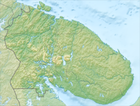
Pechenga tundra ( Finnish. Petsamontunturit ) - a mountain range [1] in the Murmansk region [2] .
| Pechenga tundra | |
|---|---|
| fin. Petsamontunturit | |
| Highest point | |
| Highest peak | Quorpukas |
| Highest point | 631 m |
| Location | |
| A country |
|
| The subject of the Russian Federation | Murmansk region |

The highest point of the ridge is Kuorpukas peak (631 m) [3] , and according to other sources 637.6 m. Other elevations are Kayeksamos (Keskitunturi, 350 m), Säryaslaki (555 m), Vilgiskoddeoayvi (518 m), Pilguyoenvara (276 m) ), Mattert (the list is not exhaustive). The mountains divide the Pechenga region into two distinct climatic zones: the coast of the Barents Sea and coniferous forests, where the climate is more continental. Vegetation in the form of a birch rises to the border of 200-300 m. The tops of the hills are treeless [4] .
In the mountains there are several copper - nickel deposits [1] .
See also
- Mustatunturi
Notes
- ↑ 1 2 Pechengi Copper-Nickel deposits (inaccessible link) - M. 1999.
- ↑ Kola Peninsula (inaccessible link) . Date of treatment August 20, 2012. Archived September 24, 2014. .
- ↑ Autoilijan tiekartta 2002 (fin) 1: 800 000. Vantaa: Genimap Oy. ISBN 951-593-736-1 . (fin.)
- ↑ Kola Encyclopedia (Inaccessible link - history ) .