Grant is one of 55 districts of West Virginia in the United States . One of the 5 counties of the state that are part of the .
| district | |
| Grant | |
|---|---|
| Grant county | |
| A country | USA |
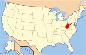
| Included in | West Virginia |
| Adm. Centre | Petersburg |
| History and Geography | |
| Date of formation | 1866 year |
| Square | 1243 km² |
| Timezone | Eastern time: VGM -5 / -4 |
| Population | |
| Population | 11 937 people ( 2010 ) |
| Density | 9 people / km² |
| Digital identifiers | |
| FIPS Index | 023 |
| Official site | |
 | |
 | |
Content
Description
The county is located in the eastern part of the state, it borders Maryland from the northwest, and on the other sides with other districts of West Virginia. Named after the 18th President of the United States, Ulysses Grant . The capital is St. Petersburg (since 1872, before that, Maysville). Open water areas make up 8 km² (0.6% of the total area of the district in 1243 km²).
History
The county was formed on February 14, 1866 by secession from Hardy County . The separation occurred due to the fact that some of the inhabitants of the original Hardy were Confederates , and the other part (separated in the Grant ) were supporters of the Union [1] .
Transport
The following major roads pass through the okrug:
- US Route 50 Federal Highway
- US Route 220 Federal Highway
- West Virginia Route 28
- West Virginia Route 42
- West Virginia Route 55
- West Virginia Route 93
County population
1870 - 4,467 inhabitants | 1930 - 8441 (-6.1%) | 1980 - 10 210 (+18.6%) |
- Racial composition
- White - 98.3%
- African Americans - 0.7%
- Asians - 0.1%
- Native Americans - 0.3%
- Hawaiians or natives of Oceania - 0.0%
- Two or more races - 0.5%
- Other - 0.1%
- Latinos (of any race) - 0.6%
According to the 2000 census [3] , 11,299 residents are living in the okrug, comprising 4,591 households and 3,273 families . The population density is 9 people per km ². There are 6 105 residential buildings in the district, with a building density of 5 buildings per km ².
Out of the total number of households , 30.20% are children under the age of 18 years, 59.50% of households are married couples living together, 8.20% of households are single women without a spouse, 28.70% of households households are not related to families , 24.50% of households consist of one person, 11.30% of households consist of elderly people (65 years and older) living alone. The average household size is 2.43 people and the average family size is 2.87 people.
The age structure of the district: 22.70% under the age of 18, 7.80% from 18 to 24, 27.50% from 25 to 44, 26.80% from 45 to 64, and 15.30% from 65 and older. The average age of a resident of the district is 39 years. For every 100 females there are 97.70 males . For every 100 females age 18 and over, there are 94.50 males .
The average household income in the district was 28 916 USD , per family - 33 813 USD . The average male earnings were 24,796 USD against 18,354 USD for a woman . The per capita income was $ 15,696. About 12.60% of families and 16.30% of the total population were below the poverty line , including 21.00% of youth (those who were not yet 18 years old) and 18.70% of those who were already over 65 years old.
Attractions
- Monongahela National Forest (partially)
- Spruce Knob-Seneca Rocks National Recreation Area (partially)
See also
- West Virginia Counties List
Notes
- ↑ Grant County History Archived June 16, 2010 on the Wayback Machine at polsci.wvu.edu
- ↑ Grant County Archived on July 11, 2011. on quickfacts.census.gov
- ↑ US Census Bureau data for Grant County (West Virginia ) . Date of treatment November 16, 2009. Archived April 11, 2012.
Links
- Official site
- Grant County at gowv.com
- Grant County Press at grantcountypress.com
- Grant County grantcounty-wv.com
- Archive and Bibliographic Information for Grant County, West Virginia