Yuma ( English Yuma County ) - one of the fifteen counties in the state of Arizona , USA .
| district | |||||
| Yuma | |||||
|---|---|---|---|---|---|
| Yuma county | |||||
| |||||
| A country | USA | ||||
| Included in | Arizona | ||||
| Adm. Centre | Yuma | ||||
| History and Geography | |||||
| Date of formation | 1864 year | ||||
| Square | 14,294 km² | ||||
| Timezone | UTC − 7 | ||||
| Population | |||||
| Population | 195 751 people ( 2010 ) | ||||
| Density | 13.7 people / km² | ||||
| Official site | |||||
 | |||||
 | |||||

Content
Description
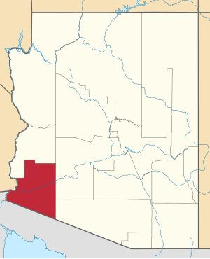
The district is located in the southwestern part of the state, it borders with other Arizona districts from the north and east, California from the west, and Mexico from the south. It is named, like most Arizona districts, in honor of representatives of the Native Americans - the Huma tribe (now known as the Quecans ). The capital and largest city is Yuma ; open water spaces occupy 13 km² (0.09% of the total area), the entire area of the district is 14,294 km². In the district there are more than a dozen abandoned settlements [1] .
The district is the first in the state and the third in the country for the supply of leafy vegetables ( salads ), in particular due to the fact that the district has more than 350 sunny days a year. More than 930 km² has been allocated for vegetable plantations, all of them are supplied with water through irrigation systems from the Colorado River, fields are marked using lasers and GPS navigation. Lemons , tangelos , tangerines , melons , watermelons are also grown. More than 160 km² are occupied by wheat fields [2] .
History
The county, one of the four “initial” (that is, formed according to the First Arizona territorial laws ), was created on November 9, 1864 after the purchase of Gadsden . Initially, it consisted of Arizona lands lying west of 113 ° 20 'west longitude and south of the Bill Williams River . Within these borders, it existed until January 1, 1983 , when the northern part, which became La Paz County, was separated from Yuma. Since 1952, an annual entertainment fair has been held in the district [3] .
Transport
The following major roads pass through the okrug:
- motorway I-8
- Arizona State Route 95
Demographics
1870 - 1621 inhabitants | 1930 - 17 816 (+ 19.5%) | 1990 - 106 895 (+ 18.0%) |
Racial Composition:
- White - 68.3%
- African Americans - 2.2%
- Asians - 0.9%
- Native Americans - 1.6%
- Hawaiians or natives of Oceania - 0.1%
- Two or more races - 3.2%
- Other - 23.6%
- Latinos (of any race) - 50.5%
43.7% of Yuma County residents use Spanish as their home language.
Attractions
- Solar Power Station Agua Caliente [5]
Reserves:
- Cabeza Prieta National Wildlife Refuge (partially)
- Imperial National Wildlife Refuge (partially)
- Kofa National Wildlife Refuge (partially)
See also
- Arizona Counties List
- National Register of Historic Places in Yuma County
Notes
- ↑ Yuma County Abandoned Settlements at ghosttowns.com
- ↑ Showing what we're growing in Yuma at visityuma.com
- ↑ Yuma County Fair at yumafair.com
- ↑ Hume County on quickfacts.census.gov
- ↑ Agua Caliente Solar Project on firstsolar.com