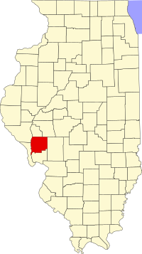
Greene County is a county in Illinois , USA . According to the 2010 census, the district’s population was 13886 people, compared with the 2000 census, it decreased by 5.9% [1] . Green County's county seat is Carrollton .
| district | |
| Green County | |
|---|---|
| English Greene county | |
| A country | |
| Included in | state of illinois |
| Adm. Centre | Carrollton |
| History and Geography | |
| Date of formation | 1821 |
| Square | 1415 km² (0.95% ) |
| Timezone | UTC-6 , summer UTC-5 |
| The largest city | Whitehall |
| Population | |
| Population | 13 886 people ( 2010 ) (0.11%) |
| Density | 9.81 people / km² |
 | |
Content
History
Green County was formed in 1821 and named after Nathaniel Green , a participant in the War of Independence [2] .
The territory of the okrug after its creation in 1821, including temporarily annexed territories
The territory of the district from 1823 to 1825
The territory of the district from 1825 to 1829
The territory of the district from 1829 to 1839
The territory of the district from 1839 to the present day
Geography
The total area of the district is 1414.8 km² (546.27 mi²), of which 1406.4 km² (543.02 mi²) or 99.41% of land and 8.4 km² (3.25 mi²) or 0.59% of water surface [3] .
Climate
The district is located in a zone of humid continental climate . Temperatures range from an average of -9 ° C in January to a maximum of 31 ° C in July. A record low temperature was recorded in January 1912 and amounted to -32 ° C, and a record high temperature was recorded in July 1934 and amounted to 45 ° C. The average monthly rainfall is from 41 mm in January to 110 mm in May [4] .
Neighboring Counties
Green County borders with counties:
- Scott - in the north
- Morgan - in the north
- Makupin - in the east
- Jersey - South
- Calhoun - Southwest
- Pike - in the northwest
Major Highways
| Motorway | Length | Starting point | Final destination | Year of foundation |
|---|---|---|---|---|
| Highway US 67 | 2511 km | Presidio Texas | Sabula , Iowa | 1926 |
| Highway Illinois-100 | 256.03 km | Alton | Dunfermline | 1924 |
| Route Illinois-108 | 87.0 km | Campsville | Raymond | 1924 |
| Route Illinois-267 | 95.0 km | Godfrey | Jacksonville | 1965 |
Settlements
| Locality | Status | Year of foundation | Square | Population ( 2010 ) |
|---|---|---|---|---|
| Greenfield | city | 4.6 km² | 1071 people | |
| Carrollton | district center | 4.9 km² | 2484 people | |
| Kane | village | 1.3 km² | 438 people | |
| Rockbridge | village | 1.8 km² | 169 people | |
| Rudhouse | city | 2.8 km² | 1814 people | |
| Whitehall | city | 6.7 km² | 2520 people | |
| Wilmington | village | 2.1 km² | 142 people | |
| Hillview | village | 2.3 km² | 193 people | |
| Eldred | village | 0.26 km² | 201 people |
Demographics
| Census year | Population | Growth |
|---|---|---|
| 1900 | 23402 | |
| 1910 | 22363 | ▼ 4.4% |
| 1920 | 22883 | ▲ 2.3% |
| 1930 | 20417 | ▼ 10.8% |
| 1940 | 20292 | ▼ 0.6% |
| 1950 | 18852 | ▼ 7.1% |
| 1960 | 17460 | ▼ 7.4% |
| 1970 | 17014 | ▼ 2.6% |
| 1980 | 16661 | ▼ 2.1% |
| 1990 | 15317 | ▼ 8.1% |
| 2000 | 14761 | ▼ 3.6% |
| 2010 | 13886 | ▼ 5.9% |
According to the 2000 census [1] , the population in the district was 14,761 people, there were 5,757 households and 4,075 families. The average population density was 10 people / km² [5] .
Racial distribution of the population:
- white - 98.06%
- German descent - 29.2%
- Irish descent - 10.2%
- English origin - 14.3%
- African Americans - 0.75%
- Native Americans - 0.24%
- Asians - 0.11%
- Latinos - 0.52%, etc.
Of the 5,757 households, 32.5% had children under the age of 18 years living with their parents, 57% had married couples living together, 9.2% had single mothers, and 29.2% had no family. 25.7% of all households consisted of individuals and 14.1% of them were single people aged 65 years and older. The average household size is 2.51 people and the average family size is 3.0.
Population by age:
- under 18 years old - 25.5%
- from 18 to 24 years old - 8.8%
- from 25 to 44 years old - 26.4%
- from 45 to 64 years old - 21.8%
- from 65 years old - 17.5%
The average age was 38 years. For every 100 females there are 96.6 males. For every 100 females age 18 and over, there are 94.0 males.
The average household income is $ 31,754, and the average household income is $ 37,057. Men have an average income of $ 30,067 versus $ 20,269 for women. The per capita income for the district is $ 15,246. About 10.1% of families and 12.4% of the population were below the poverty line, including 14.8% of those under the age of 18 and 9.1% of those age 65 and over .
See also
- US Administrative Division
Notes
- ↑ 1 2 Greene County Census 2010 Data: Population (inaccessible link) . Cubit Planning. Date of treatment July 25, 2012. Archived September 30, 2012.
- ↑ Origin and evolution of Illinois counties (inaccessible link) . Date of treatment July 25, 2012. Archived September 30, 2012.
- ↑ Census 2010 US Gazetteer Files: Counties . United States Census. Date of treatment July 25, 2012. Archived on September 9, 2012.
- ↑ Monthly Averages for Carrollton, IL (inaccessible link) . The Weather Channel, LLC. Date of treatment July 25, 2012. Archived September 30, 2012.
- ↑ American FactFinder (inaccessible link) . United States Census Bureau. Date of treatment July 25, 2012. Archived on September 7, 2012.
Links
- Wikimedia Commons has media related to Green County