Khortytsya ( Ukrainian: Khortytsya ) is the largest island on the Dnieper , located in the city of Zaporozhye below the Dnieper rapids (now near the Dnieper Hydroelectric Power Station ). National Historical and Cultural Reserve [1] [2] . The island stretches from northwest to southeast, length - 12.5 km, width - on average 2.5 km.
| Khortytsa | |
|---|---|
| Ukrainian Khortytsa | |
 Satellite view of the island | |
| Characteristics | |
| Area | 23.59 km² |
| Location | |
| Water area | Dnieper |
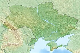
| A country |
|
| Region | Zaporozhye region |
| City | Zaporozhye |

For the first time Khortytsya is mentioned under the name of Fr. St. Gregory in the treatise " On the management of the empire " of the Byzantine emperor Constantine VII Bagryanorodny (compiled in 946-953) [3] .
In 2007, Khortytsia was named one of the " Seven Wonders of Ukraine ."
Content
Etymology
There are several versions of the origin of the name "Khortytsya". It is believed that the island (the annalistic Khartich island ) got its name from the neighboring Khortitsa river, where the noun is "-itsa" from hort- <hart, that is, "fast, fast." Thus, “Khortytsya” is “swift”, fast water (the hydronym “swift” is found more than once in the basins of the Dnieper , Dniester, and other rivers of Ukraine) [4] .
Nature
Geology
The island of Khortytsya is part of the Ukrainian crystalline shield formed in the Archean era [5] [6] . The age of the granites , gneisses and migmatites that make up the Khortytsky rocks is 2.6 billion years [6] (also called 2.85 billion years) [7] ).
Khortytsia cuts the Dnieper riverbed into two branches - New and Old Dnieper . The Dnieper water area near the island is a small, preserved section of the rapids of the river that existed before the construction of the Dnieper hydroelectric dam upstream. Before about. Khortytsya rapids were ending. The remaining small islands remind of the extremely difficult conditions for sailing along the Dnieper.
The channel of the left arm of the Dnieper sometimes became so shallow that on the eastern side of the island, braids were selected along which it was possible to go to the island. They were low-water, for example: 1575, 1708, and 1921, when the bed of the left arm of the Dnieper stood almost dry [8] .
In the northern and northwestern parts of the island, the rocks rise 40-50 meters. To the southeast, the height of the island gradually decreases, turning into a flooded floating part. Between the rocky and flooded parts of the island surface is indented by a large number of picturesque beams.
Khortytsya and the adjacent islands are declared the Dnieper rapids geological reserve .
Plant World
Various natural zones are found on the island: grass and grass steppes , oak and coniferous forests , floodplain meadows . Due to the special microclimatic conditions arising from the abundance of the sun, fresh water and dry air, the island's flora is significantly different from the mainland.
In total, about 960 species of plants grow on Khortitsa, 560 of them are representatives of the wild flora, 20 endemic . Endemic species are the Dnieper godson , Savranian onion , dream grass , irises , and the Dnieper cornflower. In addition to endemic species, relict plants are also found - water fern and chillim .
There are very few virgin areas where herbs grow on Khortitsa. These are the slopes of the beams of Shantseva, Shoe, Lipova, Gromushina, Naumova, Broad, Kostina, Kornetovskaya, Muzyka, Sovutina, Molodnyaga and others. Remains of forest ( bayrack forests ) grow in the beams, where Tatar maple , oak , elm , black and silver poplar , and pear predominate. Most of the island is covered by a young artificial pine and maple forest planted by the Khortitsky forestry. Once upon a time, oak forests grew on the island of Khortytsya with a “solid wall”. By the beginning of the XXI century, the reserve has about 10 centuries-old trees and several dozen oaks aged one hundred and a little more than years (the oldest of them are 300-year-olds), there is also a hundred-year-old wild pear. Mostly such trees grow in beams and in the flooded part of the island [9] .
According to the testimony of D. I. Yavornitsky, a giant centuries-old oak grew on the island of Khortitsa: “It was branched and of colossal thickness, stood fifty fathoms from the Ostrov-Khortitsky colony, to the south, along the very long road across the island.” According to legend, the oak was a gathering place for the Cossacks, where they had advice, under the oak Cossacks prayed before the campaign against the enemy. In 1775, after the Trinity festival, the Cossacks for the last time saluted the holy oak - they drank several barrels of vodka, danced the Cossack , and said goodbye [10] .
By 1888, the oak had withered; a stump was left from it, the circumference of which is 6 meters. Perhaps, under this oak, the Cossacks wrote their famous letter to the Turkish Sultan.
Fauna
Over 30 species of animals, 120 species of birds, ten species of reptiles, and five species of amphibians live in bayraks , but mainly in the flooded forest in the south of the island. The most numerous among the birds are waterfowl (lodges, teal, flats). Many ducks remain wintering on the flooded lakes and on the Old Dnieper, which does not freeze even in severe frosts. There are many gulls (especially silver ones) and herons on the island. In 1979, a yellow heron was registered here - a guest from the south. After a long break, black grunts returned to the Khortytsky meadows: motor boats (not all, unfortunately) finally began to bypass these places. One of the flowing islets - mostly nameless - can justifiably be called Owl . A small island (about a hundred meters in length and no more than fifteen in width) is no different from its neighbors, but owls chose it. In winter, they fly here for a day.
Of daytime feathered predators, kestrel is most often found. The black kites of the local historian consist of only a few pairs. Until 1977, a pair of white-tailed eagles nested on the island. But after the tree on which the eagles nested fell, the birds moved downstream of the Dnieper, although they still fly to the floodplains to hunt.
There are pheasants on the island, which were introduced in the 1950s. There is also a beautiful natives on the island - a golden bee-eater , reminiscent of its feathery inhabitants of the tropics.
On sandbanks, on the marshy shores of lakes, traces of roe deer and boar can be seen. They found shelter on the island of muskrats, foxes, hares, martens, white whales; moose sometimes swim. A nice little dormouse is not rare on the island - a small rodent, looking a bit like a mouse, a little like a squirrel, but generally not losing its individuality [11] .
Beams, lakes, cliffs and the adjacent islands of Khortytsia
Khortytsya is dotted with beams and lakes, it is surrounded by numerous large and small islands and rocks, which are part of the protected area.
| No. | Beams | Lakes | Cliffs | The islands |
| one | Sovutina | Stone | Sovutina (Three Masts) | Kornetovsky |
| 2 | Ganovka | Domaha | Black | Rustin |
| 3 | Kostina | Progne | Malaya Khortitsa (Baids) | |
| four | Linden tree | Rice | Oak | |
| 5 | Deer Horn (Wide) | Golovkovskoe | Three pillars | |
| 6 | Generalka | River | Bad rock | |
| 7 | Great Youngster | Osokorovoe | Skoptsev Lava and Pereyma | |
| 8 | Naumova |
Islands
Three Pillars . At the northern part of the island of Khortitsa, the islands rise: Divan or Armchair of Catherine (Catherine the Baptist), the Middle Pillar and the Pohyly, forming the island group Three Pillars.
Catherine’s island Divan is associated with the name of the Russian Empress Catherine II , who allegedly lingered here during a trip to the Crimea in 1787. The rock really looks like a sofa, but the empress never stopped on it.
On the Middle Pillar there is a deep hole (diameter 2 m, depth up to 1.4 m), which is called the “Cossack Bowl”. Deepening is a natural formation, only partially processed by people [12] . According to folk legends, “on sunny burning days in this bowl, the Cossacks cooked dumplings and fed each other with 1.5 meter spoons through the bowl.” In 1927-1929, archaeologists discovered an Eneolithic settlement of people from the end of the 4th millennium BC on the Middle Pillar. e. - Srednestogovskaya culture (mistakenly given a name from the neighboring rocks of the Stogs).
The name of the third Pillar - Lost ( Russian inclined ), was formed from the shape of a rock.
The Polish writer G. Podberezovsky, traveling the Dnieper in 1860, called the Three Pillars the “Hercules Pillars”, linking them with the legend of Herodotus about the meeting of Heracles with the serpentine goddess and the origin of the Scythians. Until the middle of the 19th century, the Three Pillars were connected with Khortytsia by a sand spit covered with trees and bushes, which was washed away by a flood [13] .
Two Stacks . On the left side of the Pillars are stones - Two Stacks that look a bit like stacks of straw. Now other names are often used - Two Brothers or Gemini.
Oak. On the north side of Khortytsya in front of the Dnieper hydroelectric station lies Dubovy Island, which is often called Sredny, Topolin or Turtle (in its form) .
Rocks Durnaya and Srednyaya (Sagaidachnogo rock) protrude between the tract Sagaidachnogo, located on the left bank of the Dnieper opposite Khortitsa and Khortitsa. According to popular tradition, on the Bad Rock Cossacks were punished. In the summer she was very warm and so hot that it was impossible to resist her barefoot. The guilty Cossack was brought to the rock in the hottest time, where he was serving his sentence. According to the pilots, this name was given to her because she "sat in the middle of the Dnieper inappropriately, in a stupid way." Other legends say that on the rock of the Bad Army of Peter I executed the Zaporizhzhya Cossacks for cooperation with Mazepa and Charles XII (1709) - that's why the rock was called the Treasury, or Bad. According to the plan of the retranscements of the 18th century, a plague infirmary was located on the Durny Rock. Cossacks called all infectious diseases “bad”, that is, those that cannot be foreseen, unlike injuries and injuries. Therefore, probably, such a name was attached to the rock.
On the Middle Rock in the 30s of the XIX century, you could see the original stone called "Cradle" ( Russian smoking pipe ), similar to a real pipe with a chubuk and a pierce. There was also a “sluggish” ( Russian bed ) or “Sagaidak's chair” - probably a processed stone with a hollowed indentation for a person to recline. In 1883, the stone was blown up by two residents of Aleksandrovsk (the name of Zaporozhye until 1921) . On the Middle Rock, archaeologists found a Neolithic site with remains of crockery, retouched flint , fish and animal bones. Rocks Durnaya and Srednyaya were significantly damaged during the construction of the Dnieper hydroelectric station and the lock.
Kornetovsky island . In the channel of the Old Dnieper near the southern part of the island, you can see the sandy island of Kornetovsky - the place of a constant refuge for fishermen. The Kornetovschina tract stretches to Khortitsa (Kornelekht among the Mennonite Germans, a probable place where the grain was crushed). The tract includes beams Kornetovskaya and Korneyichikha.
The rocks Gavunivskaya and Karakay , located behind the Generalka beam near the long sandy coast, are named after the Cossacks Karakai and Gavun, who were engaged in fishing here. Near these cliffs is a tourist beach.
Beams
More than two dozen large and small beams cut the banks of Khortitsa from the eastern and western sides. Almost all beams have their own names.
From the beam located at the northern end of the island of Sovutina to the south along the channel of the Old Dnieper there are beams: Chavunova (Sichovye Vorota), Muzychina, Naumova, Gromushina, Karakaik, Generalka, Shirokaya (Olenya), Korneyichikha, Kornetovskaya.
From the eastern side, along the channel of the New Dnieper there are beams: Great Molodnyaga, Ushvyvaya, Hanovka, Shantsevaya, Bashmachka, Kostina, Lipovaya, Kapralka (Korneeva).
Beams - a kind of natural reservation of the island. Their slopes are covered by steppe forbs, and in the depressions you can find the remains of ravine-baira forests [14] .
In the Gromushin beam there is a spring with clear water.
History
First Settlements on the Island
A man appeared on the island back in the Paleolithic and Mesolithic , but the first significant studied settlements date back to the Bronze Age (III – II millennium BC), from which numerous burials, ancient settlements and places of worship remained. From VII to III century BC. e. the island was inhabited by the Scythians . Most of the barrows found on the island, and there are 129, belong to the Scythian civilization. Basically they are tombs. Near the beam Sovutina in the V — III century BC. e. there was a whole settlement. In its place, a protective shaft, a moat and residential buildings were found.
After the Dnieper, after the rapids , a waterway passed from the Varangians to the Greeks .
To get around the rapids, we had to pull boats along the river in places. The empty section of the river from the current city of the Dnieper to Zaporozhye stretched for almost 75 km, the difference in water level in this section was ~ 50 m. After an exhausting "drag", travelers (merchants, warriors) rested on the island. The place where the Dnieper hydroelectric dam is now located was the narrowest (~ 175 m) in the lower reaches of the Dnieper, therefore it was famous in Tavria (from other Greek: Ταῦρος - the old name for the steppe region of the Dnieper-Molochansky interfluve within the modern Zaporizhia and Kherson regions The Tavrian steppes through the Sivash isthmus pass into the steppes of Tavrida (Crimean Peninsula) crossing the Dnieper - Kichkas , through which one of the branches of the Muravsky Way passed - the route of the Crimean Tatars attack on the Right-Bank Ukraine and the Commonwealth. the place was convenient for ambushes, as people sailing from the Black Sea were forced to go ashore before the rapids, where the Scythians , Pechenegs , Polovtsy , and later the Crimean Tatars , Turks , Slavs , hunted .
The first mention of the island of Khortytsia has been known since the time of Kievan Rus [15] . So in the treatise " On the management of the empire " of the Byzantine emperor Constantine VII Bagryanorodny , the "island of St. Gregory" is mentioned below the Dnieper rapids [16] .
Khortytsa during the period of Kievan Rus
The island remembers the Kiev princes Askold and Dir , Oleg , Igor and Princess Olga . There is an opinion that it was on Khortitsa that Prince Svyatoslav died in a battle with the Pechenegs , returning with his retinue from the Bulgarian campaign. This happened in the spring of 972, near the Black Rock. During the construction of the Dnieper hydroelectric station on this territory, ancient Russian swords of the 10th century were found, which is a significant fact in support of this version.
In 1103, Prince Svyatopolk Izyaslavovich and his army stopped on the island. There is a record of this in the Ipatiev Chronicle :
And poidosha on horses and loggias, and pohodosha below the threshold and stasha in Protolchekh and in the Khortichy island ... "
In 1223, Khortitsa was a gathering place for Russian princes, before the tragic battle with the Mongol-Tatars on the river. Kalke . The gathering place was not chosen by chance. At that time, in the flooded part of the island (on the shore of the Osokorovy island) there was a military outpost of Russian brodniks who controlled the movement through Protolchy ford . Archaeological research gives reason to believe that this outpost arose almost in the 5th – 7th centuries AD [8] . The settlement of brodniks disappeared during the annexation of lands to the Grand Duchy of Lithuania .
Zaporizhzhya Cossacks
In the XVI century, Dmitry Vishnevetsky on the neighboring small island of Malaya Khortitsa founded a tree-earthen castle , which is considered the prototype of the Zaporizhzhya Sich . Based on this outpost, Vishnevetsky in 1556 organized two trips to Turkish and Crimean possessions (to the cities of Ochakov and Islam-Kermen). Later, the island and the Kichkass crossing near it were controlled by the Cossacks of the Zaporizhzhya Sich [13] .
The Russo-Turkish War of 1735-1739
Several lines of earthen fortifications of the Russian-Turkish wars of the XVIII century , built by troops, under the leadership of Field Marshal Minich, were preserved on Khortitsa. The camps of the Russian troops were in the northwestern part of the Island, in the beams - Gromushin, Muzykalnaya and U Perevoz, see on the interactive map of the island (inaccessible link) . Архивировано 2 июля 2011 года. .
В 1736 году на острове Байда была заложена Запорожская верфь и крепость, в которой были построены 2 офицерских, 8 солдатских землянок и 31 казацкий курень. Большое количество судов, которые строились в Брянске в 1736 году, при переходе через днепровские пороги получали значительные повреждения или тонули. Поэтому командование русской армии приняло решение о строительстве корабельной базы за порогами. Согласно архивным сообщениям, при верфи в период 1738—1739 гг. базировалось около 400 судов разных типов. В это время Хортицу посещал известный флотоводец вице-адмирал Н. А. Сенявин [17] .
После окончания войны, а также из-за распространения в армии эпидемии чумы , русские войска оставили Хортицкий остров и Запорожскую верфь, см. страницу об острове Байда
Во владении Потёмкина
After the elimination of Sich Khortytsya, as a gift from Catherine II, went to Prince Grigory Potemkin . By order of Potemkin, a garden was laid up on the island, which was guarded by an old corporal who lived nearby in a dugout. Since then, the area (natural boundary) has been named Kapralovo, and the mounds that were located at the highest point of Khortitsa - Potemkinsky.
On the island, a postal road was laid from north to south from the High Grave to the crossing near the Naumova beam. They even said that Potemkin decided to connect his palace with bridges across the Dnieper [8] . This is evidenced not only by archival materials, but also by travel diaries of the academician of the St. Petersburg Academy of Sciences, nature researcher Vasily Fedorovich Zuev, as well as a photocopy of the plan of the famous local historian V. G. Fomenko. The full name is “The plan of the garden on the Khortitsky island of His Grace Prince Grigory Aleksandrovich Potyomkin from the testimonies on one of the different buildings”, which shows a house, a horse carriage and stables, a Turkish house, a Chinese temple, a temple of victory and even the Egyptian pyramid [ 18] .
In 1789, Potemkin handed Khortits to the state treasury.
Mennonites
In 1789, a small colony (of 18 families) of the Mennonite Germans who arrived from near Danzig settled on the left bank of the island of Khortitsa. The immigrants received benefits - each member of the family received 65 acres of land. The family was offered financial assistance of 500 rubles. In addition, the Germans were forever exempted from military service and from paying taxes for 30 years.
The Germans found the island deserted. There lived only one old soldier who guarded the garden planted at Potemkin. The garden consisted of young fruit trees of various varieties. After settling, the Germans transplanted young trees to their gardens, because in the uninhabited land at that time there was nowhere to get fruit trees.
At first, the Germans wanted to settle around the island, but it was inconvenient and dangerous: they were attacked by robbers and settlers who lived opposite the island, on the left bank of the Dnieper in the Alexander fortress and around. The latter committed robberies and killings, so the Germans founded a compact colony. By the end of the 19th century, there were three thousand inhabitants in the Khortitsa colony [19] .
Forest trade was one of the most lucrative incomes of the colonists. They used the forest only for immediate household needs. From the records of the former member of the Forestry Council, Ivan Peters (b. 1796 - d. 1881), submitted to the Trusteeship, we learn about the presence of forest on the island of Khortitsa in 1857. According to his calculation, the number of age trees was: oak - 49000, birch - 4000, linden - 1000, pear - 4500, of which 2000 on the elevated surface of the island, mixed with other species - 2500. From this it can be concluded that Peters in approximate numbers lists more valuable forest species without touching poplars, willow and vine, growing here in abundance [20] .
In 1876-1877, the population of Aleksandrovsk and Voznesenka began massive poaching of forests. The guards put up by the provincial government along the banks of the river could not stop them. During these years, a forest was cut down along the eastern and western coasts of the island. In 1883-1884, a new surge in poaching occurred, when another 35 acres of forest were cut down in 3-4 weeks. Unable to protect the island forest, in 1884 the Mennonites decided to sell it [21] . In December 1916, the Germans living on Khortitsa sold the island to the Aleksandrovsk city council for 772 thousand 350 rubles [22] .
Cemeteries
At the end of the 19th century, there were “four cemeteries on the island: one along Savutin’s beam from the southeast side, the second at the northwestern end of the island, along the gray Dnieper steep, and the other two, the largest, from the western side near Kutsay’s beam and transport through the old Dnieper " [23] .
Famous people in Khortitsa
Khortytsya was often visited by prominent people.
On the slopes of the island there is a Shevchenko trail (the poet visited here in August 1843). In 1878, the composer N.V. Lysenko came to Khortytsya.
In the spring of 1880, I.E. Repin visited the island, working on sketches that were used in the film " Cossacks ." In this creative expedition, I. Repin was accompanied by his student, young Valentin Serov [24] . In 1891, Maxim Gorky visited Khortitsa, and later Ivan Bunin .
Soviet period
March 14, 1927 the construction of the Dnieper hydroelectric station began.
In 1927-1928, technical facilities were built on Khortitsa: a water supply system, a water pump station, and a ferry crossing was organized across the New Dnieper.
In February 1928, the construction of bridges begins. The main architect of the project was M. Streletsky. The material for the masonry of bridges and granite, for their facing, was supplied from quarries equipped on the island of Khortitsa. The bridges were put into operation on September 5, 1931 [8] .
In 1958, the first title was added to the name of the island - a natural monument of local importance. In August 1963, by an order of the Council of Ministers of the Ukrainian SSR, Khortitsa was declared a natural monument of republican significance, and since September 1965, it was also a state historical and cultural reserve.
Khortytsya is part of the Dnieper rapids geological reserve, founded in October 1974.
On November 9, 2005, by decision No. 5 of the 24th session of the Zaporizhzhya City Council, the entire land of Khortytsya and the Baida, Oak, Rosstebnoy, Three Stogy islands, Srednyaya and Gemini rocks, as well as the Vyrvy tract (total 2359.34 ha), were transferred to permanent use of the Khortitsa National Reserve .
Present
There are nine villages on the island, where almost two thousand people live. Of these, only three villages are on the balance of the city - the rest are legally not owned by anyone [25] , dozens of hectares of the island are occupied by illegal buildings [26] .
In the northern and northwestern parts of the island, climbers train. Here, some rocks reach 40 meter heights.
The island is very littered, due to the fault of people, fires often occur here. Tourists often leave garbage in places where rest is forbidden: in the coastal zone or in the flooded part where birds nest, fish spawn, beautiful inland lakes with white water lilies are located.
Environmentalists are sounding the alarm: a large amount of waste and frequent fires cause serious harm to the ecology of the island. For example, animals and birds leave Khortytsya, and some species disappear altogether [27] . On burnt soil, flora is restored very slowly [27] .
99% of the garbage is left by the so-called “resting savages”. Since 2009, a project for the disposal of municipal solid waste in the Khortitsa National Reserve has been implemented. By the end of 2012, it is planned to create an infrastructure for separate collection of garbage on the island [28] .
In 2011, in the Dnieper near the island of Khortytsya, an old Russian Carolingian sword was found, dating from the middle of the 10th century . Similar finds were before - during the construction of the Dnieper hydroelectric station at the beginning of the 20th century , five swords of this type were found, but they all disappeared without a trace during the Great Patriotic War [29] .
A large number of environmental, socio-cultural, religious public organizations function on the island of Khortytsya. Among them, it is worth highlighting "Spas", "Russian Orthodox Circle", and "Preserved."
Historical and Cultural Complex "Zaporizhzhya Sich"
Construction work on the construction of the historical and cultural complex "Zaporizhzhya Sich" began in November 2004 (the laying took place on October 14, 2004). The general sponsor of its construction in 2005 was the Zaporizhstal plant. The cost of the complex amounted to about 13 million hryvnias, while the state did not participate in financing the construction of the “Sich” [30] .
In 2010, the first phase of the complex was commissioned. The complex hosts theatrical performances and even all-Ukrainian festivals, residents of Zaporozhye and city guests are invited to excursions.
In the near future, the complex will operate the exhibition facilities “House of the Ataman of the Cat”, “The Chancellery of the Chancellery”, “Kuren” and “The Church of the Intercession of the Blessed Virgin Mary”, where the interior and objects that were characteristic of the times of the Cossacks will be recreated.
Khortytsya is an important tourist destination. In 2010, the tourist sites of the reserve were visited by over 250 thousand people [30] .
Gallery
Northern rocky part of Khortitsa and DneproGES
Dnieper and northeast coast of Khortitsa
Power transmission towers and museum complex buildings
Monument commemorating the defeat of the Poles in 1649
Cossack festival in Khortitsa, 2005
Cossack festival on Khortytsya, wall to wall , 2005
Cossack festival on Khortytsya, wall to wall , 2005
Performance of the Cossack Theater
See also
- Detachment "Young Chapaevtsy" is a Komsomol-Pioneer sabotage and reconnaissance group operating on Fr. Khortytsya in August-September 1941.
- “ I am Khortytsa ” is a Soviet feature film dedicated to the exploit of the members of the Young Chapaev detachment, 1981.
Notes
- ↑ Decree of the Council of Ministers of the Ukrainian SSR of 18.IX.1965 “On the perpetuation of memorial sites related to the history of the Zaporizhzhya Cossacks”
- ↑ Khortytsya // V.A. Smoliy, V.K. Fedorchenko, V. І. Tsibuh Encyclopedic dictionary-dictionary of tourism / Peredmova V. M. Litvin. - K .: Vidavnichy Dim Slovo, 2006. - ISBN 966-8407-55-5 .
- ↑ Repchenko P.S. Khortytsya // Ukrainian radian encyclopedia . In 12 volumes / Ed. M. Bazhan. - 2nd view .. - K .: Goal. Editorial URE, 1974-1985.
- ↑ I. M. Zhelєznyak, A.P. Korepanova, L.T. Masenko, and O.S. Strizhak. Etymological dictionary of literary geographical names of Pivdenno Rus. - Academy of Sciences of the Ukrainian RSR. Ов Institute of movoznavstva ім. O.O.Potebnі. - Kyiv: Naukova Dumka, 1985 .-- S. 172. - 256 p.
- ↑ VA Glebovitskiĭ . 2.2 The Ukrainian shield, fig. 2.28 // The early Precambrian of Russia. - CRC Press, 1997. - T. 2. - S. 82. - 261 p. - ISBN 9789057020117 .
- ↑ 1 2 Tectonic scheme in the article “East European Platform”, TSB
- ↑ V. Suprunenko. Zaporizhzhya region. Popular encyclopedia . - Zaporozhye: “Enlightenment”, 2006. - ISBN 966-653-161-5 .
- ↑ 1 2 3 4 Khortytsya - History (inaccessible link) . Archived on November 27, 2011.
- ↑ There are no millennial oaks on Khortitsa . 061.in.ua (March 17, 2010). Archived August 24, 2011.
- ↑ D.I. Yavornitsky. Zaporozhye in the remnants of antiquity and the traditions of the people. - [1] : publishing house of L. F. Panteleev, 1888. - S. 232. - 294 p.
- ↑ Monuments of history | Khortytsia island - Mandria.ua
- ↑ Olіynik O. L. Results of the Cossack Bowls on the middle skeleton “Three Stacks”
- ↑ 1 2 Galina and Maxim Ostapenko. The history of our Khortitsa . Archived August 23, 2011.
- ↑ Suprunenko V.P. From beam to beam // Zaporizhzhya Territory. Popular encyclopedia of natural and historical sights, traditions and names. - Zaporozhye: Prosvita, 2007 .-- S. 73. - 232 p. - 200 copies. - ISBN 966-653-161-5 .
- ↑ History of Zaporizhzhya Khortytsya: from its origins to the present (photo) - reporter-ua.com
- ↑ About dews traveling with monoxyls from Russia to Constantinople // On the management of the empire: [Greek] text, trans., Comment. / Konstantin Bagryanorodny / Ed. G. G. Litavrina, A. P. Novoseltseva. - 2nd ed., Rev .. - M .: Nauka, 1991. - (The oldest sources on the history of the peoples of the USSR).
- ↑ Senyavin (Sinyavin) Naum Akimovich
- ↑ Larisa Belyaeva. Palace is no worse than Versailles
- ↑ Khortytsya // Brockhaus and Efron Encyclopedic Dictionary : in 86 volumes (82 volumes and 4 additional). - SPb. , 1890-1907.
- ↑ J. Novitsky. Khortitsa island on the Dnieper, its nature, history, antiquities, 2007 , p. 370
- ↑ J. Novitsky. Khortitsa island on the Dnieper, its nature, history, antiquities, 2007 , p. 24.
- ↑ German sectarians and the island of Khortitsa (Inaccessible link) . Archived on October 8, 2012.
- ↑ J. Novitsky. Khortitsa island on the Dnieper, its nature, history, antiquities, 2007 , p. 80.
- ↑ G. S. Ostrovsky. "How is the picture made?"
- ↑ Timothy Makarov. Inhabited island in the middle of Zaporozhye (Inaccessible link) . Saturday plus (08/20/2010). Archived August 24, 2011.
- ↑ Oleksandr Lashchenko, Marichka Naboka. "Khortytska land." Ostrіv Khortytsa pіd by the threat (Ukrainian) . Radio Liberty (12/11/2009). Archived August 24, 2011.
- ↑ 1 2 Khortytsa: SOS! /DAY/
- ↑ Sergey Kozodov - nature conservation, vryatuєmo Khortytsa at once! Energy conservation, alternative energy, household waste management (inaccessible link) . Archived March 2, 2010.
- ↑ Zaporozhye fishermen pulled a Carolingian sword from the Dnieper
- ↑ 1 2 Kudina E. Will Khortitsa become a Ukrainian Mecca . Citizen . Archived August 24, 2011.
Literature
- Novitsky Ya. P. Khortitsa island on the Dnieper, its nature, history, antiquities // Novitsky Yakіv. Create in 5 volumes / order book Boyko A. .. - Zaporizhzhia: Tandem-U, 2007. - T. 1. - 508 p. - ISBN 978-966-488-001-2 .
- Vilinov Yu. Ostrov in filigree eras and ways. Khortytsky collage. - Zaporozhye: Polygraph, 2003. - 206 p.
- Suprunenko V.P. Khortitsa Island. The secret of geographical names: place names, nature, attractions. - Zaporizhzhia: “Enlightenment”, 2006. - 48 p. - ISBN 966-653-180-1 .
- Reserve Khortytsya: Збірник праць співробітників the reserve. VIP 1. - Zaporizhzhia: Dike Pole, 2006. - 304 p.
- Encyclopedic Articles
- Khortytsya // Brockhaus and Efron Encyclopedic Dictionary : in 86 volumes (82 volumes and 4 additional). - SPb. , 1890-1907.
- Khortytsya // Soviet Historical Encyclopedia . - M .: Soviet Encyclopedia. Ed. E. M. Zhukova. 1973-1982.
- Repchenko P.S. Khortytsya // Ukrainian Radyan encyclopedia . In 12 volumes / Ed. M. Bazhan. - 2nd view .. - K .: Goal. Editorial URE, 1974-1985.
- Khortytsya // V.A. Smoliy, V.K. Fedorchenko, V. І. Tsibuh. Encyclopedic dictionary-doidnik for tourism / Peredmova V. M. Litvin. - K .: Vidavnichy Dim "The Word", 2006. - 372 p. ISBN 966-8407-55-5
Links
- National Reserve "Khortytsya" (Ukrainian)
- Interactive map of Khortitsa
- Galina and Maxim Ostapenko. The history of our Khortitsa . Archived August 23, 2011.
- Interactive map of the island (inaccessible link) . Archived July 2, 2011. // GIS Urban planner