Guadalentin ( Spanish: Río Guadalentín ) is a river in southeastern Spain . The length of the river is 98 kilometers, the catchment area is 3458 km² [1] [2] [3] .
| Guadalentine | |
|---|---|
| Spanish Guadalentín | |
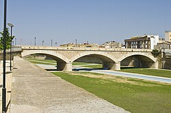 Bridge over Guadalentine in Lorca Bridge over Guadalentine in Lorca | |
| Characteristic | |
| Length | 98 km |
| Pool | 3458 km² |
| Watercourse | |
| Source | Sierra de maria |
| • Location | province of Almeria |
| • Coordinates | |
| Mouth | Segura |
| • Location | Murcia Autonomous Community |
| • Coordinates | |
| Location | |
| Water system | Segura → Mediterranean Sea |
| A country |
|
| Regions | Andalusia , Murcia |

It begins at the confluence of the Veles and Lucena rivers in the Sierra de Maria mountains ( Cordillera-Subbetika ) in the province of Almeria in Andalusia , then the river flows through Murcia , where it flows into Segura . Tributary : Nagalth [4] .
Notes
- ↑ FC García-Tornel. La huerta de Murcia y las avenidas del Guadalentín // Papeles del Departamento de Geografía. - 1968-1969. - No. 1 . - S. 111-137 . - ISSN 0210-5241 .
- ↑ FC García-Tornel, R. García Marín. Frecuencia y evolución de rachas secas en la cuenca del Guadalentín (Sureste de España) // Boletín de la Asociación de Geógrafos Españoles. - 2008. - No. 48 . - S. 71-89 .
- ↑ A. Gil Olcina. El régimen del río Guadalentin // Cuadernos de geografía. - 1968. - No. 5 . - S. 1-19 .
- ↑ Map sheet J-30-A .