Rubicon is a river in the Far East , on the border of the Chukotka Autonomous Okrug and the Kamchatka Territory of Russia .
| Rubicon | |
|---|---|
| chuck. Katynweem | |
| Characteristic | |
| Length | 26 km |
| Watercourse | |
| Source | |
| • Location | Dissected ridge |
| • Height | > 43 m |
| • Coordinates | |
| Mouth | Bering Sea |
| • Height | 0 m |
| • Coordinates | |
| Location | |
| Water system | Bering Sea |
| A country |
|
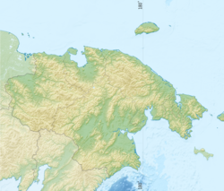
| Region | Chukotka Autonomous Okrug |
| Area | Anadyrsky district |
| HWR code | |
The name was given by the navigator F.K. Huck in 1885. Probably, the polar explorer, describing the shores of the Bering Sea, took a decisive step , crossing the border of the settlement of Koryak and Chukchi. Indigenous people call the river Katynvey , which is translated from Kerek - “cold river”. There is also another name - Nartovaya , which is associated with the passage along the river of the sledge road from the village. Swelling to with. Khatyrka . All three names were used on maps [2] .
The sources of the river are on the southern slopes of the central part of the Dissected Range . The length is 26 km [3] . It flows through the territory of the Anadyr region [4] . It falls into the lagoon of the Mullan of the Bering Sea with several sleeves.
Main tributaries: Calm [5] , Ozerny [6] .
Notes
- ↑ Surface Water Resources of the USSR: Hydrological Understanding. T. 20. Kamchatka / ed. V. Ch. Zdanovich. - L .: Gidrometeoizdat, 1966 .-- 260 p.
- ↑ Leontyev V.V. , Novikova K.A. Toponymic Dictionary of the North-East of the USSR / scientific. ed. G. A. Menovschikov ; FEB AN USSR . North-East complex. Research institutes. Lab archeology, history and ethnography. - Magadan: Magad. Prince Publishing House , 1989 .-- S. 268. - 456 p. - 15,000 copies. - ISBN 5-7581-0044-7 .
- ↑ State Water Register . Rubicon . textual.ru . Ministry of Natural Resources of Russia (March 29, 2009). Date of treatment December 20, 2018. Archived March 29, 2009.
- ↑ Rubicon River . Public cadastral map . Date of appeal May 25, 2012.
- ↑ Map sheet P-60-XIX, XX m. Rubicon . Scale: 1: 200 000. The condition of the area for 1966-76. 1988 edition
- ↑ Map sheet P-60-XIII, XIV . Scale: 1: 200,000. Terrain condition for 1981. 1988 edition