Burrow (in the upper reaches of the Right Burrow ) - a river in Russia flows through the territory of the Iultinsky district of the Chukotka Autonomous Okrug .
| Digging | |
|---|---|
| chuck. Ryvaem | |
| Characteristic | |
| Length | 82 km |
| Watercourse | |
| Source | |
| • Location | spurs of the Eciatape Range |
| • Coordinates | |
| Mouth | Rypilgyn |
| • Height | 0 m |
| • Coordinates | |
| Location | |
| Water system | Chukchi Sea |
| A country |
|
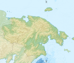
| Region | Chukotka Autonomous Okrug |
| Area | Iultinsky district |
| HWR code | |
On the river bank in the lower reaches is the now abandoned village of Leningradsky .
The name is translated from Chuk. Ryveem is a “clay river” [2] .
Content
- 1 Hydrography
- 2 Features
- 3 notes
- 4 Topographic maps
Hydrography
It begins on the eastern slopes of the Eciatape ridge on the slope of Mount Stupenka [3] ; It flows into the southeastern part of the Rypilgyn Lagoon of the Chukchi Sea . The total length of the watercourse is 82 km [4] , the flow velocity is 0.8 m / s. At the mouth there is an abundance of small thermokarst lakes.
Tributaries - Left Burrow, Deep, Fast, Upper, Straight, Two-brewed, Short, Stag, Pyatistochny, Elynichguygyn, Cretaceous, Yttynchguygin, Bolotny, Bunny [3] , Jerk, Friendly, Kuul .
Food river snow and rain. River waters have low salinity (40-50 mg / l) of sodium sulfate-hydrocarbonate composition [5] . It freezes in October, opens at the end of May.
Features
In the lower reaches of Ryveem, a unique alluvial gold deposit is being developed. Two deposits of agate and onyx also occur, fragmentedly developed along the way with gold mining [6] . The river basin is subject to contamination by gold mining technological waste [7] .
Notes
- ↑ Surface Water Resources of the USSR: Hydrological Understanding. T. 19. Northeast / ed. Yu. N. Komarnitskaya. - L .: Gidrometeoizdat, 1966 .-- 602 p.
- ↑ Leontyev V.V. , Novikova K.A. Toponymic Dictionary of the North-East of the USSR / scientific. ed. G. A. Menovschikov ; FEB AN USSR . North-East complex. Research institutes. Lab archeology, history and ethnography. - Magadan: Magad. Prince Publishing House , 1989 .-- S. 329. - 456 p. - 15,000 copies. - ISBN 5-7581-0044-7 .
- ↑ 1 2 Map sheet R-60-XXVII, XXVIII . Ruby . Scale: 1: 200,000. 1975 edition
- ↑ State Water Register . Digging . textual.ru . Ministry of Natural Resources of Russia (March 29, 2009). Date of treatment December 20, 2018. Archived March 29, 2009.
- ↑ E.I. Polyakova. Diatoms in modern sediments of the Chukchi Sea and their paleogeographic significance . Proceedings of the Academy of Sciences (No. 4, 1979). Date of treatment June 21, 2013. Archived June 27, 2013.
- ↑ E. Lyashenko. Agates of Russia and the CIS countries . Geological Bulletin (No. 10 (10) July 3, 2013).
- ↑ FEFD checks 2707-02082011 . Federal Service for the Supervision of Natural Resources (2011). Date of treatment June 21, 2013. Archived June 27, 2013.
Topographic maps
- Map sheet R-60-XXIII, XXIV Leningrad . Scale: 1: 200,000. Terrain condition for 1981. 1987 edition
- Map sheet R-60-V, Polar . Scale: 1: 500,000. State of the terrain for 1986.