Schuchenka [2] is a river in the Antropovsky district of the Kostroma region of Russia , the left tributary of the Sachi .
| Schuchenko | |
|---|---|
| Characteristic | |
| Length | 17 km |
| Pool | 53 km² |
| Watercourse | |
| Source | |
| • Location | east of the village Kordomets |
| • Coordinates | |
| Mouth | Sacha |
| • Location | 13 km from the mouth on the left bank |
| • Height | 102 m |
| • Coordinates | |
| Location | |
| Water system | Sacha → Nemda → Volga → Caspian Sea |
| A country |
|
| Region | Kostroma region |
| Area | Antropovsky district |
| HWR Code | |
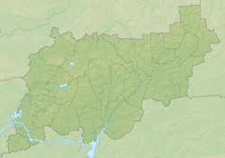
The length is 17 km, the catchment area is 53 km². The source, east of the village of Kordomets, flows into Sacha, 13 km from its mouth near the village of Eremshino.
Water Registry Data
According to the state water register of Russia, it belongs to the Upper Volga basin district , the water management section of the river is the Volga from the city of Kostroma to the Gorky hydroelectric complex (the Gorky reservoir ), without the river Unzha , the river sub-basin of the river Volga below the Rybinsk reservoir to the confluence of the Oka. The river basin is (Upper) Volga to the Kuibyshev reservoir (without the Oka basin) [3] .
According to the geographic information system of water management zoning of the territory of the Russian Federation, prepared by the Federal Agency for Water Resources [3] :
- The code of the water body in the state water register is 08010300412110000014039
- Hydrological code (GI) - 110001403
- Pool code - 01/08/03/004
- GI Volume Number - 10
- Issue on GI - 0
Notes
- ↑ Surface water resources of the USSR: Hydrological knowledge. T. 10. Verkhne-Volzhsky district / ed. V.P. Shaban. - L .: Gidrometeoizdat, 1966. - 528 p.
- ↑ In the state water register of the Russian Federation it is listed as “The river without a name at p. Eremoshino "
- ↑ 1 2 State Water Register . Schuchenka . textual.ru . Ministry of Environment of Russia (March 29, 2009). The appeal date was December 20, 2018. Archived March 29, 2009.