Annobon (lit. " good year ") - an island in the Gulf of Guinea of the Atlantic Ocean . In 1973 - 1979, it was called Pagal . Belongs to Equatorial Guinea . The territory of the island forms the province of Annobon ( fr. , Spanish and port. Annobón ).
- The administrative center of the province is the city of San Antonio de Pale .
- Area - 17 km² , population - 5008 people ( 2001 ). The predominant language is Annobon (one of the Portuguese-Creole languages).
| provinces | |
| Annobon | |
|---|---|
| fr. , Spanish and port. Annobón | |
| A country | Equatorial Guinea |
| Included in | Island region |
| Includes | 1 municipality |
| Adm. center | San antonio de palais |
| History and Geography | |
| Area | 17 km² (7th place ) |
| Timezone | UTC + 1 |
| Population | |
| Population | 5,008 people ( 2001 ) ( 7th place ) |
| Density | 294.59 people / km² (2nd place) |
| Nationalities | annobonts |
| official languages | annobon |
| Digital identifiers | |
| ISO 3166-2 Code | Gq-an |
| Official site | |
 | |
Notes: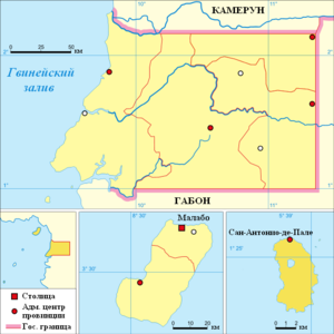  | |
Geography
The island is mountainous, of volcanic origin, with fertile soils. Annobon Island is an eroded surface of a stratovolcano with a height of about 5000 m above the ocean floor, which was laid on the oceanic crust. Its visible base is composed of palagonite breccias, which contain phenocrysts and megacrysts of clinopyroxene and olivine. They are penetrated by subvertical dikes of ancaramite basanites. With erosive disagreement, the lower complex is blocked by flows of basanite flows, the lower of which is 18.4 million years old. In turn, they are also pierced by dikes with an age of 5.35 million years. At the last stages, the formation of tristanite and trachyte domes took place, the largest of which was Pico de Fuego [1] . The climate is equatorial, constantly humid.
History
It was discovered by the Portuguese on January 1, 1473 , so it got its name, which means Happy New Year (literally “good year”). Together with the island of Fernando Po and the modern coast of Equatorial Guinea in 1778 annexed to Spain . In 1968, it became part of the independent Equatorial Guinea.
Administrative Division
The province consists of only one municipality - San Antonio de Pale.
Economics
The island is of strategic interest to Equatorial Guinea . The possession of Annobon allows the government to consider vast sea areas south of Sao Tome and Principe , potentially rich in oil fields, as their exclusive economic zone. In addition, the island is used for the storage of toxic and radioactive waste [2] .
Notes
Links
- Annobon, or Annobom // Brockhaus and Efron Encyclopedic Dictionary : in 86 volumes (82 volumes and 4 additional). - SPb. , 1890-1907.