The Michurinsky swamp [1] (also known as the Kabanye swamp ) is a bog in the Kaliningrad region , in the Krasnoznamensky district , on the territory of the Dobrovolsky rural settlement , in the center of the Michurinsky forest . The length of the swamp is more than 5 km, width 3 km, area - about 1300 ha. The Michurinskoye (Boar) swamp was included in the list of the USSR swamps protected and designated for protection [2] .
| Michurinsky swamp | |
|---|---|
| Specifications | |
| Absolute height | from 38 to 40 m |
| Length | 5 km |
| Width | 3 km |
| Square | 13 km² |
| Location | |
| A country |
|
| The subject of the Russian Federation | Kaliningrad region |
| Area | Krasnoznamensky district |

Geography
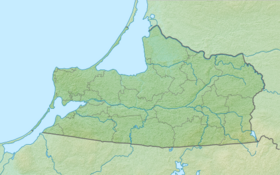
The Michurinsky swamp is located in the northern part of the Sheshupskoye lake-glacial plain, 3 km southeast of Krasnoznamensk . It is a peat deposit up to 5 m thick, the upper layers of which are poorly decomposed upper sphagnum peat, and the lower layers are highly decomposed lowland peat. The hydrological regime has been changed due to drainage forestry operations; the state of the swamp is close to natural [3] . The swamp feeds the headwaters of the Instruch River.
Notes
- ↑ Topographic maps give only the name of the Michurinsky swamp : Map sheet N-34-11 - FSUE GOSGISTSENTR, Map sheet N-34-46 - FSUE GOSGISTSENTR, Map sheet N-34-46-A - FSUE GOSGISTSENTR
- ↑ Napreenko M.G. Marshes of the Kaliningrad region: their role in maintaining biodiversity and the environment in the region (inaccessible link) . Archived on April 14, 2012.
- ↑ Soil science and soil protection. Horse swamp Boar. (inaccessible link - history ) .