ISO 3166-2: AI is an International Organization for Standardization standard that defines geocodes. It is a subset of the ISO 3166-2 standard related to Anguilla . The standard covers the islands of Anguilla which are the overseas territory of Great Britain. The geocode consists of: Alpha2 code according to ISO 3166-1 for Anguilla - AI . The Anguilla geocode is a subset of the top-level domain code - AI assigned by Anguilla in accordance with ISO 3166-1 .
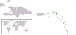 Anguilla on a world map Anguilla on a world map | |
| Geocodes according to ISO 3166-1 | |
| Alpha2 code | AI |
| Alpha3 code | Aia |
| Digital code | 660 |
Content
Anguilla Geocode
| Title | Alpha2 | Alpha3 | digital | Geocode by ISO 3166-2 | Status |
|---|---|---|---|---|---|
| Anguilla | AI | Aia | 660 | not assigned | overseas territory |
Geocodes of Anguillan Border States
- Saint-Martin - ISO 3166-2: MF (in the south (maritime border)),
- British Virgin Islands - ISO 3166-2: VG (in the northwest (maritime border))
- US Virgin Islands - ISO 3166-2: VI (in the northwest (maritime border)).
See also
- ISO 3166-1
- ISO 3166-2
- UK Administrative Division
- Overseas territories of Great Britain