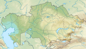
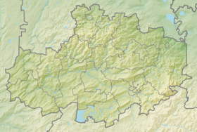
Kurgaldzhin - a lake in the central part of Kazakhstan , is part of the Tengiz-Kurgaldzhin system of lakes . The lake is located at the bottom of the large Tengiz-Kurgaldzhin depression at an altitude of 308 m. The northern (up to 4-6 m high) and eastern shores are steep, western and southern are gentle, with characteristic reed vegetation. The bottom is flat, clay, covered with gray or black silt . Snow food. The Nura River flows into Kurgaldzhin and in the high-water period (spring) water from Kurgaldzhin along the river. Nura is dumped into Lake Tengiz . Mineralization of water varies in different parts: near the mouth of the Nura River, the water is fresh, in the remaining parts of the lake it is brackish.
| Lake | |
| Kurgaldzhin | |
|---|---|
| kaz. Қорғалжын | |
| Morphometry | |
| Absolute height | 308 m |
| Area | 330 km² |
| Coastline | 187 km |
| Deepest | 2 m |
| Average depth | 1.6 m |
| Swimming pool | |
| Flowing river | Nura |
| Flowing river | Nura |
| Location | |
| A country |
|
| Region | Akmola region |
| Area | Korgalzhyn district |
There are about 40 islands on the lake, the largest of them are Aral-Tyube, Kokpekty and Zhar-Tyube. Floating islands are also found, noisy colonies of gulls , terns are arranged on them, ducks and grebes nest.
The lake is rich in fish ( crucian carp , mirror carp , pike , tench , ide , perch , etc.).
Lake Kurgaldzhin is part of the Korgalzhyn reserve . The reserve was created to preserve the nesting of pink flamingos .
In 1976, the Tengiz-Kurgaldzhin system of lakes was included in the list of wetlands of international importance covered by the Ramsar Convention [1] .
Notes
- ↑ Kourgaldzhin and Tengiz Lakes . Ramsar Sites Information Service. Date of treatment January 24, 2018.
Literature
- Great Soviet Encyclopedia