Kegult ( Kalm. Kөglt - thorny ) is a river in the Ketchenerovsky district of Kalmykia . It originates within the Ergeninsky Upland in the Kegult beam. Lost on the Priergeninsky Plain north of the village of Shatta [2] . The length of the river is 52 km, the catchment area is 399 km². It belongs to the West Caspian basin district , the drainless territories of the interfluve of the Terek, Don and Volga [3] .
| Kegult | |
|---|---|
| Calm Kөglt | |
| Characteristic | |
| Length | 52 km |
| Swimming pool | 399 km² |
| Watercourse | |
| Source | |
| • Location | Ergeni, at the village of Kegult |
| • Height | 86 m |
| • Coordinates | |
| Mouth | |
| • Location | interfluve of Terek , Don and Volga |
| • Height | 10 m |
| • Coordinates | |
| Location | |
| A country |
|
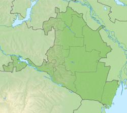
| Region | Kalmykia |
| Area | Ketchenerovsky district |
| HWR code | |
Content
- 1 Physical and geographical characteristic
- 1.1 Pool
- 1.2 Climate and hydrology
- 2 notes
- 3 Source
Physico-geographical characteristics
Pool
The source of the river is located within the village of Kegult . The catchment area is small and amounts to 399 km² [3] . The main tributary is the Gashun River. Below the mouth of the Gashun River, Kegult has no tributaries.
- Kegult
- b. Dry (left component [4] )
- b. Elista Sala (right side [4] )
- b. Kugra - (l) [4]
- R. Gashun - (n) [4]
| Climateogram Kegulty | |||||||||||
|---|---|---|---|---|---|---|---|---|---|---|---|
| I AM | F | M | BUT | M | AND | AND | BUT | FROM | ABOUT | N | D |
27 -3 -9 | 19 -3 -9 | 19 four -four | 21 16 5 | 34 24 eleven | 40 28 16 | 33 31 eighteen | thirty thirty 17 | 25 23 eleven | 21 fourteen 5 | 28 5 -one | thirty 0 -5 |
| Temperature in ° C • Sum of precipitation in mm Source: Climate: Kegult | |||||||||||
Almost the entire catchment basin of the Kegult River is located within Kalmykia , a small part in the adjacent territories of the Rostov Region [5] .
Climate and Hydrology
The amount of precipitation falling in the Kegult river basin is small and decreases in the direction from west to east. The upper reaches of the river according to the Köppen climate classification are located within the zone of humid continental climate with hot summers and moderately cold winters (Dfa index). Most of the runoff falls on a short period of spring flood. Like other rivers in the drainage-free region of the West Caspian basin, due to significant evaporation in the spring-summer period, the role of rain nutrition is small. As a result, the river is characterized by a long summer-autumn low water. The maximum discharge of rain floods does not exceed 25-30% of the maximum discharge of spring flood. [6]
Notes
- ↑ Surface Water Resources of the USSR: Hydrological Understanding. T. 8. The North Caucasus / ed. D. D. Mordukhai-Boltovsky. - L .: Gidrometeoizdat, 1964 .-- 309 p.
- ↑ Maps of the General Staff L-38 (A) 1: 100000. Republic of Kalmykia and Rostov Region
- ↑ 1 2 State Water Register . Kegult . textual.ru . Ministry of Natural Resources of Russia (March 29, 2009). Date of treatment December 20, 2018. Archived March 29, 2009.
- ↑ 1 2 3 4 L-38 (A) maps of the General Staff of the USSR
- ↑ Maps of the General Staff L-38 (A) 1: 100000. Republic of Kalmykia and Rostov Region
- ↑ SKIOVO of the inland areas between the Terek, Don and Volga rivers. Book 1. General characteristics of drainage areas.
Source
- Atlas of the Republic of Kalmykia, Federal State Unitary Enterprise “North Caucasian Airborne Geodetic Enterprise”, Pyatigorsk, 2010, p. 78