Sharyn-Sala ( Kalm. Sharyn-Sala ) is a river in the Republic of Kalmykia . In the upper part, before the confluence of the Ar-Hara River , it is also known as the Perednaya Khara gully. The length is 58 kilometers, the catchment area is 470 km² [4] . It flows in the Iki-Burulsky and Yashkulsky districts of Kalmykia. Refers to the Western Caspian Basin District [4]
| Sharyn-Sala | |
|---|---|
| Characteristic | |
| Length | 58 km |
| Pool | 470 km² |
| Watercourse | |
| Source | |
| • Height [?] | ≈ 130 [1] m |
| • Coordinates | |
| Mouth | Ulan-Zuha |
| • Height [?] | ≈ 25 [2] m |
| • Coordinates | |
| River slope | ≈ 1.8 m / km |
| Location | |
| Water system | Ulan-Zuha |
| A country |
|
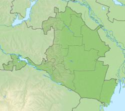
| Region | Kalmykia |
| Areas | Iki-Burul district , Yashkul district |
| HWR Code | |
Physical-geographical characteristic
The Sharyn-Sala River originates within the Ergeninsky Upland, in the Perednyaya Khara [1] . From the source to the mouth, the river flows mainly from west to east. To the mouth of the river Ar-Hara, the river flows in a rather narrow gully. Below, the beam gradually expands, reaching a width of 2-3 km below the mouth of the Bagut-Sala river [5] .
Like other rivers of the drainage region of the Western Caspian basin , the main role in the formation of the flow of the Sharyn-Sal river belongs to precipitation in the cold part of the year. Due to the significant evaporation in the spring-summer period, the role of rain nutrition is small. As a rule, the entire runoff passes in the spring within 30–50 days, sometimes this period is reduced to 10 days [6] .
On the river Sharyn-Sal there is a reservoir "Gosprud" capacity of 1.8 million m³ [7]
Pool
- Sharyn-Sala [8]
- R. Ar-Hara (left component) - 45 km from the mouth
- b. Burat (right component)
- b. Imkin-Sala (l)
- R. Bagut-Sala (p) - 24 km from the mouth
See also
- Kalmykia Rivers
Notes
- ↑ 1 2 Maps of the General Staff L-38 (A) 1: 100000. The Republic of Kalmykia and the Rostov Region . www.etomesto.ru . The appeal date is January 21, 2019.
- ↑ Maps of the General Staff L-38 (A) 1: 100000. The Republic of Kalmykia and the Rostov Region . www.etomesto.ru . The appeal date is January 21, 2019.
- ↑ Surface water resources of the USSR: Hydrological knowledge. V. 8. The North Caucasus / ed. D. D. Mordukhay-Boltovsky. - L .: Gidrometeoizdat, 1964. - 309 p.
- ↑ 1 2 State Water Register . Sharyn-Sala (Front Hara beam) comp. R. Ulan-Zuha . textual.ru . Ministry of Environment of Russia (March 29, 2009). The appeal date was December 20, 2018. Archived March 29, 2009.
- ↑ Maps of the General Staff L-38 (A) 1: 100000. The Republic of Kalmykia and the Rostov Region . www.etomesto.ru . The appeal date is January 21, 2019.
- ↑ Scheme for the integrated use and protection of water bodies in drainless regions between the Terek, Don and Volga rivers. Book 1 . www.zkbvu.ru . The appeal date is January 21, 2019.
- ↑ Scheme for the integrated use and protection of water bodies in drainless regions between the Terek, Don and Volga rivers. Appendix 2. . www.zkbvu.ru . The appeal date is January 21, 2019.
- ↑ Maps of the General Staff L-38 (A) 1: 100000. The Republic of Kalmykia and the Rostov Region . www.etomesto.ru . The appeal date is January 21, 2019.
Source
- Atlas of the Republic of Kalmykia, Federal State Unitary Enterprise North Caucasus Aerogeodetic Enterprise, Pyatigorsk, 2010, pp. 139, 140.
Links
- Sheet map L-38-XV Elista . Scale: 1: 200 000. Specify the date of issue / state of the area .