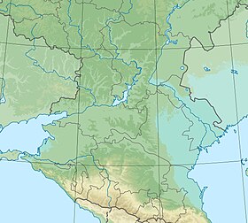
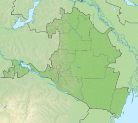
Batyr-Mala ( Kalm. Baatr Mal ) - a disappeared lake in the Sarpinsky district of Kalmykia . Belongs to the water system of Sarpinsky lakes . Located in the Priergeninsky hollow.
| Lake | |
| Batyr Mala | |
|---|---|
| Calm Baatr Mal | |
| Morphometry | |
| Absolute height | 3m |
| Dimensions | 9.5 × ≥ 2.5 km |
| Area | ≥ 21.9 km² |
| Hydrology | |
| Type of mineralization | salty |
| Swimming pool | |
| Pool area | 769 km² |
| Flowing river | Tsaryn-Zelmen |
| Location | |
| A country |
|
| The subject of the Russian Federation | Kalmykia |
| Area | Sarpinsky district |
| Identifiers | |
| HWR : | |
Belongs to the West Caspian basin district . According to the state water registry, the area is 21.9 km² [2] . Included in the system of Sarpinsky lakes .
Content
- 1 Name
- 2 Physical and geographical characteristics
- 2.1 Hydrography and climate
- 2.2 Pool
- 3 notes
- 4 Source
Title
Literally, the name of the lake can be translated as bogatyr / cattle , but according to legend, the name of the lake is associated with Baatr-Malyagi (nephew of Solom-Tseren's noon) - the initiator of the creation of the Kalmyk Iki-, Dund- and Bagakhurulov. According to popular legend, the founder suburgan in memory of the founder was erected in the middle of the lake [3] .
Physico-geographical characteristics
Hydrography and climate
The hydrological regime of the lake is naturally anthropogenic. The lake is located in a zone of sharply continental , semi-desert climate. Under conditions of significant evaporation, the role of rainfall in the water regime of the lake is not great. Before the commissioning of the Sarpinsky irrigation and watering system, the main source of water supply for the reservoir was rainfall in the winter [4] .
Currently, the lake has undergone significant anthropogenic transformation. The territory is drained using drainage channels. Excess water is discharged into the Arshan-Zelmen River . On the topographic map of 1989 is indicated as the tract Batyr-Mala. The territory of the lake is used as a grassland [5] .
Pool
The catchment area is 769 km². The Tsaryn-Zelmen River (Kamennaya beam) flows into the lake, and the lake is also the final receiver of the waters of the beams of Kure-Sala and Harul [6]
Notes
- ↑ Surface Water Resources of the USSR: Hydrological Understanding. T. 8. The North Caucasus / ed. D. D. Mordukhai-Boltovsky. - L .: Gidrometeoizdat, 1964 .-- 309 p.
- ↑ State Water Register . Batyr-Mala . textual.ru . Ministry of Natural Resources of Russia (March 29, 2009). Date of treatment December 20, 2018. Archived March 29, 2009.
- ↑ Arshan-Selmensky Iki - Hurul
- ↑ SKIOVO of the inland areas between the Terek, Don and Volga rivers. Appendix 3. Explanatory note to the book 1.
- ↑ Maps of the General Staff L-38 (A) 1: 100000. Republic of Kalmykia and Rostov Region
- ↑ American map of Russia and the USSR
Source
- Atlas of the Republic of Kalmykia, Federal State Unitary Enterprise “North Caucasian Airborne Geodetic Enterprise”, Pyatigorsk, 2010, p. 43