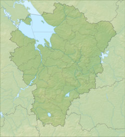
Solmas (Bezvestny) - a stream in Russia , flows in the Poshekhonsky district of the Yaroslavl region. The source is located near the village of Zadnevo. It flows mainly to the north, 1-2 km west of the villages of Bolshoy and Maloye Milkovo, Averkovskoye, Nikolo-Ramenie, Panfilki. Further, the river bed hides for about 2 km in the Artyomovsky swamp, passing a swamp a stream flows into the Soga River. The mouth of the river is located 50 km along the left bank of the Soga River. The river is 16 km long, its catchment area is 33.4 km² [2] .
| Solmas (Unknown) | |
|---|---|
| Characteristic | |
| Length | 16 km |
| Pool | 33.4 km² |
| Watercourse | |
| Mouth | Soga |
| • Location | 50 km on the left bank |
| • Height | below 138.5 m |
| • Coordinates | |
| Location | |
| Water system | Soga → Rybinsk Reservoir → Volga → Caspian Sea |
| A country |
|
| Region | Yaroslavskaya oblast |
| Area | Poshekhonsky district |
| HWR code | |
Water registry data
According to the state water register of Russia, it belongs to the Upper Volga Basin District , the water sector of the river is the Rybinsk Reservoir to the Rybinsk Hydroelectric Complex and the rivers flowing into it, without the Mologa , Suda and Sheksna Rivers from the source to the Sheksninsky Hydroelectric Complex , the river sub-basin is the Rivers of the Rybinsk Reservoir Basin. The river basin - (Upper) Volga to the Kuibyshev reservoir (without the Oka basin) [2] .
According to the geographic information system of water management zoning of the Russian Federation, prepared by the Federal Agency for Water Resources [2] :
- The code of the water body in the state water registry is 08010200412210000010031
- The code for hydrological knowledge (GI) is 110001003
- Pool code - 01/08/02.004
- GI Volume Number - 10
- GI Issue - 0
Notes
- ↑ Surface Water Resources of the USSR: Hydrological Understanding. T. 10. Upper Volga region / ed. V.P. Shaban. - L .: Gidrometeoizdat, 1966 .-- 528 p.
- ↑ 1 2 3 State Water Register . Solmas . textual.ru . Ministry of Natural Resources of Russia (March 29, 2009). Date of treatment December 20, 2018. Archived March 29, 2009.
Links
- Map sheet O-37-56 Goat . Scale: 1: 100,000. Status of the terrain for 1981. 1986 edition