Tumanshet is a river in the Irkutsk region of Russia , the left tributary of Biryusa .
| Mist | |
|---|---|
| Characteristic | |
| Length | 249 km |
| Pool | 4780 km² |
| Water consumption | 52.6 m³ / s (16 km from the mouth) |
| Watercourse | |
| Source | river confluence: Left Tumanshet and Right Tumanshet |
| • Height | 1092 m |
| • Coordinates | |
| Mouth | Biryusa |
| • Location | 600 km from the estuary on the left bank |
| • Coordinates | |
| Location | |
| Water system | Biryusa → Taseeva → Angara → Yenisei → Kara Sea |
| A country |
|
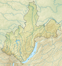
| Region | Irkutsk region |
| Areas | Nizhneudinsky district , Taishet district |
| HWR code | |
Content
Title
The name Tumashet is not related to the word fog and has Kott roots, where shet means a river [2] .
According to Stansilav Gurulev , the basis can be explained by the Buryat tomen - ten thousand , countless [3] .
It is believed that the basis of the Fog comes from the Kottian thu-man - tomorrow [4] .
A number of scientists consider the element man to belong to some unknown language [5] .
According to Andrei Dulzon , this element fell into the Yenisei languages from the Indo-European [6] .
Some consider this to be a Turkic element [7]
General information
It flows through the territory of the Nizhneudinsky and Taishet districts [8] . Formed by the merger of the Left and Right Tumanshet at an altitude of 1092 m above sea level. The length from the source of the Right Tumanshet is 249 km, the catchment area is 4780 km². The source is on the eastern slopes of the Rotten ridge. In the lower reaches - the village of the same name in the Taishet district and the village of the railway station of the Krasnoyarsk railway with the same name.
According to observations from 1963 to 1989, the average annual water flow in the area of the village of Vengerka (16 km from the mouth) is 52.6 m³ / s. The smallest (6.29 m³ / s) falls on February, the largest (221.27 m³ / s) on May [9] . It flows into Biryusa 600 km from its mouth on the left bank.
Water registry data
According to the state water registry of Russia and the geographic information system of water management zoning of the territory of the Russian Federation, prepared by the Federal Agency for Water Resources [10] :
- Basin District - Angara-Baikal
- River Basin - Angara
- River sub-basin of the river - Taseeva
- The water sector of the river - Biryusa
Major tributaries
(distance from the mouth)
- 19 km: river Big Camel (lv)
- 52 km: Slyudyanka river (lv)
- 112 km: Tegur River (ave)
- 116 km: Chernaya river (pr)
- 146 km: Lower Belaya River (pr)
- 163 km: Verkhnyaya Belaya River (pr)
Notes
- ↑ Surface Water Resources of the USSR: Hydrological Understanding. T. 16. Angara-Yenisei region. Vol. 2. Hangar / ed. T.S. Kirillova, N.N. Korchazhnikova. - L .: Gidrometeoizdat, 1965 .-- 224 p.
- ↑ "Geographical names of Eastern Siberia" // Melkheev M.N. (1969)
- ↑ Geographical names of the Irkutsk region: toponymic dictionary / S. A. Gurulev; scientific ed. L. M. Korytny; Institute of Geography V. B. Sochava SB RAS, Irkut. reg. Branch Rus. geo islands
- ↑ Proceedings of the Tomsk Regional Museum of Local Lore, Volume 15. p. 227
- ↑ Melheev M.N. Toponymy of Buryatia: History, System and Origin of Geographical Names. p. 42
- ↑ A.P. Dulzon / Hydronymic range of mans in southern Siberia
- ↑ Toponymy of the East: proceedings of the meeting / Geographical Society of the USSR. Moscow branch. Toponymic Commission. East Literature Publishing House, 1962 - Total pages: 210. p. 25
- ↑ mist . Public cadastral map . Date of treatment April 29, 2013. Archived April 30, 2013.
- ↑ Tumanshet At Vengerka . Statistics on the R-ArcticNET website . Date of treatment April 29, 2013. Archived April 30, 2013.
- ↑ State Water Register of the Russian Federation: Fog . Archived on September 11, 2012.