Macal ( East Belize , Eng. Macal ) - a river in Central America , flows to the east of the Yucatan Peninsula in Belize . The length of Makal is 320 km . Its catchment area has 1492 km² .
| Macal, East Belize | |
|---|---|
| English Macal | |
 | |
| Characteristic | |
| Length | 320 km |
| Pool | 1492 km² |
| Watercourse | |
| Source | |
| • Coordinates | |
| Mouth | Belize |
| • Coordinates | |
| Location | |
| Water system | Belize → Caribbean |
| A country |
|
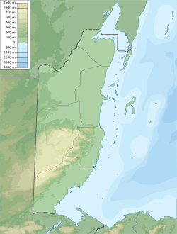
It originates in the mountains of May near the mountains of Serrania Mountain Pine at an altitude of 653 m [1] . From May to July, the most abundant. It has several tributaries. Merging with Western Belize forms the Belize River ( Caribbean Basin).
The river is an important source of drinking water for local residents; a number of reserves have been created on the banks.
On the Russian maps, the lower course of the river is designated as “Western Belize”, and the upper reaches - “Makal” [1] .
Notes
- ↑ 1 2 Map sheet E-16-B . Scale: 1: 500,000 .