The middle one is a river in the Smolensk region of Russia .
| Average | |
|---|---|
| Characteristic | |
| Length | 15 km |
| Pool | 53.6 km² |
| Watercourse | |
| Source | |
| • Coordinates | |
| Mouth | Volost |
| • Location | 40 km on the right bank |
| • Coordinates | |
| Location | |
| Water system | Volosta → Ugra → Oka → Volga → Caspian Sea |
| A country |
|
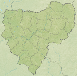
| Region | Smolensk region |
| Area | Vyazemsky district |
| HWR Code | |
It flows in a southeastern direction through the territory of the Vyazemsky district . The source, northwest of the village of Vostok , flows into the Volost River 40 km from its mouth on the right bank. The length of the river is 15 km, the catchment area is 53.6 km².
Along the river there are settlements of Kaidakovsky and Yushkovsky rural settlements - the villages of Vostok, Panfilovo and Andriana .
Water Registry Data
According to the state water register of Russia, it belongs to the Oka basin district , the water management section of the river - the Ugra from its source to the mouth, the river subbasin of the river - the Oka tributaries to the confluence of the Moksha. River basin - Oka [2] .
According to the geographic information system of water management zoning of the territory of the Russian Federation, prepared by the Federal Agency for Water Resources [2] :
- The code of the water body in the state water register is 09010100412110000020811
- Hydrological code (GI) - 110002081
- Pool code - 01/09/01,004
- GI Volume Number - 10
- Issue on GI - 0
Notes
- ↑ Surface water resources of the USSR: Hydrological knowledge. T. 10. Verkhne-Volzhsky district / ed. V.P. Shaban. - L .: Gidrometeoizdat, 1966. - 528 p.
- ↑ 1 2 State Water Register . Average . textual.ru . Ministry of Environment of Russia (March 29, 2009). The appeal date was December 20, 2018. Archived March 29, 2009.