Verchuga (Verchiga) [2] [3] - a river in Russia , flows through the Antropovsky district of the Kostroma region . The mouth of the river is 215 km along the left bank of the Neya River near the village of Tsibakovo . The river is 13 km long [4] .
| Verchuga | |
|---|---|
| Characteristic | |
| Length | 13 km |
| Watercourse | |
| Source | |
| • Coordinates | |
| Mouth | Not me |
| • Location | 215 km on the left bank |
| • Coordinates | |
| Location | |
| Water system | Neya → Unzha → Volga → Caspian Sea |
| A country |
|
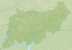
| Region | Kostroma region |
| Area | Antropovsky district |
| HWR code | |
On the banks of the river are the villages of Filino-Sofiyskoye, Shuvakino, Kamennovo, Botvino and Tsibakovo.
Water registry data
According to the state water register of Russia, it belongs to the Upper Volga Basin District , the water sector of the river is Unzha from the source to the mouth, the river sub-basin of the river is the Volga tributaries basin below the Rybinsk Reservoir until the Oka River flows into it. The river basin - (Upper) Volga to the Kuibyshev reservoir (without the Oka basin) [4] .
The code of the object in the state water register is 08010300312110000016126 [4] .
Notes
- ↑ Surface Water Resources of the USSR: Hydrological Understanding. T. 10. Upper Volga region / ed. V.P. Shaban. - L .: Gidrometeoizdat, 1966 .-- 528 p.
- ↑ Map sheet O-38-51 Antropovo . Scale: 1: 100,000. 1979 edition
- ↑ Public Cadastral Map .
- ↑ 1 2 3 State Water Register . Kozlovka . textual.ru . Ministry of Natural Resources of Russia (March 29, 2009). Date of treatment December 20, 2018. Archived March 29, 2009.