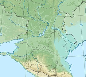
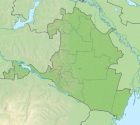
Khanat ( Kalm. Khanat ) is a large salt lake in the north of Kalmykia on the border of Maloderbetovskiy and Sarpinskiy districts . It occupies a middle position in the system of Sarpinsky lakes .
| Lake | |
| Hanata, Big Hanata | |
|---|---|
| Calm Hanat | |
| Morphometry | |
| Absolute height | -1m |
| Dimensions | ≥5 × ≥10 km |
| Square | ≥38 km² |
| Pool | |
| Flowing rivers | Suha , Arshan-Selmen |
| Location | |
| A country |
|
| The subject of the Russian Federation | Kalmykia |
| Identifiers | |
| HWR : | |
Refers to the West Caspian Basin District [2] .
Title
The name of the lake is of Mongolian origin and translates as reed (comes from Kalm. Khan - thick, large reeds ) [3]
Physico-geographical characteristics
Origin
Like other lakes in the water system of the Sarpinsko-Davanskaya hollow , the lake is of relic origin. The formation of the lake is associated with the Lower Khvalyn transgression of the Caspian Sea . The lake is a relic of an ancient delta that formed over a period of 7–8 thousand years at the site of a deep estuary at the end of the Late Pleistocene [4] .
Hydrography and climate
The hydrological regime of the lake is naturally anthropogenic. The lake is located in a zone of sharply continental climate. Under conditions of significant evaporation, the role of rainfall in the water regime of the lake is not great. Before the commissioning of the Sarpinsky irrigation and watering system, the main source of water supply for the reservoir was rainfall in the winter [4] . Since the late 1970s, water has come into the lake from the Sarpinsky irrigation and watering system . The flow of water into Lake Sarpa (Tsagan-Nur) is prevented by an earthen dam [5] .
The lake is highly mineralized: in 2011, water salinity was 20 g / l [4] .
Pool
The catchment area is not known. A stream of Sukha flows into the lake [6] . Also, the flow of the Arshan-Zelmen River was redirected to the lake [7]
Flora and Fauna
A significant part of the lake is covered with dense reed beds . Hygrophytes are represented by an abundance of salt-loving species ( soda hodgepodge , dummy hodgepodge ), which is explained by an increase in water mineralization due to the drying of the reservoir. The lake is the core of the Hanata regional reserve . Habitats of waterfowl and near-water birds ( gray crane on the span, gray goose , spoonbill , white great heron , strepto , stilt , firefight , pegans ) [8]
Environmental Situation
Excessive development of macrophytes leads to oxygen deficiency in winter and spring [4] .
The area of the lake depends on the level of water supply from the Sarpinsky system: in 1978, the area of the lake was 37.82 km², by 2001 the area of the reservoir was reduced by 7 times. The annual drainage band was 13.67 km². Lake nutrition - due to surface runoff, precipitation, and water supply from the P-1 channel from the Volga [9] .
The cessation of Volga water supply and a decrease in precipitation led to shallowing in 2001. The situation repeated in 2011 [10] and 2012 [11] , which caused a massive death of fish and deprived the livestock of residents of the surrounding villages of water.
Notes
- ↑ Surface Water Resources of the USSR: Hydrological Understanding. T. 8. The North Caucasus / ed. D. D. Mordukhai-Boltovsky. - L .: Gidrometeoizdat, 1964 .-- 309 p.
- ↑ State Water Register . Hanata . textual.ru . Ministry of Natural Resources of Russia (March 29, 2009). Date of treatment December 20, 2018. Archived March 29, 2009.
- ↑ Nomto.org unopened (inaccessible link) . Date of treatment February 17, 2012. Archived on September 28, 2016.
- ↑ 1 2 3 4 SKIOVO of inland areas between the Terek, Don and Volga rivers. Appendix 3. Explanatory note to the book 1.
- ↑ Maps of the General Staff L-38 (A) 1: 100000. Republic of Kalmykia and Rostov Region
- ↑ State Water Register . Hanata (Big Hanata) . textual.ru . Ministry of Natural Resources of Russia (March 29, 2009). Date of treatment December 20, 2018. Archived March 29, 2009.
- ↑ Maps of the General Staff L-38 (A) 1: 100000. Republic of Kalmykia and Rostov Region
- ↑ Khanat Sanctuary - Preserved Russia
- ↑ Soils of the Khanata reserve, an area of 52.2 thousand ha. Department for the Protection and Rational Use of Hunting Resources - Soils of the Republic of Kalmykia - Soil Science and Soil Protection (Link not available) . Date of treatment December 10, 2011. Archived April 2, 2015.
- ↑ > Due to the shallowing of Lake Hanata, a fish dies "Vesti Kalmykia / Branch of FSUE VGTRK State Television and Radio Broadcasting Company Kalmykia (Inaccessible link - > history ) .
- ↑ Andrey Serenko. A humanitarian catastrophe of a regional character . Independent newspaper (September 26, 2012). Date of treatment February 15, 2013. Archived March 14, 2013.
Literature
- Atlas of the Republic of Kalmykia, Federal State Unitary Enterprise “North Caucasian Airborne Geodetic Enterprise”, Pyatigorsk, 2010, p. 34