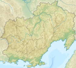
Apkitkich is a river in Russia , in the Far East , flows through the territory of the North Even District of the Magadan Region , far from settlements [2] . Apkitkich the left tributary of the Omolon [2] flows into it at 1016 km from the mouth, the total length of the river is 34 km [3] .
| Apkitkich | |
|---|---|
| Evensk. Apkit | |
| Characteristic | |
| Length | 34 km |
| Watercourse | |
| Source | |
| • Location | Kolyma Highlands |
| • Coordinates | |
| Mouth | Omolon |
| • Location | 1016 km on the left bank |
| • Height | below 734 m |
| • Coordinates | |
| Location | |
| Water system | Omolon → Kolyma → East Siberian Sea |
| A country |
|
| Region | Magadan Region |
| HWR code | |

Name from Even. Apkit is a “gorge” [4] .
Water registry data
According to the state water register of Russia, it belongs to the Anadyro-Kolyma basin district , the river basin is Kolyma, and the river sub-basin is Omolon. The water sector of the river is the Omolon River [3] .
According to the geographic information system of water management zoning of the Russian Federation, prepared by the Federal Agency for Water Resources [3] :
- The code of the water body in the state water registry is 19010200112119000048282
- The code for hydrological knowledge (GI) is 119004828
- Pool code - 01/19/02.001
- GI Volume Number - 19
- GI Issue - 0
Notes
- ↑ Surface Water Resources of the USSR: Hydrological Understanding. T. 19. Northeast / ed. Yu. N. Komarnitskaya. - L .: Gidrometeoizdat, 1966 .-- 602 p.
- ↑ 1 2 Apkitkich . Public cadastral map . Date of treatment December 21, 2011. Archived on September 5, 2012.
- ↑ 1 2 3 State Water Register of the Russian Federation: Apkitkich Neopr . Archived on September 5, 2012.
- ↑ Leontyev V.V. , Novikova K.A. Toponymic Dictionary of the North-East of the USSR / scientific. ed. G. A. Menovschikov ; FEB AN USSR . North-East complex. Research institutes. Lab archeology, history and ethnography. - Magadan: Magad. Prince Publishing House , 1989 .-- S. 72. - 456 p. - 15,000 copies. - ISBN 5-7581-0044-7 .
Links
- The article used information provided by the Federal Agency for Water Resources from the list of water bodies registered in the state water register as of March 29, 2009. List (rar-archive, 3.21 Mb).