Kopa [2] ( Kazakh. Қopa ) [3] - a lake on the Chaglinka river near the city of Kokshetau in the Akmola region of Kazakhstan [2] .
| Lake | |
| Kopa | |
|---|---|
| kaz. Қope | |
 Lake in the summer of 2009 | |
| Morphometry | |
| Dimensions | 5.6 × 12 km |
| Area | 14 [1] km² |
| Swimming pool | |
| Pool area | 3860 [1] km² |
| Flowing rivers | Chagallaly , Kylshakty |
| Flowing river | Chagallal |
| Location | |
| A country |
|
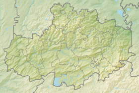
| Region | Akmola region |
| City | Kokshetau |
Content
- 1 Location and description
- 2 Lake condition
- 3 Cleansing the lake
- 4 Interesting Facts
- 5 notes
- 6 References
Location and Description
Lake Kopa is located near the foot of the Kokshetau Upland , at the northwestern part of the city of Kokshetau . The lake has an average area of 14 km² and a depth of 2.0–3.0 m. The total catchment area is 3860 km². The lake is flowing, never-ending [1] .
On the south and west sides, the lake is separated from the adjacent lower sections by coastal ramparts. The northern and eastern shore of the lake is low, gentle, overgrown with grassy vegetation. The water surface of the lake is mostly open, only reeds, reeds and cattails with an average width of 300 m stretch along the western and northern ones. The bottom of the lake is viscous, even, covered with a layer of clay, loamy silt and sand with silt, with a thickness of 0.5 to 2.8 m, sometimes reaching 6 m (the northern part), on average 2 m. In the flood period and at the time of discharge of water from the Chaglinsk reservoir annually about 20 thousand m³ of silt and soil are washed off into the lake. Along the southern and eastern shores stretches a sand and pebble bank formed as a result of the abrasive activity of the lake. The northwestern, northern, and partially northeastern shores are low, gentle, overgrown with aquatic vegetation, their edge is not pronounced.
In 1955, the volume of water in the lake was 39.2 million m³ [1] , the mirror area was 13.6 km². From 1955 to 1990, the volume of the lake decreased by 13 million m³ and is currently 26 million m³ with a water level of 223.8 m, above which the flow of water from the lake begins along lower Chaglinka [1] .
Lake dimensions: 5.4 km on the longest side and 3.3 km in width.
The amplitude of water fluctuations in the lake is 0.5-1.5 m. [1]
According to the chemical composition of the water, the lakes are characterized as chloride, potassium, mineralization from 1.9 to 2.6 mg / l, water hardness 13.8 19.8 kg / equiv (very hard), alkaline water, aggressive to concrete. [one]
Lake State
The general sanitary condition of the lake is gradually deteriorating. Previously, the water surface of the lake was mostly open, only along the western and northern shores were reed, reeds and cattail thickets with a strip of 0.3 to 1.0 km. In connection with the shallowing of the lake, increased heating of the water, increased pollution by sewage and agricultural fertilizers washed into the lake, aquatic vegetation sets in on a water mirror.
In 1974, work began on clearing Lake Kopa from sediment and continued intermittently until 1993. In total, about 400 thousand m³ of sand and gravel soil were withdrawn from the lake from the Kylshakty river removal cone with the simultaneous pouring of this soil onto the area. Then, the cleaning work was stopped and things did not come to the extraction of silt. [four]
In order to preserve the ecological state of Lake Kopa, which is the only resting place for residents of the city of Kokshetau, for many years the environmental services of the city and the region sent materials to the city and regional akimats to take concrete measures to save the reservoir from pollution. In order to promote the same ideas, articles were published in the media, local television broadcasts, and students from urban high schools and students conducted environmental campaigns to clean the coastal zone of Lake Kopa from household garbage. Constant monitoring is carried out by the Akmola branch of the Esil Ecology Department, the mobile laboratory conducts annual studies of the water quality of Lake Kopa and the flowing rivers Kylshakty and Chaglinka. [one]
The routine laboratory tests of the water quality of Lake Kopa for compliance with the requirements of SanPiN 4630-88 “Sanitary rules and standards for the protection of surface waters from pollution” are being carried out by the Sanitary Inspection Department of the city of Kokshetau under routine sanitary inspection. Laboratory control is carried out at 4 control points for physico-chemical and microbiological properties.
According to the Kazhydromet service, the composition of the water in the lake belongs to hydrocarbonate, sodium chloride. The pollution index corresponds to “moderately polluted”. [one]
Lake Work
In June 2011, the regional department of natural resources and environmental management held a tender for the development of design and estimate documentation for the cleaning of Lake Kopa and an agreement was concluded in the amount of 90 607 000 tenge , and it was planned to develop the design and estimate documentation with a subsequent application to the regional budget commission and the start of cleaning work in 2012 year, but as it became known later, the money allocated for cleaning, simply disappeared. In June 2013, the Department for Combating Economic and Corruption Crimes in the Akmola Region instituted criminal proceedings on the fact of unjustified embezzlement of budget funds allocated in 2011 for the development of design and estimate documentation for the environmental protection measure to clean Lake Kopa in the amount of more than 75 million tenge. [5]
Later, the immediate vicinity of Kokshetau was examined by German specialists in images obtained from the US aerospace agency NASA . Thus, foreigners tried to assess the damage caused to Lake Kopa. [one]
Interesting Facts
Kopa Lake has spring food, like all other lakes located on the Kokshetau Upland - Zerenda , Borovoye Auelikol , Big Chebach Lake , Small Chebach Lake , Lake Shalkar (Chelkar) and others. The runoff of the flowing rivers Kylshakty and Shagalaly (Chaglinka) does not have a noticeable effect on the level of the lake, except during the spring flood. At the end of the 19th century, during a period of drought and a natural decrease in groundwater levels and, as a consequence, a sharp decrease in the level of the lake, it was decided to direct the channel of the Shagalaly (Chaglinka) river to the lake. This did not save the lake from temporary shallowing due to the disproportionate amount of incoming water and natural evaporation from a large (~ 14km²) area (average evaporation rate of 200 ml per hour from one square meter). Traces of the old river bed are still preserved in the area of the village of Krasny Yar. Currently, due to the strong siltation of the southern and southwestern shores of the lake, groundwater (spring) waters come to the surface in the coastal part of the city and destroy buildings. The last severe shallowing was observed in the late 1960s - early 1970s, when potatoes were planted on the resulting shallows (reeds are growing there). In 1977-78, a dam from construction debris and rubble was poured on the northern shore of the lake and saved the lake due to this dam. The water level rose by 60-80 cm and thus did not allow the lake to completely dry out. Prior to siltation of the lake from dust during the development of virgin lands in the late 1950s, the depth of the lake reached 16 meters and the water was suitable for drinking. As well as in other lakes of the Kokshetau Upland .
Notes
- ↑ 1 2 3 4 5 6 7 8 9 10 Shlymov M.E. On the state of the environment and natural water bodies (inaccessible link) . ecokomitet.kz . Committee for Environmental Regulation and Control. Date of treatment March 25, 2014. Archived March 25, 2014.
- ↑ 1 2 Kopa // Dictionary of names of hydrographic objects of Russia and other countries - members of the CIS / ed. G.I. Donidze. - M .: Kartgeotsentr - Geodezizdat, 1999. - S. 190. - ISBN 5-86066-017-0 .
- ↑ Akmola region. // Directory of geographical names of Kazakhstan (.Xls). zin.ru. Web portal of ZIN RAS . - Compiled on the basis of the State Catalog of Geographical Names of the Republic of Kazakhstan ( Kazakh Republic of the Republic of Kazakhstan geography ата ataularyna ң memelectic catalogs ) published on the “State Language Portal of the Committee on Languages of the Ministry of Culture and Information of the Republic of Kazakhstan” . Date of treatment April 4, 2018. Archived on September 25, 2017.
- ↑ Who dares to dive? Akmola News (unavailable link) . Date of treatment March 25, 2014. Archived July 23, 2014.
- ↑ A criminal case has been opened on embezzlement of budget funds for cleaning Lake Kopa in Kokshetau - News feed - Kazakhstan News, today. Bnews.kz unopened (inaccessible link) . Date of treatment March 25, 2014. Archived March 25, 2014.
Links
- Baimuldin N. The Lake Will Live // Express K: Newspaper. - 06/25/2009. - No. 359 (16745) . Archived on April 20, 2014.
- Video Cops
- photos, videos and articles about Lake Kopa in Kokshetau
- Kokshetau Upland. The formation of mountains, lakes and geology