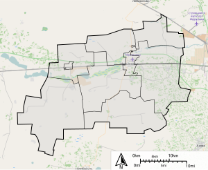
Mar'yanovsky District is an administrative-territorial unit ( district ) and a municipality ( municipal district ) in the south-west of the central part of the Omsk region of Russia .
| district [1] / municipal district [2] | |||||
| Maryanovsky district | |||||
|---|---|---|---|---|---|
| |||||
| A country | |||||
| Enters into | Omsk region | ||||
| Includes | 10 municipalities | ||||
| Adm Centre | town Maryanovka | ||||
| Head of Maryanovsky municipal district | A.I. Solodovnichenko | ||||
| History and geography | |||||
| Date of education | January 25, 1935 (I education) January 11, 1965 (II education) | ||||
| Square | 1,651.95 [3] km² | ||||
| Timezone | MSK + 3 ( UTC + 6 ) | ||||
| Population | |||||
| Population | ↗ 27,602 [4] people ( 2017 ) | ||||
| Density | 16.71 p / km² | ||||
| Digital identifiers | |||||
| Telephone code | 38168 | ||||
 | |||||
 | |||||


The administrative center is Maryanovka urban-type settlement.
Geography
Maryanovsky district is located in the south of Western Siberia in the Omsk region. Area area - 1700 km ².
History
District formed in January 1935 :
- 4 village councils, 1 village sovkhoz council transferred from the Sherbakulsky district (Aulsovet No. 11, Bogolyubovsky, Novopopovsky, Nokinsky and Moskalensky sovkhoz village council);
- 4 village councils were transferred from the Lubinsky District (Maryanovsky, Orlovsky, Pokrovsky, Stepninsky). [five]
In April 1936, Aulsovet number 11 was renamed Narimanovsky with the transfer of the center from the village Zhundos to the village Narimanovka [6] .
In 1936, there were 96 settlements, 8 village councils (1 Kazakh, 1 German, 1 village), 50 collective farms, 4 state farms, 1 MTS, 40 primary schools, 9 secondary schools, 1 secondary school, 16 club facilities, 1 hospital , 2 dispensaries. The area is 1616 square kilometers [7] .
On January 1, 1938, the area of the district was 1600 square kilometers, there were 8 village councils. The distance to the center of the region is 50 kilometers. The nearest train station is here [8] .
In 1938, the center of the Pokrovsky village council was moved from the village of Pokrovka to the village of Piketnoye.
In 1940, the center of the Maryanovsky village council was moved from the village of Usovka to the village of Maryanovka.
By January 1, 1941, there were 9 village councils in the district. The area of the district was 1700 square kilometers. The distance to the center of the region is 52 kilometers [9] .
In 1941, the center of the Nokinsk village council was moved from the village of Nok to the village of Sheremetyevka.
In 1945, Vasilyevsky was formed from parts of the Bogolyubovsky and Maryanovsky village councils. Gribanovsky was formed from parts of Maryanovsky, Nokinsky, Novopopovsky rural councils. Parts of the Stepninsky Village Council were transferred to Dzerzhinsky and Sharapovsky. The center of Narimanov village council was transferred from the village Narimanovka to the village Kara-Terek [10] .
By January 1, 1947, there were 9 village councils in the district. The area of the district was 1700 square kilometers. The nearest railway station is here [11] .
In 1949, the center of the Nokinsk village council was moved from the village of Sheremetyevka to the village of Nok.
In 1954, the Narimanov Village Council and part of Dzerzhinsky joined Vasilyevsky. A part of the Dzerzhinsky village council and Sharapovsky are attached to Stepninsky [12] .
In May 1958, the village of Maryanovka was transformed into a working village. Formed Marjanovo village council. Maryanovsky, Nokinsky village councils are attached to Usovsky [13] .
In August 1958, the Pokrovsky Village Council was renamed Piketinsky [14] .
In 1959, the Novopopovsky Village Council was joined to the Moskalensky State Farm Village Council [15] .
In 1961, the Bogolyubovo Village Council was annexed to Vasilyevsky. The center of the Vasilyevsky village council was transferred from the village of Vasilyevka to the village of stud No. 40. The Usovsky village council was joined to Gribanovsky [16] .
In 1963 the district was liquidated:
- 4 village councils, 1 village council transferred to Lyubinsky district (Vasilyevsky, Orlovsky, Piketinsky, Stepninsky and Maryanovsky village council);
- 1 village council, 1 village sovkhoz council transferred to Moskalensky district, Gribanovsky village council, Moskalensky sovkhoz village council). [17]
In 1965, the district was again formed:
- 3 village councils, 1 village sovkhoz council transferred from the Moskalensky district (Vasilyevsky, Gribanovsky, Piketinsky village councils and Moskalensky sovkhoz village council);
- 2 village councils, 1 village council are devoted from the Lyubinsky district (Maryanovsky village council and Orlovsky, Stepninsky village councils);
- 1 village council transferred from the Tavrichesky district (Berezovsky).
Renamed some of the settlements in the area [18] .
In 1966, Bogolyubovsky was separated from Vasilievsky and Gribanovsky village councils [19] .
In 1970, the center of the Gribanovsky village council was moved from the village of Gribanovka to the working village Maryanovsky [20] .
By 1987, the nearest railway station is here. The distance to Omsk is 47 kilometers [21] .
In 1989, Sharapovsky was separated from the Stepninsky Village Council [22] .
In January 1991, Zarinsky was separated from the Piket village council [23] .
As of March 1, 1991, there were 10 village councils in the region, 1 working village and 45 settlements in the countryside. The territory of the area is 1,800 square kilometers. The population of the area is 30173 people. There were 2 state farms (“Novoazovskiy”, “Yuzhny”), 4 collective farms (“Zarya Svoboda”, “Banner of Communism”, “Iskra”, “Druzhba”), 1 grain farm (“Russia”), 1 farm (“Omsky”) , 1 goslemzavod ("Maryanovsky"). [24]
In 1993, the village councils were abolished.
In 2003, village administrations were introduced in the region [25] .
In 2004, rural administrations were transformed into rural districts [26] .
In 2006, the district coat of arms was approved [27] .
As of January 1, 2009, there were: 1 working village, 41 rural settlements, 9 rural districts [28] .
Population
| Population | ||||||
|---|---|---|---|---|---|---|
| 1959 | 1970 | 1979 | 1989 | 2002 [29] | 2009 [30] | 2010 [31] |
| 29,921 | ↘ 29,828 | ↘ 28,477 | ↗ 30,173 | ↘ 27 802 | ↘ 27,307 | ↗ 27 595 |
| 2011 [32] | 2012 [33] | 2013 [34] | 2014 [35] | 2015 [36] | 2016 [37] | 2017 [4] |
| ↘ 27,556 | ↘ 27,417 | ↘ 27,183 | ↘ 26,974 | ↗ 27,428 | ↗ 27,588 | ↗ 27,602 |

According to the All-Union Census of January 15, 1959, 29921 people lived in the region (13,841 m - 16080).
According to the All-Union Census of January 15-22, 1970, there were 29,828 people living in the region (13,886 meters - 15,942).
According to the All-Union Census of the Population on January 17, 1979, there were 28,477 people living in the area (13,213 m - 15,264).
According to the All-Union Census of January 12-19, 1989, 30173 people lived in the area (14262 m - 15911).
According to the All-Russian population census of October 9, 2002, 27,802 people lived in the region (13,104 m - 14,698).
According to the All-Russian Census of October 14-25, 2010, 27,595 people lived in the district (12989 m - 14606). In percentage terms, 47.1% of men and 52.9% of women [38] .
- National composition
According to the 2010 All-Russian Population Census [39]
| Nationality | Population, people | Percentage of population [40] |
|---|---|---|
| Belarusians | 139 | 0.50 |
| Kazakhs | 1924 | 6.97 |
| Germans | 2321 | 8.41 |
| Russians | 21184 | 76.77 |
| Tatars | 397 | 1.44 |
| Ukrainians | 888 | 3.22 |
| Other nations | 742 | 2.69 |
| Total area | 27595 | 100.00 |
Municipal unit
In Maryanovsky district there are 42 settlements in one urban and nine rural settlements:
| No | Urban and rural settlements | Administrative center | amount inhabited points | Population | Square, km 2 |
|---|---|---|---|---|---|
| one | Maryanovsky urban settlement | working village Maryanovka | one | ↗ 8720 [4] | 34.12 [3] |
| 2 | Bogolyubovo rural settlement | village Bogolyubovka | five | ↘ 2041 [4] | 251.32 [3] |
| 3 | Vasilievsky rural settlement | village Konezavodsky | 6 | ↘ 3598 [4] | 215.65 [3] |
| four | Gribanovskoye rural settlement | Maryanovsky village | 6 | → 2977 [4] | 245.01 [3] |
| five | Zarinskoe rural settlement | village Zarya Svoboda | 3 | ↘ 1135 [4] | 144,69 [3] |
| 6 | Moskalenskoye rural settlement | Moskalensky settlement | eight | ↗ 4021 [4] | 385.69 [3] |
| 7 | Oryol rural settlement | Orlovka village | 2 | ↘ 1569 [4] | 140.91 [3] |
| eight | Piketin rural settlement | Piketnoye village | 3 | ↘ 878 [4] | 7.63 [3] |
| 9 | Stepninskoye rural settlement | Stepnoye village | 3 | ↘ 1001 [4] | 117.85 [3] |
| ten | Sharapovskoye rural settlement | village of New Sharapovka | five | ↗ 1662 [4] | 109.08 [3] |
| List of settlements of the district | ||||
|---|---|---|---|---|
| No | Locality | Type of | Population | Municipality |
| one | 2857 km | railway stop | 26 [31] | Sharapovskoye rural settlement |
| 2 | Aleksandrovka | village | ↘ 235 [31] | Sharapovskoye rural settlement |
| 3 | Alekseyevka | village | ↗ 388 [31] | Vasilievsky rural settlement |
| four | Alon | railway stop | 58 [31] | Vasilievsky rural settlement |
| five | Berezovka | village | ↗ 456 [31] | Oryol rural settlement |
| 6 | Bogolyubovka | village | 1079 [31] | Bogolyubovo rural settlement |
| 7 | Big Grove | village | 437 [31] | Bogolyubovo rural settlement |
| eight | Vasilyevka | village | ↗ 441 [31] | Vasilievsky rural settlement |
| 9 | Golenki | village | 389 [31] | Vasilievsky rural settlement |
| ten | Gribanovka | village | ↘ 52 [31] | Gribanovskoye rural settlement |
| eleven | Dombay | aul | 403 [31] | Moskalenskoye rural settlement |
| 12 | Dawn of liberty | village | 751 [31] | Zarinskoe rural settlement |
| 13 | Green Valley | village | 148 [31] | Bogolyubovo rural settlement |
| 14 | Kara-Terek | aul | 307 [31] | Vasilievsky rural settlement |
| 15 | Konezavodsky | village | 1957 [31] | Vasilievsky rural settlement |
| sixteen | Lesnogorsky | village | 110 [31] | Moskalenskoye rural settlement |
| 17 | Small Stepninka | village | ↗ 225 [31] | Stepninskoye rural settlement |
| 18 | Maryanovka | working village | ↗ 8720 [4] | Maryanovsky urban settlement |
| nineteen | Maryanovsky | village | 1108 [31] | Gribanovskoye rural settlement |
| 20 | Mikhaylovka | village | 149 [31] | Bogolyubovo rural settlement |
| 21 | Moskalensky | village | 2468 [31] | Moskalenskoye rural settlement |
| 22 | Neydorf | village | ↘ 205 [31] | Moskalenskoye rural settlement |
| 23 | New Sharapovka | village | ↘ 662 [31] | Sharapovskoye rural settlement |
| 24 | New Field | village | ↘ 3 [31] | Stepninskoye rural settlement |
| 25 | Orlovka | village | 1275 [31] | Oryol rural settlement |
| 26 | Branch No. 2 of the Russian State Farm | locality | 114 [31] | Moskalenskoye rural settlement |
| 27 | Branch No. 3 of the Russian State Farm | locality | 412 [31] | Moskalenskoye rural settlement |
| 28 | Branch No. 5 of the Russian State Farm | locality | 196 [31] | Moskalenskoye rural settlement |
| 29 | Ohrovka | village | 159 [31] | Gribanovskoye rural settlement |
| thirty | Petrovka | village | 312 [31] | Sharapovskoye rural settlement |
| 31 | Picket | village | ↗ 819 [31] | Piketin rural settlement |
| 32 | Nursery | village | 53 [31] | Moskalenskoye rural settlement |
| 33 | Chapaev settlement | village | 250 [31] | Zarinskoe rural settlement |
| 34 | Reinfeld | village | 235 [31] | Zarinskoe rural settlement |
| 35 | Old Sharapovka | village | ↗ 495 [31] | Sharapovskoye rural settlement |
| 36 | Steppe | village | 798 [31] | Stepninskoye rural settlement |
| 37 | Tatyanovsky | railway stop | 11 [31] | Piketin rural settlement |
| 38 | Tatyanovskiy Kordon | locality | 3 [31] | Piketin rural settlement |
| 39 | Catch | village | 827 [31] | Gribanovskoye rural settlement |
| 40 | Cozy | village | 415 [31] | Gribanovskoye rural settlement |
| 41 | Cheburenki | village | 178 [31] | Gribanovskoye rural settlement |
| 42 | Sheremetyevka | village | 356 [31] | Bogolyubovo rural settlement |
Economy
Among the 399 business entities registered in the region, 46% are peasant farms, about 20% are economic companies and partnerships, 9% of non-profit organizations are municipal institutions, 3% are state institutions.
The district has flour milling, feed and food industries. The flour-and-cereals industry annually provides up to 80% of the total industrial output of the district. About 15% gives the food industry. From January to December 2001, the volume of industrial output amounted to 133,948 thousand rubles.
In 2001, residential buildings with an area of 2204 m² were commissioned. Retail trade turnover in the region in 2001 amounted to 95,203 thousand rubles. The turnover of public catering enterprises in the region from January to September 2001 amounts to 2,300 thousand rubles.
There are about 10 large agricultural organizations in the region. The dynamics of gross agricultural production in farms of all categories in the late 1990s is as follows:
- 1996 - 167240 thousand rubles,
- 1997 - 187548 thousand rubles,
- 1998 - 187,126 thousand rubles,
- 1999 - 334199 thousand rubles.
The gross grain harvest in farms of all categories in 2001 was 123.1 thousand tons. The area under crops in farms of all categories covers more than 86 thousand hectares. Grain crops occupy more than 46 thousand hectares, fodder crops - more than 38 thousand hectares.
Livestock in large and medium-sized agricultural organizations - more than 16 thousand heads. Developed poultry, pig, sheep.
Largest Businesses
- Combine Cooperative Industry
- Combine bread products
- Goslemmonzavod "Omsky"
- SEC Plemzavod "Sheep"
Transportation
The length of roads with hard surface is more than 390 km. Indicators of road transport in the late 1990s are as follows:
- 1996 - 19222.0 thousand t.km,
- 1997 - 16934.0 thousand t.km,
- 1998 - 10,923.2 thousand t.km,
- 1999 - 11,929.9 thousand t.km.
Attractions
Monuments of history, architecture, archeology and monumental art
- Steppe redoubt , village Stepnoye
- Mass grave of fighters for Soviet power in 1919, organized in 1955, the village of Stepnoye
- The mass grave of the participants of the battle of Maryanovskiy 1918, organized in 1958, rp Maryanovka.
- The mass grave of victims of the White Guards 1918-1919, organized in 1957, the village of Piketnoye
- The building of the railway station of 1896, where the headquarters and the observation point of the Red Guard detachment in the battle of Maryanovka 1918 were located, the railway station of the enterprise Maryanovka.
- The water tower of 1896, where the headquarters and the observation point of the Red Guard detachment in the battle of Maryanovskiy 1918 were located, the railway station of the enterprise Maryanovka.
- The place where the train was located, in which the headquarters of the 5th Army was located in 1919, from there was given a telegram to VI Lenin about the liberation of Omsk from the White Guard, the railway station Maryanovka.
- The obelisk to the soldiers-countrymen who died during the Great Patriotic War of 1941–1945 was installed in 1969, the village of Moskalensky
- Monument to the Hero of the Soviet Union I. S. Ponomarenko , established in 1965, the village of Bogolyubovka
- Monument to V.I. Lenin 1967, Orlovka Village [41]
- The place of the Marianovsky Red Guards battle with the White Czechs, 15 m to the east of the railway station of Marianovka.
- The Mill where Joseph Broz Tito worked, the village of Bogolyubovka
- Kurgan redoubt , rp Maryanovka
- The house that housed the evacuated orphanage number 23, st. South village Stepnoye
- Location of the commune "Kurzeme", 5 km of the highway "Maryanovka-Sherbakul"
- Pokrovskaya fortress
Notes
- ↑ from the point of view of the administrative-territorial structure
- ↑ from the point of view of the municipal structure
- ↑ 1 2 3 4 5 6 7 8 9 10 11 Omsk Region. Total land area of the municipality
- ↑ 1 2 3 4 5 6 7 8 9 10 11 12 13 Population of the Russian Federation by municipalities as of January 1, 2017 (July 31, 2017). The date of circulation is July 31, 2017. Archived July 31, 2017.
- Resolution of the All-Russian Central Executive Committee of January 25, 1935 “On the organization of new districts of the Omsk Region”
- ↑ Resolution of the Regional Executive Committee No. 520 of April 19, 1936 “On the renaming of the“ numbered ”aul Soviets”
- ↑ Districts of the Omsk Region. Omsk Regional Department of National Economic Accounting. OMGIZ. Omsk. 1936.
- Administrative-territorial division of the Union Republics of the USSR on January 1, 1938
- Administrative-territorial division of the Union Republics of the USSR on January 1, 1941
- ↑ Decision of the regional executive committee No. 106 dated February 6, 1945 “On disaggregation of the village councils of the Maryanovsky district of the Omsk region” (Approved by the Supreme Soviet of the RSFSR of October 16, 1947). The decision of the regional executive committee dated January 23, 1945 “On partial change of the borders of rural Soviets of the Maryanovsky district”. Decree of the Supreme Soviet of the RSFSR of October 16, 1947 “On the Formation of Vasilyevsky, Gribanovsky, Dzerzhinsky and Sharapovsky Rural Soviets as part of the Maryanovsky District of the Omsk Region”
- ↑ USSR administrative-territorial division of the Union republics on January 1, 1947. Fifth edition, supplemented. Information and Statistics Department under the secretariat of the Presidium of the Supreme Soviet of the USSR. Publishing house "News of the Soviets of Workers of the USSR". Moscow. 1947
- Decision of the regional executive committee dated June 22, 1954 “On the unification of the rural Soviets of the Omsk region” (Approved by the Supreme Soviet of the RSFSR 06/18/1954)
- Decision of the regional executive committee of May 16, 1958 “On classifying the village of Maryanovka, Maryanovsky district, as a working-class settlement”
- The decision of the regional executive committee of August 31, 1958 “On the renaming of some village councils in the districts of the region”
- The decision of the regional executive committee of April 8, 1959 "On the unification of Moskalensky and Novo-Popovsky rural Councils of Maryanovsky district"
- Decision of the regional executive committee dated August 5, 1961 “On the unification of the rural Soviets of the Maryanovsky district”
- Decision of the regional executive committee dated December 15, 1962 “On the enlargement of rural areas” (Approved by the Supreme Council of the RSFSR 02/01/1963)
- ↑ Decision of the regional executive committee No. 14 of January 18, 1965 “On changes in the administrative-territorial division of the region” (Decree of the Supreme Soviet of the RSFSR of January 11, 1965). The decision of the regional executive committee number 145 of February 29, 1968 "On the renaming of settlements Moskalensky, Maryanovsky and Kormilovsky districts" (Decree of the Supreme Soviet of the RSFSR of January 9, 1969)
- Decision of the regional executive committee No. 249 dated March 31, 1966 “On the formation of the Bogolyubovo village council of Maryanovsky district”
- Decision of the regional executive committee No. 609 dated October 6, 1970 “On changes in the administrative and territorial division of some village councils of the region”
- Administrative-territorial division of the Union Republics of the USSR on January 1, 1987
- Decision of the regional executive committee No. 264 dated September 29, 1989 “On some changes in the administrative-territorial division of Bolsheukovsky, Ishklskar, Kalachinsky, Kormilovsky, Lyubinsky, Maryanovsky, Moskalensky, Muromtsevsky, Nazyvaevsky, Nizhneomsky, Novomarshavsky, Pavlogradsky, St. Petersburg, Murtavsky, Nazykayevsky, Nizhneomsky, Novoarshavsky, Pavlogradsky, Nizhnyaevsky, Nizhnyomsky, Novomarshavsky, Lutsky, Martaynsky, Moskalensky, Murmantsky, Nizhnyomsky, Novomarshavsky, Lutsky , Tarsk, Tevriz, Ust-Ishim districts of the region "
- Decision of the Presidium of the Regional Council No. 8 of January 15, 1991 “On some changes in the administrative-territorial division of the Maryanovsky, Moskalensky and Odessa districts of the Omsk Region”
- ↑ Administrative and territorial division on March 1, 1991. Presidium of the Omsk Regional Council of People's Deputies. Editorial and publishing department. Omsk. 1991
- ↑ Resolution of the Legislative Assembly of the Omsk Region. Law of the Omsk Region of October 15, 2003 No. 467-OZ “On the Administrative-Territorial Structure of the Omsk Region and the Procedure for its Amendment”
- ↑ Resolution of the Legislative Assembly of the Omsk Region No. 216 dated July 15, 2004 “On Amendments and Additions to the Law of the Omsk Region” “On the Administrative-Territorial Structure of the Omsk Region and the Procedure for its Amendment”
- Decision of the Council of the Maryanovsky Municipal District of the Omsk Region of August 3, 2006 No. 37/7 “On the Official Symbols of the Maryanovsky Municipal District of the Omsk Region”
- ↑ The memorial book of the Omsk region in 2008. Federal State Statistics Service. The territorial body of the Federal State Statistics Service in the Omsk region. Omsk. 2008
- ↑ All-Russian population census of 2002. Tom. 1, table 4. The population of Russia, federal districts, constituent entities of the Russian Federation, districts, urban settlements, rural settlements — regional centers and rural settlements with a population of 3,000 or more . Archived on February 3, 2012.
- ↑ The resident population of the Russian Federation by cities, urban-type settlements and districts as of January 1, 2009 . The date of circulation is January 2, 2014. Archived January 2, 2014.
- ↑ 1 2 3 4 5 6 7 8 9 10 11 12 13 14 15 16 17 18 19 20 21 22 23 24 25 26 27 28 29 30 31 33 33 35 35 37 38 39 40 41 42 All-Russian population census 2010. The population of urban and rural settlements of the Omsk region . The appeal date is April 16, 2014. Archived April 16, 2014.
- ↑ Omsk region. Estimate of the number of resident population on January 1, 2009-2016
- Population of the Russian Federation by municipalities. Table 35. Estimated number of resident population on January 1, 2012 . The date of circulation is May 31, 2014. Archived May 31, 2014.
- ↑ Population of the Russian Federation by municipalities as of January 1, 2013. - M .: Federal State Statistics Service Rosstat, 2013. - 528 p. (Table 33. Population of urban districts, municipal districts, urban and rural settlements, urban settlements, rural settlements) . The appeal date is November 16, 2013. Archived November 16, 2013.
- ↑ Table 33. The population of the Russian Federation by municipalities as of January 1, 2014 . Circulation date August 2, 2014. Archived August 2, 2014.
- ↑ Population of the Russian Federation by municipalities as of January 1, 2015 . Circulation date August 6, 2015. Archived August 6, 2015.
- Population of the Russian Federation by municipalities as of January 1, 2016
- ↑ Rosstat . The date of circulation is January 5, 2014. Archived on May 23, 2013.
- Population of municipal districts of Omsk region by nationality (2010)
- Share of the most numerous nationalities of the Omsk region in the population of municipal districts and the city of Omsk (2010)
- Decision of Omsk Regional Executive Committee dated June 26, 1980 No. 239/10 “On measures to improve the protection, restoration and use of historical and cultural monuments of the Omsk Region”