Sarva ( Bashk. Sarua ) - a river, the right tributary of the Saldybash river, a natural monument (1985).
| Sarva | |
|---|---|
| head off. Sarua | |
 River and lake River and lake | |
| Characteristic | |
| Watercourse | |
| Source | |
| • Coordinates | |
| Mouth | Saldybash |
| • Coordinates | |
| Location | |
| Water system | Saldybash → Ufa → Belaya → Kama → Volga → Caspian Sea |
| A country |
|
| Region | Bashkortostan |
| Area | Nurimanovsky district |
| HWR code | |
Content
Description
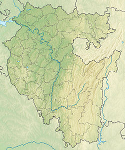
Sarva originates on the northwestern slope of the Karatau ridge on the border of Bashkortostan and the Chelyabinsk region . The Sarva River flows from the north-east to the south-west along the territory of the Nurimanovsky district of the Republic of Bashkortostan and flows into the Saldybash river (a tributary of Ufa ) 36 km from its mouth.
The river basin is located within the Ufa plateau , its forest cover is 90%.
The length of the riverbed, which has a constant flow, is about 15 km. Sarva has several sources. The main one is the Saula River, flowing down from Karatau, after 5 km it disappears into a fissure, barely falling from the sandstones of the ridge into the limestones of the Ufa Plateau. In the upper reaches is the Saulla karst river, which after 5 km goes underground and for 28 km the channel does not have a constant flow of water and consists of the Aikudra, Alikudrinsky drylands and their tributaries Karimovsky, Alyoshkin, Usaklinsky, Travyanaya, Krasny Kamen, Mochalny, Askan and others. The entire highlands above Sarva are dotted with craters and blind logs. Which indicates that the Sarva catchment area is the entire territory lying east of the karst source.
In the middle reaches (near the village of Sarva ), the river unloads into Sarvinskoe lake . Length about 60 m, width 30 m, and depth reaches 52 m .
Water system: Saldybash → Ufa → Belaya → Kama → Volga → Caspian Sea .
Water registry data
According to the state water register of Russia, it belongs to the Kama basin district , the water sector of the river is Ufa from the Pavlovsky hydroelectric complex to the water meter post of the urban-type settlement Shaksha , the river sub-basin of the river is Belaya. The river basin of the river is Kama [2] .
The code of the object in the state water registry is 10010201212111100023858 [2] .
Notes
- ↑ Surface Water Resources of the USSR: Hydrological Understanding. T. 11. The Middle Urals and the Urals. Vol. 1. Kama / ed. V.V. Nikolaenko. - L .: Gidrometeoizdat, 1966 .-- 324 p.
- ↑ 1 2 State Water Register . Sarva . textual.ru . Ministry of Natural Resources of Russia (March 29, 2009). Date of treatment December 20, 2018. Archived March 29, 2009.
Links
- Zagorsky V.A. Sarva, river // Bashkir Encyclopedia / Chap. M.A. Ilgamov. - Ufa: GAUN “ Bashkir Encyclopedia ”, 2015—2019. - ISBN 978-5-88185-306-8 .
- Reference article. Karst spring lake Sarva. Site All Southern Urals
- Sarva - the deepest lake in Bashkiria
- Virtual tour of Lake Sarva