Muisko-Kuandinskaya depression - a depression in the north of Transbaikalia , located on the territory of Buryatia and the Trans-Baikal Territory .
| Muisko-Kuandinsky depression | |
|---|---|
| Specifications | |
| Depth | 450 m |
| Length | 130 km |
| Width | 50 km |
| Type of Origin | Baikal |
| Location | |
| A country |
|
| Subjects of the Russian Federation | Buryatia , Trans-Baikal Territory |
| Between the ridges | North Mui Range , South Mui Range |
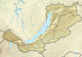
Geography
It lies between the North Muisky and South Muisky ridges. The length of the depression is ~ 130 km, the greatest width is ~ 50 km, and heights are from 450 to 700 m. It enters the Baikal rift zone and is filled with a thick layer of river and lake sand and sandy loam . A flat, flat, swampy bottom is occupied by the merged floodplains of Vitim and its tributaries Mui and Kuanda . Also in the lower parts of the basin are numerous lakes of glacial, thermokarst and old origin. In places, there are hilly elevations with pine and pine- larch forests .
The depression is located in a highly seismic zone: in 1958, a powerful earthquake occurred here.
Mastery
Along the southern edge of the Muisko-Kuandinsky Depression passes the Baikal-Amur Railway and the parallel AvtoBAM highway. Within the lowlands are settlements - Taksimo , Ust-Muya , Kuanda and a number of smaller villages.
Sources
- Muisko-Kuandinsky Depression // Dictionary of modern geographical names / Rus. geo about . Mosk. Centre; Under the total. ed. Acad. V.M. Kotlyakova . Institute of Geography RAS . - Yekaterinburg: U-Factoria, 2006 ..
- Muyskaya Depression . ez.chita.ru . The project " Encyclopedia of Transbaikalia ." Date of treatment January 19, 2019. Archived September 24, 2018.