The Chernyshev Ridge is a mountain range in the Amur Region of Russia , at the junction of the mountain systems of Transbaikalia and Amur . The western link of the Tukuringra - Jagda chain.
| Chernyshev Ridge | |
|---|---|
| Specifications | |
| Length | 120 km |
| Highest point | |
| Highest peak | Lucinda |
| Absolute height | 1572 m |
| Location | |
| A country |
|
| The subject of the Russian Federation | Amur region |

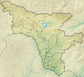
The length of the ridge is 120 km. The highest point is Mount Lucinda (1572 m). The ridge divides the valleys of the Nyukzha rivers ( Olekma basin ), Olda and Tynda ( Amur basin ). It is composed mainly of granites and crystalline schists . The ridges have flattened and swollen shapes. Mountain taiga prevails ; higher on the slopes - thickets of cedar dwarf .
The ridge was named in honor of the outstanding Russian geologist Theodosius Nikolaevich Chernyshev .
Sources
- Chernyshev Ridge - an article from the Great Soviet Encyclopedia . .