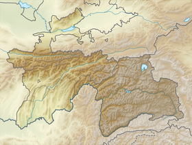
The Shahdarin Range is a mountain range in the south of the Western Pamirs . Administratively located in the Gorno-Badakhshan Autonomous Region of Tajikistan . It serves as a watershed of the Shahdar and Pyanj rivers .
| Shahdara Range | |
|---|---|
| Specifications | |
| Length | |
| Width | |
| Highest point | |
| Absolute height | 6726 m |
| Location | |
| A country |
|
| Mountain system | Pamir |
The Shahdarinsky ridge consists of the meridional Ishkashim ridge (western part) and the sub-latitudinal Shakhdarinsky ridge (middle and eastern parts). In the east it continues by the Vakhan ridge . The length of the Ishkashim ridge is 95 km, the maximum height is 6096 m ( Mayakovsky peak ). The length of the Shahdara Range is 105 km, the highest point is Karl Marx Peak (6726 m). Other high peaks of the ridge: Engels peak (6510 m) and Mayakovsky peak (6096 m).
A wide plateau-like surface stretches along the foot of the northern slope of the ridge; the southern slope is deeply indented by narrow gorges . On the slopes of the highlands steppes and meadows . In the highlands there are more than 300 glaciers with a total area of 269 km² .
Sources
- Shakhdarinsky ridge - article from the Great Soviet Encyclopedia . .
- Dictionary of modern geographical names / Rus. geo about . Mosk. Centre; Under the total. ed. Acad. V.M. Kotlyakova . Institute of Geography RAS . - Yekaterinburg: U-Factoria, 2006 ..