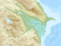
Aker ( azerb. Həkəri ), also Akari , Hakari ( armen . Հակարի) - the left tributary of Araks ; river flowing on the territory of Azerbaijan ( unrecognized Nagorno-Karabakh Republic ). The source of the river is located on the Karabakh plateau .
| Akera | |
|---|---|
| azerb. Həkəri , arm. Հակարի | |
 Akera River near Lachin Akera River near Lachin | |
| Characteristic | |
| Length | 170 km |
| Watercourse | |
| Source | river confluence: Gochazsu and Shalva |
| • Location | Karabakh Highlands |
| • Coordinates | |
| Mouth | Arax |
| • Coordinates | |
| Location | |
| Water system | Araks → Kura → Caspian Sea |
| A country |
|
Formed by the confluence of the Gochazsu and Shalva rivers [1] .
It flows through a narrow and deep gorge, in the middle course the valley expands. In the upper reaches, the Aker channel is laid in sedimentary, volcanic rocks, and flows in banks overgrown with oaks and hornbeams. The main food is snow and rainwater. Used for irrigation. High water in May-June.
Average water consumption:
- in the area of Lachin in May 22.7 m³ / s;
The river is rich in fish resources, developed fishing .
Inflows: Vorotan / Bazarchay [2] [3] (largest), Meidanderesi [3] , Zabuhchay , Kichik Akera [4] .
In antiquity, it served as the border between the Armenian historical regions of Syunik and Artsakh ( Nagorno-Karabakh ) [5] .
Notes
- ↑ Map sheet J-38-V .
- ↑ Armenia. General geographic map (scale 1: 500 000). Roscartography, 2005.
- ↑ 1 2 Map sheet J-38-XI .
- ↑ Map sheet J-38-22 Lachin . Scale: 1: 100,000. 1975 edition.
- ↑ V. Minorsky . Studies in Caucasian History. - CUP Archive, 1953. - S. 68-69. :
The river Hakar (now Akera), which like a sword-cut divides the rugged highlands, separates Siunik 'from its eastern neighbor Artsakh (now Qarabagh).