The province of Utcubamba ( Spanish: Provincia de Utcubamba ) is one of the seven provinces that form the department of Amasonas in northeastern Peru .
| Utkubamba Province | |||||
|---|---|---|---|---|---|
| Provincia de Utcubamba | |||||
| |||||
| A country | |||||
| Enters into | Amasonas Region | ||||
| Includes | 7 districts | ||||
| Adm Centre | Bagua grande | ||||
| Milesio Vallejos Bravo (2011—2014) [1] | Alcald Province | ||||
| History and geography | |||||
| Square | 3860 km² | ||||
| Population | |||||
| Population | 118 367 people ( 2005 ) | ||||
| Density | 30.67 people / km² | ||||
| Official site | |||||
 | |||||
In the north it borders with the provinces of Bagua and Kondorkanka , in the east - with the province of Bongara , in the south - with the province of Luia and in the west - with the department of Kahamarka . The area of the province is 3859.93 km² (9.83% of the area of the Amazonas region).
Administrative division
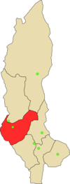
The province is divided into seven districts:
- Bagua grande
- Kaharuro
- Kumba
- Logna grande
- Hamalka
- El Milagro
- Yamon
Capital
The administrative center of the province is the city of Bagua Grande .