Sarma - a river in Russia , flows through the territory of the Olkhon district of the Irkutsk region .
| Sarma | |
|---|---|
| Characteristic | |
| Length | 66 km |
| Pool | 787 km² |
| Watercourse | |
| Source | |
| • Location | Seaside ridge |
| • Coordinates | |
| Mouth | Baikal |
| • Location | near the village of Sarma |
| • Coordinates | |
| Location | |
| Water system | Baikal → Angara → Yenisei → Kara Sea |
| A country |
|
| Region | Irkutsk region |
| Area | Olkhon district |
| HWR Code | |
The river valley is the place of origin of the strongest Baikal wind, bearing the same name as the river - Sarma .
Geography
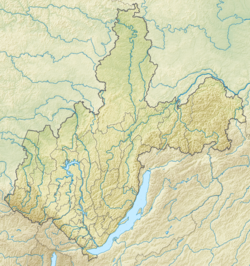
The length of the river is 66 km, the basin area is 787 km² [2] . It originates on the Primorsky Ridge about 10 kilometers north-west of the lake lying near the Three-headed Golets mountain . In the upper course it flows along a plateau, in the upper third of the current mainly in the western direction, then turns to the south, flows from the north into the Small Sea Strait of Lake Baikal . In the river delta, on the right bank, the village of Sarma is located. The shores are covered with taiga , with the exception of the steppe 5-km long mouth site on the pre-Baikal lowland.
Geology
The Sarma gorge is formed as a result of a powerful collapse across the Baikal rift rift. The river delta is a typical debris cone, looking unusually large for the rivers of this region [3] .
Tributaries
They flow into Sarma [2] [3] :
- Sukhaya stream (14 km from the mouth) - left tributary
- creek Uspan (18 km from the mouth) - right tributary
- Yakshal Stream (22 km from the mouth) - right tributary
- Nugan (Nagan) stream (27 km from the mouth) - left tributary
- Malaya Beleta Stream (32 km from the mouth) - right tributary
- river without name (45 km from the mouth) - right tributary
- creek Left Sarma - left tributary
Water Registry Data
The object code in the state water register is 16040000112116300000466 [2] .
Notes
- ↑ Surface water resources of the USSR: Hydrological knowledge. T. 16. Angaro-Yenisei district. Issue 3. Transbaikalia / ed. V.I. Zilberstein. - L .: Gidrometeoizdat, 1966. - 159 p.
- ↑ 1 2 3 State Water Register . Sarma . textual.ru . Ministry of Environment of Russia (March 29, 2009). The appeal date was December 20, 2018. Archived March 29, 2009.
- ↑ 1 2 Sarma River . Nature of Baikal. The date of circulation is September 17, 2011. Archived on August 28, 2012.