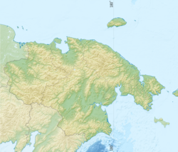
Khatyrka [2] - a river in the Far East of Russia , flows through the territory of the Anadyr region of the Chukotka Autonomous Okrug [3] . The administrative border with the Kamchatka region runs along the river.
| Khatyrka | |
|---|---|
| chuck. Vatyrkan | |
| Characteristic | |
| Length | 367 km |
| Pool | 13,400 km² |
| Water consumption | 174 m³ / s |
| Watercourse | |
| Source | |
| • Location | Koryak Highlands |
| • Coordinates | |
| Mouth | Bering Sea |
| • Height | 0 m |
| • Coordinates | |
| Location | |
| Water system | Bering Sea |
| A country |
|
| Region | Chukotka Autonomous Okrug |
| Area | Anadyrsky district |
| HWR code | |
The river is 367 km long, the catchment area is 13400 km² [4] . By the area of the Khatyrka basin, it occupies the 8th place among the Chukotka rivers and the 74th in Russia [5] .
The name is translated from Chuk. Vatyrkan - "a dry, exhausted place." The first description of the river was left by the Russian merchants Bakhov and Novikov, who stopped at the mouth of Khatyrka in 1748 [6] .
It takes its source on the northern slopes of the nameless mountain (1050 m) [7] of the Koryak Upland , flows into the gorge in the upper and middle parts, reaches the heavily boggy plain in the lower reaches, where the channel breaks into branches and flows into the Bering Sea . The mouth of the river and the Bolshoi island located here in the middle of the stream are separated from the sea by the oblique Direct [8] .
The spring-summer period accounts for up to 90% of the annual water flow. From January to April, the river may freeze in places.
Inflows (from the source): Successful, flow to Lake Goltsovoye, Koyanga, Ghosts, May, Night, Maigyeithynvaam , Basalt, Snezhniy, Erkipkan, Branched, Koltsevaya, Floodplain, Vychnaivaam , Koyvelvygyngylyngylyngylynygylygynygynygylygynygylygynygynygylygynygynygylygynygynygynygynygylyygynygylyvylyvylydylhylyvylydylydylylyl . Gachineken, radiant, Marakavaam , Hidden, Wide, Varapelin sloping valleys, Elgytavravayam , Rytgylveem , Iomrautvaam , Etchenmuveem , Etkuviveem, Ylkakvykargynvaam , Ilyneyveem, Relyavaam , tones, Chetkinvaam , gravel, Inechveem, Alder, Elginmyvayam , Ituneyveem , Kuyy .
At the mouth of the river is the national village of Khatyrka .
In 1965-66 complex geological and hydrological work was carried out in the Khatyrka basin, according to the results of which the prospects of the region’s oil and gas potential were determined [9] .
Khatyrkite , a unique mineral of extraterrestrial origin, was discovered in the river basin [10] .
On the Khatyrka River, commercial salmon fishing is carried out with an established annual quota of 190 tons (2003) [11] , as well as smelt (30 tons, 2010) [12] .
Notes
- ↑ Surface Water Resources of the USSR: Hydrological Understanding. T. 19. Northeast / ed. Yu. N. Komarnitskaya. - L .: Gidrometeoizdat, 1966 .-- 602 p.
- ↑ Khatyrka // Dictionary of names of hydrographic objects of Russia and other countries - members of the CIS / ed. G.I. Donidze. - M .: Kartgeotsentr - Geodezizdat, 1999. - S. 323. - ISBN 5-86066-017-0 .
- ↑ Khatyrka river . Public cadastral map . Date of treatment May 25, 2012. Archived on August 28, 2012.
- ↑ State Water Register . Khatyrka River . textual.ru . Ministry of Natural Resources of Russia (March 29, 2009). Date of treatment December 20, 2018. Archived March 29, 2009.
- ↑ Khatyrka . - An article from the popular science encyclopedia Water of Russia.
- ↑ Leontyev V.V. , Novikova K.A. Toponymic Dictionary of the North-East of the USSR / scientific. ed. G. A. Menovschikov ; FEB AN USSR . North-East complex. Research institutes. Lab archeology, history and ethnography. - Magadan: Magad. Prince Publishing House , 1989 .-- S. 398. - 456 p. - 15,000 copies. - ISBN 5-7581-0044-7 .
- ↑ Map sheet P-59-I, II . Scale: 1: 200 000. Indicate the date of issue / condition of the area .
- ↑ Map sheet P-60-I, II . Scale: 1: 200 000. Indicate the date of issue / condition of the area .
- ↑ SVTGU. Hydrogeology of the USSR / ed. O. N. Tolstikhina. - Moscow: Nedra, 1972. - T. XXVI. - S. 22. - 297 p. - 1,500 copies
- ↑ Julia Rudy. The unique Russian mineral turned out to be extraterrestrial . News (January 17, 2012). Date of treatment September 4, 2013.
- ↑ In Chukotka, quotas for catching chum salmon increased (inaccessible link) . Specialized accounting center in the agricultural sector (August 16, 2012). Date of treatment September 4, 2013. Archived March 4, 2016.
- ↑ V. Gubanov. Count the teeth smelt . Far North (2011).