Konkudera ( Kunkuderi, Bol. Konkuderi ) - a river in the Irkutsk region of Russia , the right tributary of the Mama .
| Concudera | |
|---|---|
| Characteristic | |
| Length | 153 km |
| Swimming pool | 4920 km² |
| Water consumption | 110 m³ / s (0.7 km from the mouth) |
| Watercourse | |
| Source | |
| • Height | 1495 m |
| • Coordinates | |
| Mouth | Mama |
| • Location | n. Konkudera |
| • Height | 318 m |
| • Coordinates | |
| Location | |
| Water system | Mom → Vitim → Lena → Laptev Sea |
| A country |
|
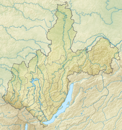
| Region | Irkutsk region |
| Area | Mamsko-Chuy district |
| HWR code | |
Geography
It originates in the north of the Delyun-Uransky ridge , in mountain lakes and glaciers, at an altitude of about 1495 meters above sea level [2] [3] . In the upper reaches is called Big Concudery . It flows along the North Baikal Highlands , where at 43 km from the mouth it merges with the Little Konkuderi and from this place is called Konkuderi . At the village of Konkuderi (now uninhabited) it flows into the Mama River. The height of the mouth is 318 meters above sea level [4] .
The river is meandering. The length of the river is 153 km, the catchment area is 4920 km² [5] . The average annual flow rate is 110 m³ / s [6] .
Notes
- ↑ Surface Water Resources of the USSR: Hydrological Understanding. T. 17. Lensko-Indigirsky district. Vol. 1. Upper Lena / ed. V.A. Vinogradova. - L .: Gidrometeoizdat, 1966 .-- 170 p.
- ↑ Map sheet O-49-119 source p. Bol Concudery . Scale: 1: 100,000. Status of the area for 1967. 1978 edition
- ↑ Map sheet O-49-XXX . Scale: 1: 200 000. Indicate the date of issue / condition of the area .
- ↑ Map sheet O-49-94 .
- ↑ State Water Register . Konkudera . textual.ru . Ministry of Natural Resources of Russia (March 29, 2009). Date of treatment December 20, 2018. Archived March 29, 2009.
- ↑ 1 2 Konkuderiy At Konku . R-ArcticNET. Date of treatment February 20, 2019.