Chota Nagpur ( Hindi छोटा नागपुर पठार ) is a mountain plateau in central India , occupying most of the state of Jharkhand , as well as the adjacent parts of the states of Orissa , West Bengal , Bihar and Chhattisgarh .
| Chhota Nagpur | |
|---|---|
| Hindi छोटा नागपुर पठार | |
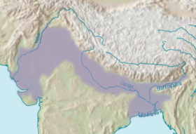 Indo-Gangetic plain. Chota Nagpur Plateau - Southwest of the Ganges | |
| Characteristics | |
| Area | 65,000 km² |
| Highest point | |
| Highest point | 1164 m |
| Location | |
| A country |
|
| Regions | Jharkhand , Orissa , West Bengal , Bihar , Chhattisgarh |

Name Etymology
The word "Nagpur" most likely comes from the name of the Nagavanshi dynasty, which ruled here in antiquity. "Chhota" is a distorted "Chkhutiya", the name of a village in the vicinity of Ranchi , where there are the remains of the ancient fort of Nagavanshi.
Geography
To the north and east of the plateau is the Indo-Gangetic plain , to the south - the Mahanadi river basin . The total area of the plateau is approximately 65 thousand km².
The Chota-Nagpur Plateau is divided into three parts. The western, highest part of the plateau, called Pata , has an average height of 910–1100 m above sea level, the highest point is 1164 m. The second part of the plateau has an average height of 610 m and occupies the main part of the Ranchi and Khazaribagh districts , as well as a part of Palamu County. The lowest part of the plateau has an average height of 300 m and is located on the territory of East Singhbhum and West Singhbhum counties of Jharkhand state and West Bengal state of Purulia .
The Chhota-Nagpur Plateau is divided into separate subregions:
- Stampede
- Ranchi Plateau
- Hazaribagh Plateau
- Coderma Plateau
- Trench Damodar
- Palamu
- Manbhum Singhbhum