The river in the Kotovras ravine is a river in the Saratov region , in the Khopra basin.
| Ravine Kotovras | |
|---|---|
| Characteristic | |
| Length | 16 km |
| Pool | 84.9 km² |
| Watercourse | |
| Source | |
| • Coordinates | |
| Mouth | Hopper |
| • Location | lakes in the floodplain with. Cotovras |
| • Coordinates | |
| Location | |
| Water system | Hopper → Don → Azov Sea |
| A country |
|
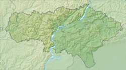
| Region | Saratov region |
| Areas | Arkadak District , Balashov District |
| HWR Code | |
Description
The length of the river is 16 km, the catchment area is 84.9 km² [2] . The source is 7 km south-east of the village of Malinovka in Arkadaksky district [3] . Flows through the ravine to the west-south-west, the middle and lower reaches of the Balashov district , in the mouth of the banks of the village Kotovras (the only settlement in the basin). It falls into the old lakes in the left-bank Khopra flood plain near the village [4] .
The river is drying up, the flow of the river and tributaries is regulated [3] . There are two bridges across the river - in the center of the village and on the outskirts (on the highway Balashov - Penza ).
Water Registry Data
According to the state water register of Russia, it belongs to the Don basin district , the water management section of the river is Khopyor from its source to the confluence of the Voron river, the river sub-basin of the river Khoper. River basin - Don (Russian part of the basin).
The object code in the state water register is 05010200112107000005919 [2] .
Notes
- ↑ Surface water resources of the USSR: Hydrological knowledge. V. 7. Donskoy district / ed. D. D. Mordukhay-Boltovsky. - L .: Gidrometeoizdat, 1964. - 267 p.
- ↑ 1 2 State Water Register . ravine Kotovras (Silent Dell) . textual.ru . Ministry of Environment of Russia (March 29, 2009). The appeal date was December 20, 2018. Archived March 29, 2009.
- ↑ 1 2 Map Sheet M-38-3-Dd - FSUE "GOSGISTSENTR"
- ↑ Map Sheet M-38-3-Dc - FSUE “GOSGISTSENTR”