Mash - a river in Russia , flows through the territory of the Oktyabrsky district of Perm Territory . The mouth of the river is 80 km on the right bank of the Sars River. The length of the river is 17 km, the catchment area is 215 km² [2] .
| Mash | |
|---|---|
| Characteristic | |
| Length | 17 km |
| Pool | 215 km² |
| Watercourse | |
| Source | |
| • Coordinates | |
| Mouth | Sars |
| • Location | 80 km on the right bank |
| • Height | 212 m |
| • Coordinates | |
| Location | |
| Water system | Sars → Tyuy → Ufa → Belaya → Nizhnekamsk reservoir → Kama → Volga → Caspian Sea |
| A country |
|
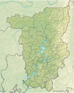
| Region | Perm region |
| Area | Oktyabrsky District |
| HWR code | |
14 km from the estuary, the Tavda River flows along the left bank.
Water registry data
According to the state water register of Russia, it belongs to the Kama basin district , the water sector of the river is Ufa from the Nyazepetrovsky hydroelectric complex to the Pavlovsky hydroelectric complex , without the Ai river, the river river sub-basin is Belaya. The river basin of the river is Kama [2] .
The code of the object in the state water registry is 10010201112111100022982 [2] .
Notes
- ↑ Surface Water Resources of the USSR: Hydrological Understanding. T. 11. The Middle Urals and the Urals. Vol. 1. Kama / ed. V.V. Nikolaenko. - L .: Gidrometeoizdat, 1966 .-- 324 p.
- ↑ 1 2 3 State Water Register of the Russian Federation: Mash . Date of treatment August 7, 2011. Archived August 24, 2012.