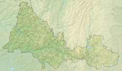
Dry Huberlya - a river in Russia , flows in the Orenburg region. The mouth of the river is 46 km along the left bank of the Huberli River. The river is 52 km long.
| Dry Guberl | |
|---|---|
| Characteristic | |
| Length | 52 km |
| Pool | 763 km² |
| Watercourse | |
| Source | |
| • Height | above 323.7 m |
| • Coordinates | |
| Mouth | Guberl |
| • Location | 46 km on the left bank |
| • Height | below 240.2 m |
| • Coordinates | |
| Location | |
| Water system | Caspian Sea |
| A country |
|
| Region | Orenburg region |
| HWR code | |
Water registry data
According to the state water register of Russia, it belongs to the Ural Basin District , the water sector of the Ural River from the city of Orsk to the confluence of the Sakmara River , there is no river sub-basin - the Sub-basin. The river basin is the Urals (the Russian part of the basin) [2] .
According to the geographic information system of water management zoning of the territory of the Russian Federation, prepared by the Federal Agency for Water Resources [2] :
- The code of the water body in the state water registry is 12010000812112200004058
- The code for hydrological knowledge (GI) is 112200405
- Pool code - 12.01.00.008
- GI Volume Number - 12
- GI Issue - 2
Notes
- ↑ Surface Water Resources of the USSR: Hydrological Understanding. T. 12. Lower Volga and Western Kazakhstan. Vol. 2. Ural-Emba region / ed. Z. G. Markova. - L .: Gidrometeoizdat, 1966 .-- 152 p.
- ↑ 1 2 State Water Register . Dry Guberl . textual.ru . Ministry of Natural Resources of Russia (March 29, 2009). Date of treatment December 20, 2018. Archived March 29, 2009.