Tuyalas [2] (outdated. Tualls [3] ) is a river in Russia that flows through the Baymak district of the Republic of Bashkortostan . Merging with the stream, Tukan forms Tugazhman [2] (a tributary of Khudolaz ). The length of the river is 11 [3] km.
| Tuyalas | |
|---|---|
| Characteristic | |
| Length | 11 km |
| Watercourse | |
| Source | |
| • Location | irendyk ridge |
| • Coordinates | |
| Mouth | Tugazhman |
| • Coordinates | |
| Location | |
| Water system | Tugazhman → Khudolaz → Ural → Caspian Sea |
| A country |
|
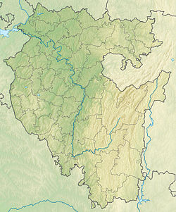
| Region | Bashkortostan |
| Area | Baymak district |
| HWR code | |
Tuyalas originates on the eastern slope of the Irendek ridge and flows to the northeast [2] . Near the source, it takes on its right its first tributary - the seasonal stream Bagyrma [2] . Flowing to the village of Isyanbetovo, the watercourse sharply changes the direction of the flow to the southeast. Further Tuyalas flows through Bolshebasaevo , and, merging with the Tukan stream, forms Tugazhman , which is part of the river system of the Ural River .
The upper river valley is covered with forest ; forest is also found in areas in the central and lower parts of the Tuyalas valley [2] .
Water registry data
According to the state water register of Russia, it belongs to the Ural basin district , the water sector of the river is the Urals from the Magnitogorsk hydroelectric complex to the Iriklinsky hydroelectric complex , and there is no river sub-basin - the Sub-basin. The river basin is the Urals (the Russian part of the basin) [3] .
Notes
- ↑ Surface Water Resources of the USSR: Hydrological Understanding. T. 12. Lower Volga and Western Kazakhstan. Vol. 2. Ural-Emba region / ed. Z. G. Markova. - L .: Gidrometeoizdat, 1966 .-- 152 p.
- ↑ 1 2 3 4 5 Map sheet N-40-117 Tubinsky . Scale: 1: 100,000. 1980 edition
- ↑ 1 2 3 State Water Register . Toalls . textual.ru . Ministry of Natural Resources of Russia (March 29, 2009). Date of treatment December 20, 2018. Archived March 29, 2009.