Pezhenga is a river in Russia , flows in the Kologrivsky district of the Kostroma region . The mouth of the river is 289 km along the left bank of the Unzha River . The river is 64 km long.
| Pezhenga | |
|---|---|
| Characteristic | |
| Length | 64 km |
| Pool | 406 km² |
| Watercourse | |
| Source | |
| • Height | above 144 m |
| • Coordinates | |
| Mouth | Unzha |
| • Location | 289 km on the left bank |
| • Height | above 110 m |
| • Coordinates | |
| Location | |
| Water system | Unzha → Volga → Caspian Sea |
| A country |
|
| Region | Kostroma region |
| Area | Kologrivsky district |
| HWR code | |
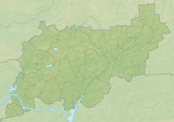
The source of Pezhengi is located northeast of the non-residential village of Ulshma. The entire course of Peugeeng passes through an uninhabited forest. In the upper stream flows to the north-west, at the confluence of Vynoshkova and Tinovka, it turns to the south-west. The channel is extremely winding. In the middle course on the shore is the non-residential village of Ardomysikha. It flows into Unzhu east of the village of Akatovo, 8 km above the village of Uzhuga .
Content
Water registry data
According to the state water register of Russia, it belongs to the Upper Volga Basin District , the water sector of the river is Unzha from the source to the mouth, the river sub-basin of the river is the Volga tributaries basin below the Rybinsk Reservoir until the Oka River flows into it. The river basin - (Upper) Volga to the Kuibyshev reservoir (without the Oka basin) [2] .
According to the geographic information system of water management zoning of the territory of the Russian Federation, prepared by the Federal Agency for Water Resources [2] :
- The code of the water body in the state water registry is 08010300312110000015358
- Hydrological Understanding (GI) Code - 110001535
- Pool code - 01/08/03.003
- GI Volume Number - 10
- GI Issue - 0
Tributaries (km from the mouth)
- 6.1 km: river Peshpart (lv)
- Tinovka River (pr)
- Talitsa river (pr)
- Yurmanga river (pr)
- 37 km: Vynoshkova river (ave.)
Notes
- ↑ Surface Water Resources of the USSR: Hydrological Understanding. T. 10. Upper Volga region / ed. V.P. Shaban. - L .: Gidrometeoizdat, 1966 .-- 528 p.
- ↑ 1 2 State Water Register of the Russian Federation: Pezhenga . Date of treatment August 7, 2011. Archived August 24, 2012.
Topographic maps
- Map sheet O-38-IX . Scale: 1: 200 000. Status of the terrain for 1982. 1989 Edition
Links
- The article used information provided by the Federal Agency for Water Resources from the list of water bodies registered in the state water register as of March 29, 2009. List (rar-archive, 3.21 Mb).