Bely Luh is a river in the Kostroma and Nizhny Novgorod regions of Russia , the left tributary of the Unzhi .
| White Luh | |
|---|---|
| Characteristic | |
| Length | 119 km |
| Pool | 1490 km² |
| Watercourse | |
| Source | |
| • Height | 160-170 m |
| • Coordinates | |
| Mouth | Unzha |
| • Location | 23 km from the mouth, 2 km from the village of Gorchukha ( Makarievsky district ) |
| • Height | 84.5 m |
| • Coordinates | |
| Location | |
| Water system | Unzha → Volga → Caspian Sea |
| A country |
|
| Regions | Kostroma region , Nizhny Novgorod region |
| Areas | Vetluzhsky district , Varnavinsky district , Makarievsky district |
| HWR Code | |
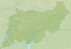
The length of the river is 119 km, the catchment area is 1,490 km² [2] . It flows in forests, mainly through the territory of the Makaryevsky district of the Kostroma region. It originates in wetlands in the east of the district, 25 km south-west of the village named after Kalinin [3] . It flows a little to the east from the source and, deviating to the right, changes the direction of the flow to the west in the upper reaches (the small extreme eastern part of the flow is located within the boundaries of the Vetluzhsky and Varnavinsky districts of the Nizhny Novgorod region). It further flows west and flows into Unzha on the left bank 23 km from its mouth (2 km north of the village of Gorchukha [4] ).
The course is very tortuous. On the middle reaches, on the right bank, there is the village of Nesterovo , not far from it in the river basin are the settlements of Timoshino , Karkovo , Halaburdiha , Kukui-1 , Kukui-2 [5] .
The Unzhlaga camps (one of the Gulag camps) were located in the river basin.
Tributaries (km from the mouth)
- Spiriha (lv)
- Mitina (lv)
- Gremyachka (lv)
- 17 km: Wond (lv)
- Elkhovka river (lv)
- 37 km: Tomsha (PR)
- 42 km: Pull over (lv)
- 56 km: Kuchinka (lv)
- 63 km: Nereg (Nerec) (lv)
- Strelichnaya (pr)
- 75 km: Porzhnia (Porznya) (lv)
- Chirkusha (lv)
- Snake (lv)
- 88 km: Train ( PR )
- 89 km: Kernas (lv)
- 97 km: High (lv)
- Nikolskaya (lv)
- Medvedevka (lv)
- Sowing (lv)
Water Registry Data
According to the state water register of Russia, it belongs to the Upper Volga basin district , the water management section of the river - Unzha from its source to the mouth, the river sub-basin of the Volga tributaries below the Rybinsk reservoir to the confluence of the Oka. The river basin is the (Upper) Volga to the Kuibyshev reservoir (without the Oka basin) [2] .
The code of the water body in the state water register is 08010300312110000016607.
Notes
- ↑ Surface water resources of the USSR: Hydrological knowledge. T. 10. Verkhne-Volzhsky district / ed. V.P. Shaban. - L .: Gidrometeoizdat, 1966. - 528 p.
- ↑ 1 2 State Water Register . Bely Luh . textual.ru . Ministry of Environment of Russia (March 29, 2009). The appeal date was December 20, 2018. Archived March 29, 2009.
- ↑ Map Sheet O-38-78 . Scale: 1: 100,000. Indicate the date of issue / state of the terrain .
- ↑ Map sheet O-38-76 Makaryev . Scale: 1: 100,000. 1972 Edition.
- ↑ Map Sheet O-38-77 . Scale: 1: 100,000. Indicate the date of issue / state of the terrain .