Vyazovka [2] - a river in Russia , flows in the Buzuluk district of the Orenburg region . The river is 24 km long [3] . The catchment area is 166 km² [3] .
| Knitting | |
|---|---|
| Characteristic | |
| Length | 24 km |
| Pool | 166 km² |
| Watercourse | |
| Source | |
| • Coordinates | |
| Mouth | Samara |
| • Height | 70.4 m |
| • Coordinates | |
| Location | |
| Water system | Samara → Saratov Reservoir → Volga → Caspian Sea |
| A country |
|
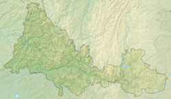
| Region | Orenburg region |
| Area | Buzuluk district |
| HWR code | |
It starts north of the village of Verkhnyaya Vyazovka , flows in a general south direction [2] . It flows into Samara to the right between the forest of Telnik and the tract Sarminsky Pines at an altitude of 70.4 meters above sea level [4] .
The main tributaries are Elkhovka, Babya Kasha, Kirmetsky, Tsabanny (all are left) [2] .
Water registry data
According to the state water register of Russia, it belongs to the Lower Volga Basin District , the water sector of the river is Samara from the Sorochinsky hydroelectric complex to the water gauge near the village of Elshanka . The river basin is the Volga from the upper Kuybyshevsky water basin to the confluence with the Caspian [3] .
The code of the object in the state water registry is 1101000101211212100006730 [3] .
Notes
- ↑ Surface Water Resources of the USSR: Hydrological Understanding. T. 12. Lower Volga and Western Kazakhstan. Vol. 1. Lower Volga / ed. O. M. Zubchenko. - L .: Gidrometeoizdat, 1966 .-- 287 p.
- ↑ 1 2 3 Map sheet N-39-118 Grachevka . Scale: 1: 100,000. State of the terrain for 1987. 1992 edition
- ↑ 1 2 3 4 State Water Register . Vyazovka . textual.ru . Ministry of Natural Resources of Russia (March 29, 2009). Date of treatment December 20, 2018. Archived March 29, 2009.
- ↑ Map sheet N-39-130 Totsky . Scale: 1: 100,000. 1978 edition