The nameless river in the Glinny ravine is a river in Russia that flows in the Sorochinsky district of the Orenburg region. The river mouth is located 390 km on the left bank of the Samara River, near the town of Sorochinsk . The length of the river is 11 km.
| Ravine clay | |
|---|---|
| Characteristic | |
| Length | 11 km |
| Pool | 30.5 km² |
| Watercourse | |
| Mouth | Samara |
| • Location | 390 km on the left bank |
| • Coordinates | |
| Location | |
| Water system | Samara → Volga → Caspian Sea |
| A country |
|
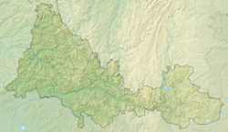
| Region | Orenburg region |
| Area | Sorochinsky district |
| HWR Code | |
Water Registry Data
According to the state water register of Russia, it belongs to the Lower Volga basin district , the water management section of the river - Samara from the Sorochinsky hydroelectric complex to the gauging station near the village of Elshanka , the river sub-basin of the river - the sub-basin is absent. The river basin is the Volga from the headwaters of the Kuibyshev reservoir to its confluence with the Caspian Sea [2] .
According to the geographic information system of water management zoning of the territory of the Russian Federation, prepared by the Federal Agency for Water Resources [2] :
- The code of the water body in the state water register is 11010001012112100006471
- Hydrological code (GI) - 112100647
- Pool code 01.01.00.010
- GI Volume Number - 12
- Issue on GI - 1
Notes
- ↑ Surface water resources of the USSR: Hydrological knowledge. T. 12. The Lower Volga region and Western Kazakhstan. Issue 1. The Lower Volga / ed. O.M. Zubchenko. - L .: Gidrometeoizdat, 1966. - 287 p.
- ↑ 1 2 State Water Register of the Russian Federation: Glinny Ravine . The appeal date is August 7, 2011. Archived August 21, 2012.
Links
- The article uses information provided by the Federal Agency for Water Resources from the list of water bodies registered in the state water register as of March 29, 2009. List (rar-archive, 3.21 MB).