Salmysh is a river in the Orenburg region of Russia , flows through the territory of the Sharlyk , October and Sakmar regions. The mouth of the river is 59 km along the right bank of the Sakmara River. Length - 193 km, catchment area - 7340 km².
| Salmysh | |
|---|---|
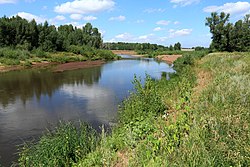 Salmysh near the village of Arkhipovka Salmysh near the village of Arkhipovka | |
| Characteristic | |
| Length | 193 km |
| Swimming pool | 7340 km² |
| Water consumption | 10.4 m³ / s (79 km from the mouth) |
| Watercourse | |
| Source | |
| • Coordinates | |
| Mouth | Sakmara |
| • Coordinates | |
| Location | |
| Water system | Sakmara → Ural → Caspian Sea |
| A country |
|
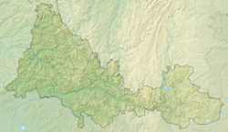
| Region | Orenburg region |
| Areas | Sharlyksky district , Oktyabrsky district , Sakmarsky district |
| HWR code | |
Content
- 1 Etymology
- 2 Hydrology
- 3 Water registry data
- 4 tributaries
- 5 Gallery
- 6 notes
- 7 References
Etymology
Bashkirs name the river - Khayylmysh. The hydronym is compared with the Bashkir khayyldashyu - "make noise", mysh - perhaps the affix of the present participle, characteristic of a number of Turkic languages, or a word-formation element. [2]
Hydrology
The main food is snow. High water from late March to early May. It freezes in November, opens in April. The average annual water flow rate of 79 km from the mouth is 10.4 m³ / s.
Water registry data
According to the state water register of Russia, it belongs to the Ural Basin District , the water sector of the Sakmara River, from the confluence of the Bolshoy Ik River to the mouth, the river sub-basin, is absent. The river basin is the Urals (the Russian part of the basin) [3] .
The code of the object in the state water registry is 12010000712112200006626 [3] .
Tributaries
(distance from the mouth)
- 6 km: Yangiz river (pr)
- 53 km: Shestimir river (pr)
- 55 km: Bolshoy Yushatyr river (lv)
- 81 km: Burliuk river (lv)
- 106 km: Telgaz river (lv)
- 140 km: Syskan river (lv)
- 154 km: Net river (pr)
- 164 km: Yalonga river (lv)
- 165 km: Charlyk river (ave.)
Gallery
Notes
- ↑ Surface Water Resources of the USSR: Hydrological Understanding. T. 12. Lower Volga and Western Kazakhstan. Vol. 2. Ural-Emba region / ed. Z. G. Markova. - L .: Gidrometeoizdat, 1966 .-- 152 p.
- ↑ Strelnikov S. M. Geographical names of the Orenburg region. - 2nd ed., Supplemented and amended. - Kuvandyk: Publishing House S. M. Strelnikova, 2002 .-- S. 124.
- ↑ 1 2 State Water Register of the Russian Federation: Salmysh . Date of treatment August 7, 2011. Archived on August 20, 2012.
Links
- Salmysh - article from the Great Soviet Encyclopedia .